
Country United States FIPS code 40-13500 Elevation 287 m Population 3,126 (2013) Area code 405 | Time zone Central (CST) (UTC-6) GNIS feature ID 1091199 Zip code 74834 Local time Thursday 12:57 PM | |
 | ||
Weather 16°C, Wind W at 10 km/h, 15% Humidity Area 21.24 km² (18.91 km² Land / 233 ha Water) | ||
Chandler is a city in and the county seat of Lincoln County, Oklahoma, United States. and is part of the Oklahoma City Metropolitan Area. The population was 3,100 at the 2010 census, an increase from 2,842 at the 2000 census.
Contents
- Map of Chandler OK 74834 USA
- History
- Geography
- Demographics
- Economy
- Recreation
- Notable people
- Education
- National Register of Historic Places
- References
Map of Chandler, OK 74834, USA
Chandler is located northeast of Oklahoma City on SH-66 and I-44, and north of Shawnee on SH-18.
History
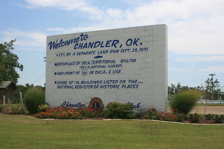
Chandler was named after Judge George Chandler, a member of Congress and Assistant Secretary of the Interior. The site of Chandler was opened by a land run on September 28, 1891. The town had been planned to be opened on September 22, (the date of the Land Run of 1891) but the site survey had not been completed. The Chandler Post Office had opened September 21, the day before the planned run. When Oklahoma Territory County A (Lincoln County) was organized, Chandler became the county seat. On May 30, 1897, a tornado destroyed most of the fledgling town and killed 14 residents.
In 1891 the county government operated out of an office building until the original courthouse was built. The courthouse was destroyed by the tornado of 1897, and a two-story frame building was erected as a temporary courthouse was erected on the present site. This building was removed in 1907 to make way for a stone courthouse. This third courthouse burned down on December 23, 1967 and the current courthouse was set in its place.
The St. Louis and Oklahoma City Railroad (later the St. Louis and San Francisco Railway, also known as the "Frisco") built a line through Chandler in 1898. The railroad enabled Chandler to move its agricultural products, as well as bricks made by the Chandler Brick Company. to markets.
Chandler is one of the many cities along the famous U.S. Route 66 and contains a number of attractions to devotees of "The Mother Road." These include The Route 66 Interpretive Center, The Oklahoma Law Enforcement Museum and Hall of Fame, The Lincoln County Museum of Pioneer History, several Route 66-themed murals, the newly restored old cottage-style Phillips 66 gas station, and one of the last remaining painted barns adverting Meramec Caverns, also on Route 66 in Missouri.
U.S. Route 66 brought a significant amount of commercial business to Chandler - due to travelers crossing the state and the country; however when the Turner Turnpike (Interstate 44) was built, much of this business died out.
In 1949, the Oklahoma legislature declared Chandler to be, "The pecan capital of the world," in Resolution No. 5.
In 1958, professional baseball player Bo Belcher opened Chandler Baseball Camp. For 42 years, the camp hosted campers from around the world for a bootcamp-like baseball camp during summers. The camp closed in 2000 due to the death of Tom Belcher. In 2011 it was added to the National Register of Historic Places.
Geography
According to the United States Census Bureau, Chandler has a total area of 8.1 square miles (21 km2), of which, 7.3 square miles (19 km2) of it is land and 0.9 square miles (2.3 km2) of it (10.43%) is water.
Demographics
As of the census of 2010, there were 3,100 people, 1,204 households, and 801 families residing in the city.
The population density was 389.3 people per square mile (150.3/km²). There were 1,403 housing units at an average density of 176.7 per square mile (68.2/km²). The racial makeup of the city was 79.77% White, 9.68% African American, 5.63% Native American, 0.39% Asian, 0.49% from other races, and 4.05% from two or more races. Hispanic or Latino of any race were 1.79% of the population.
Of all households, 31.2% had children under the age of 18 living with them, 47.1% were married couples living together, 14.0% had a female householder with no husband present, and 34.8% were non-families. 32.1% of all households were made up of individuals and 17.3% had someone living alone who was 65 years of age or older. The average household size was 2.36 and the average family size was 2.98.
In the city, the population was spread out with 25.7% under the age of 18, 8.7% from 18 to 24, 25.3% from 25 to 44, 20.7% from 45 to 64, and 19.6% who were 65 years of age or older. The median age was 38 years. For every 100 females there were 89.8 males. For every 100 females age 18 and over, there were 84.0 males.
The median income for a household in the city was $26,833, and the median income for a family was $35,744. Males had a median income of $28,125 versus $19,397 for females. The per capita income for the city was $14,676. About 12.1% of families and 16.7% of the population were below the poverty line, including 20.3% of those under age 18 and 15.4% of those age 65 or over.
Economy
Today, Chandler's economy is driven mostly by agriculture and livestock, oil and gas services, and manufacturing. The National American Insurance Company is headquartered in Chandler. Downtown Chandler, which is located on historic Route 66 and is home to many shops and restaurants. Lincoln County's first Wal-Mart Supercenter opened in 2008 on the east side of Chandler.
The Ioway Casino opened west of Chandler on June 1, 2013. The Ioway Casino is operarted by the Iowa Tribe of Oklahoma and is the sister casino to Cimarron Casino located in Perkins. The Ioway Casino has 250 machines and is located on SH-66 between Chandler and US-177.
Recreation
Chandler is home to several city parks, a baseball complex, a municipal swimming pool, and Ripped Health and Fitness. Chandler has two lakes, Bell Cow Lake, and Chandler Lake. Bell Cow Lake, which features camping, boating, fishing, and horse trails, is located north of town, along with Chandler Golf Course. The Lincoln County Raceway, a quarter mile dirt track, is located south of Chandler.
Notable people
Education
Chandler and the surrounding area is served by the Chandler Public School District. The Chandler High School Alumni Association describes itself as "the oldest and most active" in the state.
Chandler High School Lions State Championships: