
Founded February 15, 1839 Area 1,603 km² | Named for John A. Logan Congressional district 18th Website www.co.logan.il.us Population 29,964 (2013) | |
 | ||
Colleges and Universities Lincoln College, Lincoln Christian University Rivers Salt Creek, Kickapoo Creek, West Fork Sugar Creek Points of interest Lincoln Park District, Kickapoo Creek Park, Lincoln Heritage Museum, Railsplitter Covered Wagon, Route 66 Arcade Museum | ||
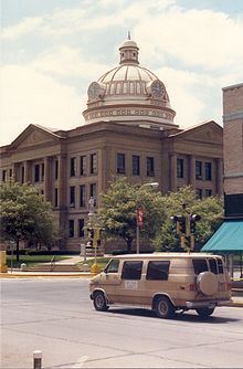
Logan County is a county located in the U.S. state of Illinois. According to the 2010 census, it had a population of 30,305. Its county seat is Lincoln.
Contents
- Map of Logan County IL USA
- History
- Geography
- Climate and weather
- Major highways
- Adjacent counties
- Demographics
- Government and infrastructure
- Cities
- Census designated places
- Notable people
- References
Map of Logan County, IL, USA
Logan County comprises the Lincoln, IL Micropolitan Statistical Area, which is included in the Springfield-Jacksonville-Lincoln, IL Combined Statistical Area.
History
Established in 1839, Logan County was named after physician and State Representative John Logan, father of Union General John Alexander Logan.[1]
Geography
According to the U.S. Census Bureau, the county has a total area of 619 square miles (1,600 km2), of which 618 square miles (1,600 km2) is land and 0.9 square miles (2.3 km2) (0.1%) is water.
Climate and weather
In recent years, average temperatures in the county seat of Lincoln have ranged from a low of 15 °F (−9 °C) in January to a high of 86 °F (30 °C) in July, although a record low of −29 °F (−34 °C) was recorded in December 1914 and a record high of 113 °F (45 °C) was recorded in July 1936. Average monthly precipitation ranged from 1.55 inches (39 mm) in February to 4.42 inches (112 mm) in May.
Major highways
Adjacent counties
Demographics
As of the 2010 census, there were 30,305 people; 12,107 households; and 7,274 families residing in the county. The population density was 49 people per square mile (19/km²). The racial makeup of the county included the following percentages non-Hispanic: 87.7% White, 7.4% Black or African American, 0.2% Native American, 0.6% Asian, 5 persons Pacific Islander, 12 persons from other races, and 1.1% from two or more races. 2.9% of the population were Hispanic or Latino of any race.
There were 11,070 households out of which 29.7% had children under the age of 18 living with them, 50.3% were married couples living together, 10.6% had a female householder with no husband present, and 34.3% were non-families. 29.4% of all households contained individuals who were 65 years of age or older. The average household size was 2.34 and the average family size was 2.85.
14.4% of the population were living in group quarters including 11.4% of the population instituitionalized.[2]
As of the 2010 United States Census, there were 30,305 people, 11,070 households, and 7,274 families residing in the county. The population density was 49.0 inhabitants per square mile (18.9/km2). There were 12,107 housing units at an average density of 19.6 per square mile (7.6/km2). The racial makeup of the county was 89.1% white, 7.5% black or African American, 0.6% Asian, 0.2% American Indian, 1.2% from other races, and 1.3% from two or more races. Those of Hispanic or Latino origin made up 2.9% of the population. In terms of ancestry, 30.9% were German, 17.4% were American, 13.1% were Irish, and 10.8% were English.
Of the 11,070 households, 29.7% had children under the age of 18 living with them, 50.3% were married couples living together, 10.6% had a female householder with no husband present, 34.3% were non-families, and 29.2% of all households were made up of individuals. The average household size was 2.34 and the average family size was 2.85. The median age was 39.4 years.
The median income for a household in the county was $48,999 and the median income for a family was $63,245. Males had a median income of $43,940 versus $31,783 for females. The per capita income for the county was $22,063. About 6.8% of families and 9.8% of the population were below the poverty line, including 15.1% of those under age 18 and 5.2% of those age 65 or over.
Government and infrastructure
The Illinois Department of Corrections Logan Correctional Center is located in unincorporated Logan County, near Lincoln.
Cities
Census-designated places
Notable people
William Keepers Maxwell, Jr., editor, novelist, short story writer