
- elevation 169 m (554 ft) Length 10 km | - elevation 106 m (348 ft) | |
 | ||
775 applewood trail little etobicoke creek 1
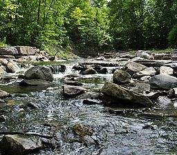
Little Etobicoke Creek is a small river in Mississauga, Regional Municipality of Peel in the Greater Toronto Area of Ontario, Canada. It is in the Great Lakes Basin and is a right tributary of Etobicoke Creek, which flows to Lake Ontario.
Contents
- 775 applewood trail little etobicoke creek 1
- 781 applewood trail little etobicoke creek 7
- CourseEdit
- References
781 applewood trail little etobicoke creek 7
CourseEdit
Little Etobicoke Creek emerges from a culvert on the south side of Britannia Road East, just east of Tomken Road. It flows southeast, passing under Highway 401, Eglinton Avenue, Eastgate Parkway, Burnhamthorpe Road and Bloor Street, before briefly heading northeast under Dixie Road. It then returns to a southeast path, passing under Dundas Street and the GO Transit Milton line, and finally turns east to its mouth at Etobicoke Creek just north of the Queensway (Peel Regional Road 20).
References
Little Etobicoke Creek Wikipedia(Text) CC BY-SA