
Population 23,614 (2015 est) Area 2,914 km² | Established 1985 Founded 1985 | |
 | ||
Website Litchfield Municipality Clubs and Teams Southern Districts Football Club, Litchfield Bears Points of interest Territory Wildlife Park, Crocodylus Park, Spectacular Jumping Crocodile, Berry Springs Nature P, Freds Pass Sport and Recreatio Destinations Darwin, Humpty Doo, Berry Springs - Northern, Howard Springs - Northern, Noonamah - Northern Territory | ||
The Litchfield Municipality is a local government area of the Northern Territory of Australia on the eastern and southeastern outskirts of the Darwin-Palmerston urban area. The municipality covers an area of 2,914.3 square kilometres (1,125.2 sq mi), and was created by the Northern Territory government on 6 September 1985.
Contents
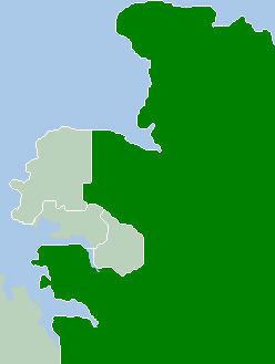
Map of Litchfield, NT, Australia
History
The original inhabitants of the Litchfield area were the Larakia, Woolner and Djowei Aboriginal people. The arrival of European settlers dates from 1864. Litchfield is named after Frederick Henry Litchfield who with William Patrick Auld was a member of an early survey and settlement party and who explored areas of the Northern Territory from Escape Cliffs on the Timor Sea to the Daly River. Some growth took place during the 1870s and 1880s, after the construction of the Overland Telegraph Line. There was more substantial growth during the post-war years, especially during the 1970s.
The Litchfield Shire was proclaimed by an Act of the NT Parliament on 6 September 1985. On 7 December 1985 an election was held to elect the first Council composed of a Shire President and four Councillors each representing a ward - North, South, East and Central.
This first elected body formulated a series of objectives under which Council was to operate. The objectives were based upon the provision of services in what is traditionally known as the 3R's ( Roads, Rubbish and Recreation) and on the principle of contracting out the provision of these services. The level of services under these functions were to be commensurate with a philosophy of low rates.
In 2008 Litchfield Shire became a municipality under the new Local Government Act 2008, which saw changes in the structure of local government across the Northern Territory.
On 1 July 2008 Litchfield Council's responsibilities also included management of the Thorak Regional Cemetery.
Geography
The Litchfield Municipality is bounded by the Adelaide River to the east, Van Diemen Gulf and the Coomalie Shire in the south and the City of Darwin and City of Palmerston to the northwest. The Stuart and Arnhem Highways run through the Litchfield Municipality. Most of the Municipality is rural or rural-residential in character.
Localities
Localities within the boundary of the Municipality include:
* amended localities
# newly created localities