
- elevation 1,200 m (3,937 ft) Length 422 km Basin area 18,246 km² | - elevation 0 m (0 ft) Discharge 362 m³/s | |
 | ||
- average 362 m/s (12,784 cu ft/s) Sources Sierra Madre de Chiapas, Citalá Similar Cerrón Grande Dam, Cerro El Pital, Lake Ilopango, Coatepeque Caldera, San Vicente | ||
The Lempa River (Spanish: Río Lempa) is a 422-kilometre (262 mi) long river in Central America.
Contents
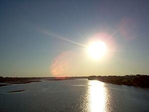
Map of Rio Lempa
Geography
Its sources are located in between the Sierra Madre and the Sierra del Merendón in southern Guatemala, near the town of Olopa. In Guatemala the river is called Río Olopa and flows southwards for 30.4 kilometres (18.9 mi) before entering Honduras and changing its name to Lempa river at 14.547700°N 89.264002°W / 14.547700; -89.264002. In Honduras it flows through Ocotepeque Department for 31.4 kilometres (19.5 mi), and crosses the border with El Salvador at the town of Citalá (14.371857°N 89.212439°W / 14.371857; -89.212439) in the department of Chalatenango. The river continues its course for another 360 kilometres (220 mi) in El Salvador, flowing in a generally southwards direction until it reaches the Pacific Ocean in the department of San Vicente. The river forms a small part of the international boundary between El Salvador and Honduras.
The river's watershed covers 18,246 square kilometres (7,045 sq mi), of which 10,255 square kilometres (3,959 sq mi) (56 percent) is in El Salvador, 5,696 square kilometres (2,199 sq mi) in Honduras and 2,295 square kilometres (886 sq mi) in Guatemala. Forty-nine percent of El Salvador's territory is covered by the Lempa river basin, and 77.5 percent of the Salvadoran population lives in cities, towns, and villages that are in its basin, including the capital city of San Salvador.
Hydroelectricity
There are several hydroelectric dams along the river. In El Salvador there is the Guayojo dam, the Cerrón Grande Hydroelectric Dam, the 5 de Noviembre dam, and the 15 de Septiembre dam which can be easily seen from the Pan-American highway.