
Elevation 2,730 m | Prominence 1,530 m Parent range Sierra Madre de Chiapas | |
 | ||
Listing Country high pointUltra Similar Coatepeque Caldera, Santa Ana Volcano, Cerro Verde National, Izalco, San Salvador | ||
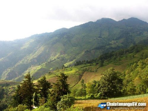
Cerro El Pital is a mountain in Central America, on the border of El Salvador and Honduras. It is located 12 km (7 mi) from the town of La Palma at a height of 2,730 m (8,957 ft) above sea level, and is the highest point in Salvadoran territory. Cerro El Pital is in the middle of a cloud forest that has an average annual temperature of 10 °C (50 °F).
Map of Cerro El Pital
It is one of the most popular tourist draws in El Salvador, with great biodiversity in a wide altitudinal range containing many endangered species of flora and fauna. The cloud forest has some of the rarest plants and animals in the country, including quetzals and other endangered species.
From November to February the temperature ranges between −6 °C (21 °F) and 10 °C (50 °F) (lowest recorded, in January 1956) and in the rest of the year the temperature ranges between 5 °C (41 °F) and 20 °C (68 °F). It is the coldest place in El Salvador. On 13 April 2004, much of the mountain was blanketed by an accumulation of hail during a storm, an unusual event that caused a commotion among the local community.