
Time zone Eastern (EST) (UTC-5) FIPS code 24-46250 Area 2.69 km² Area code 301 | ZIP codes 20879, 20882 Elevation 187 m Population 366 (2013) | |
 | ||
Country United States of America | ||
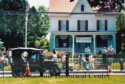
Laytonsville is a town in Montgomery County, Maryland, United States. The population was 353 at the 2010 census. Laytonsville was originally known as Cracklintown. This name originated from the popular cracklin bread, which was baked in the locale.[Montgomery Magazine, August/September 2014, "A Cracklin' Place" by Charles Jeffries, p. 17]
Contents
- Map of Laytonsville MD 20882 USA
- History
- Geography
- Demographics
- 2010 census
- 2000 census
- Education
- References
Map of Laytonsville, MD 20882, USA
} This recipe, essentially a bacon corn bread, also lent the entire area the p of Cracklin District. Laytonsville was incorporated in 1892.
History
Laytonsville has stood as a crossroad to the history of Maryland for over two centuries. The intersection of the northern district of the town provides a route to the major metropolitan areas of the state-- Damascus and Frederick County, to the east to Baltimore, to the south toward Washington, D.C., and to the west the Potomac River. Although in January 1998 Laytonsville is still a cozy town, its small size, 614 acres and a population of 295, belies its long and interesting history.
Laytonsville was originally known as Cracklintown. This name originated from the popular cracklin bread, which was baked in the locale. This recipe, essentially a bacon corn bread, also lent the entire area the name of Cracklin District. The original town extended beyond Laytonsville’s current boundaries, along Sundown Road toward the Hawlings River. The earliest church, school, and store were in this area. The first major transit road through Cracklintown was built in the early 1800s. This was the Brink-Sundown Road, referred to in documents from the early 1800s as the “road from the mouth of the Monocacy to Ellicotts Mills.”
Route 108 appears in the historical record to have been added in the very early 1800’s. This crossroads provided a major artery for cattle and pigs headed for the bustling markets of Baltimore, and established the town as a comfortable stopover for the drovers. By the early nineteenth-century, substantial brick buildings were being constructed, such as the Layton House and a tavern across the road from. By 1850, the southeast corner of the crossroads was developed. Much of the rest of the town along Rt. 108 was not developed until the 1870s.
A second reason for the development of the town was the successful farming in the area. Laytonsville farmers were blessed by the quality of the soil, a Manor loam or Chester loam, very fertile and well drained, but a soil which doesn't dry out too quickly. Under the loam lies a subsoil of red clay which assists in holding the moisture for roots even during hot, dry summers – great farming land.
Laytonsville was incorporated in 1892.
Geography
Laytonsville is located at 39°12′41″N 77°8′24″W (39.211256, -77.140134). According to the United States Census Bureau, the town has a total area of 1.04 square miles (2.69 km2), all of it land. The town has more of a small town, rural character than nearby Olney, Maryland. There are a number of tracts of farmland on the outskirts, as well as numerous homes on large plots of land.
Demographics
The median household income was $104,384 in 2009. Males had a median income of $57,500 versus $38,750 for females. The per capita income for the town was $30,681. None of the families and 0.7% of the population were living below the poverty line.
2010 census
As of the census of 2010, there were 353 people, 127 households, and 98 families residing in the town. The population density was 339.4 inhabitants per square mile (131.0/km2). There were 133 housing units at an average density of 127.9 per square mile (49.4/km2). The racial makeup of the town was 83.0% White, 6.8% African American, 7.4% Asian, and 2.8% from two or more races. Hispanic or Latino of any race were 1.1% of the population.
There were 127 households of which 39.4% had children under the age of 18 living with them, 67.7% were married couples living together, 7.1% had a female householder with no husband present, 2.4% had a male householder with no wife present, and 22.8% were non-families. 17.3% of all households were made up of individuals and 1.6% had someone living alone who was 65 years of age or older. The average household size was 2.78 and the average family size was 3.19.
The median age in the town was 42.9 years. 23.8% of residents were under the age of 18; 4.7% were between the ages of 18 and 24; 23.8% were from 25 to 44; 38.5% were from 45 to 64; and 9.1% were 65 years of age or older. The gender makeup of the town was 51.0% male and 49.0% female.
2000 census
As of the census of 2000, there were 277 people, 103 households, and 77 families residing in the town. The population density was 282.4 people per square mile (109.1/km²). There were 107 housing units at an average density of 109.1 per square mile (42.2/km²). The racial makeup of the town was 97.70% White, 0.86% African American and 1.44% Asian. Hispanic or Latino of any race were 1.81% of the population.
There were 103 households out of which 39.8% had children under the age of 18 living with them, 64.1% were married couples living together, 5.8% had a female householder with no husband present, and 25.2% were non-families. 22.3% of all households were made up of individuals and 4.9% had someone living alone who was 65 years of age or older. The average household size was 2.69 and the average family size was 3.17.
In the town, the population was spread out with 26.4% under the age of 18, 7.2% from 18 to 24, 27.4% from 25 to 44, 28.9% from 45 to 64, and 10.1% who were 65 years of age or older. The median age was 39 years. For every 100 females there were 93.7 males. For every 100 females age 18 and over, there were 98.1 males.
Education
Laytonsville is served by the Montgomery County Public Schools.
Schools that serve Laytonsville include: