
- elevation 400 ft (122 m) Basin area 1,927 km² | - elevation 200 ft (61 m) Length 94 km | |
 | ||
Bridges Bullfrog Road Bridge, Monocacy River bridge and viaduct, Tuscarora Creek (Monocacy River) bridge | ||
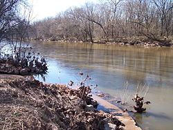
Monocacy river smallmouth kayak fishing 4 24 16
The Monocacy River is a free-flowing left tributary to the Potomac River, which empties into the Atlantic Ocean via the Chesapeake Bay. The river is 58.5 miles (94.1 km) long, with a drainage area of about 744 square miles (1,930 km2). It is the largest Maryland tributary to the Potomac.
Contents
- Monocacy river smallmouth kayak fishing 4 24 16
- Map of Monocacy River Maryland USA
- The monocacy river in buckeystown
- Geography
- Pollution
- References
Map of Monocacy River, Maryland, USA
The name "Monocacy" comes from the Shawnee name for the river, Monnockkesey, which translates to "river with many bends." (However, another local tradition asserts that "Monocacy" means "well-fenced garden" in an Indian language.) The first town ever settled in Western Maryland, Monocacy, also gets its name from this river.
The Monocacy National Battlefield lies alongside part of the river, marking an 1864 engagement during the American Civil War, the Battle of Monocacy Junction. The Chesapeake and Ohio Canal crosses over the river at the Monocacy Aqueduct, the largest of the 11 aqueducts on the canal.
The monocacy river in buckeystown
Geography
The river rises in Carroll County, Maryland, west of the unincorporated town of Harney, at the Maryland-Pennsylvania border. The river is formed by the confluence of Marsh Creek and Rock Creek, which flow out of Adams County, Pennsylvania. Maryland tributaries include Furnace Branch, Tuscarora Creek, Carroll Creek, Linganore Creek and Ballenger Creek in Frederick County and Double Pipe Creek in Carroll County; other Pennsylvania tributaries include Alloway Creek and Toms Creek in Adams County.
About 60% of the Monocacy watershed is dedicated to agricultural use; about 33% of the watershed is forested. The city of Frederick and its suburbs form the largest urban area within the watershed.
The 960 square mile water shed averages a flow of 600 Mgd at the mouth where it enters the Potomac River. Dendrology of the Watershed:
The vegetation of the watershed is very similar to what one would expect to find thorough the piedmont and valley and ridge regions. I would like to highlight some of the native species, species that may be moving into the watershed do to climate change, and then some invasive species that threaten the balance of the ecosystem. A very good source for pant and tree information is the USDA-NRCS Plant Fact Sheets at .
Some Native or Established species that are viewed as beneficial vegetation in the watershed
• White oak • Red Maple • Cattail • Sliver Maple(Second growth) • Bald Cypress (Native, but may migrate due to climate change)
Some Invasive species that threaten to disrupt the ecosystem of the watershed:
• https://www.nps.gov/plants/alien/pubs/midatlantic/pyca.htm • Tree of Heaven • https://www.nps.gov/plants/alien/fact/phau1.htm#table • Parrott feather
Pollution
The State of Maryland designated the Monocacy as a Maryland Scenic River in 1974. However, it has one of the greatest nonpoint source pollution problems in the state due in large part to runoff from the 3,500 farms, livestock operations and dairies in the watershed. The Maryland Department of the Environment (MDE) has listed the Monocacy with impaired water quality for sediment and fecal coliform bacteria. A major tributary basin, the Double Pipe Creek watershed, is also impaired for sediment and bacteria.
Some farmers in the Monocacy watershed participate in the national Conservation Security Program operated by the U.S. Department of Agriculture (USDA), designed to help stem pollution due to erosion and pollutant runoff from farming. In the 1990s the watershed was part of a national water quality demonstration project sponsored by USDA, which helped farmers reduce fertilizer usage and reduced discharges of nitrogen and phosphorus to the river.
Point Source pollution within the watershed is fairly well identified and regulated with few options to further reduce inputs outside investment in better technologies to remove contamination from water to be discharged into the system. Because higher tech systems come at a higher cost it may be more effective for users to pay for removal of an equal or larger amount of nutrients from the system by installing natural storm water treatment features in urban and agricultural areas that will provide a better return on investment than trying the remove the last 5 mg/L of a nutrient out of wastewater discharge point. Generally nutrients from waste water can be reduced to around 10 ppm using low tech solutions, in order to achieve lower concentrations to meet TMDL’s higher technology systems must be used.[11])
Green solutions to addressing runoff pollution include using natural filtration systems like a buffer strip or bio filtration system to treat storm water and reduce the volume and velocity in which the storm water enters the drainage system.
The benefits of developing green infrastructure are many and reach beyond water treatment they include : • Reduced runoff quantity • Longer resonance time of water in the system • Habitat Improvement • Soil conservation • Improved livability through green space • Enhance property value • Low impact and generally low cost • Promotes native planting and growth • Promotes stream restoration and health (DC water 2016
Because parts of the watershed near are underlain by karst topography it will be important to ensure that we are not loading groundwater in those areas to avoid destabilizing the subsurface resulting in a sinkhole, but that does not limit the use of bio retention and infiltration trenches, as long as they are lined in those areas.
Bio filters in a laboratory setting have been shown to remove up to 85% of phosphorus, 70% nitrogen and 95% of suspended solids from storm water prior to discharge for a properly sized unit. (Bratieres et al, 2008) Although these results were observed in a controlled setting, a lower % removal would still make a significant impact in real world use given proper sizing and maintenance.
In urban areas the goal is to treat and address storm water where it falls and to mitigate storm surges in the water system that often increase the sediment, nutrient, and trash in the water course. This approach has an additional benefit of reducing scouring of the local stream beds to allow for stream bank stabilization. A side benefit is a increase in quality of life in hares with a high % of impervious surfaces, which often coincide with poorer areas in municipalities.
The state of Maryland has several good examples of storm water management systems in their design manual:
Buffer strips
For both urban and agriculture areas but especially for the agricultural regions of the watershed, we should promote the use of vegetative buffer strips to protect streams weather herbaceous ( grasses and/or brush) or forested. Regardless of the type of buffer there is general consensus among practitioners that a minimum 35” buffer on either side of a waterway is a preferred for an effective buffer strip to have the greatest effect but as seen in the North Carolina State report on buffer use and effectiveness, even a 15 ‘ buffer would have a significant impact to stream and watershed health. ( NCSU, 2016) There will need to be a bit of negotiation in how much land a farmer or landowner is willing to give up which may or may not be the optimum thickness, but we should be sensitive to what the minimum thickness required to make a significant difference and what can be implemented. Buffer strip effectiveness
Buffer Type Width (M) % Sediment Reduction % Nitrogen Reduction % Phosphorus Reduction Grass 4.6 61 4 28 Grass 9.2 74 22 24 Forest 19 89 74 70 Grass/Forest 23.6 96 75 78 Grass/Forest 29.2 97 80 77 ( adapted from NCSU, 2016)
Thicker and forested buffer strips provide the best return on value for stream protection and nutrient removal. They have an added benefit of adding richness in the biodiversity of the watershed and protection for fields from wind and water action helping to keep soils and nutrients on the property. Tree’s add to the quality of streams by reducing the water temperature through shading, and providing structure to the stream in the form of downed trees and snags within the waterway that provide habitat for many species.
Grass and shrub buffers are still beneficial to the health of the watershed and conserving nutrients and soil on surrounding landscapes through soil and bank stabilization and reduction of water velocity entering the stream system from overland flow.
Example of herbaceous buffer strip removal actions
Monocacy and Catoctin Alliance.
The alliance is run out of the Frederick County Sustainability Office.
Each municipality, county, or state with in the watershed has separate improvement plans, for instance Frederick County Capital improvement Plan for TMDL is different than the City of Fredrick’s effort. The alliance brings together the neighboring districts to help conform and leverage resources to meet Chesapeake Bay TMDL levels. • Usually projects are sponsored and run by members who look to the alliance for assistance and to take a holistic approach to work within the watershed. • Current goals for the county and alliance focus on meeting the Chesapeake Bay TMDLs and reducing nutrients, biological and sediment from entering the system. • The counties watershed restoration plan calls for reduction of impervious surfaces, planning on using credits from WWTP discharge reductions to pay for storm water BMP efforts and to reduce % impervious surfaces.
State- nutrient trading system The Maryland department of agriculture has already issued guidance for how they would like to see credits work, the rest of the state is following their lead. Right now credits will be given to reduce nitrogen, phosphorus and sediment in respective watersheds I
Watershed Needs Survey provides a comprehensive assessment of the capital costs needs to meat the water quality goals of the clean water act and collects data from: • All Publicly owned wastewater collection and treatment facilities • Stormwater and combined sewer overflow facilities • Some non-point source projects • Decentralized wastewater management projects