
 | ||
Laurentide ice sheet
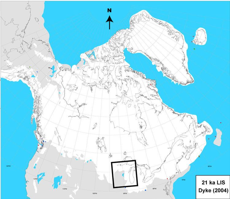
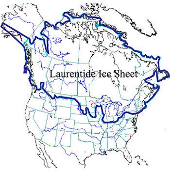
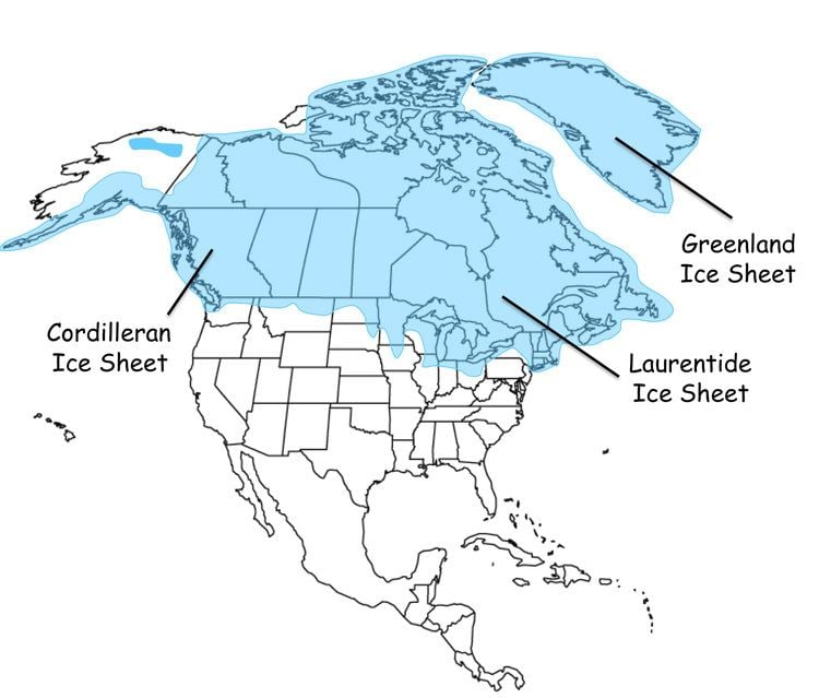
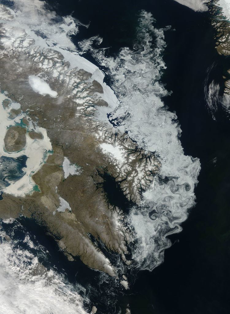
The Laurentide Ice Sheet was a massive sheet of ice that covered millions of square kilometers, including most of Canada and a large portion of the northern United States, multiple times during the Quaternary glacial epochs— from 2.588 ± 0.005 million years ago to the present. The last advance covered most of northern North America between c. 95,000 and c. 20,000 years before the present day, and among other geomorphological effects, gouged out the five Great Lakes and the hosts of smaller lakes extending from the extensive lakes of Minnesota, Wisconsin, and Michigan to the Finger Lakes, through Lake Champlain and Lake George areas of New York, across the northern Appalachians into and through all of New England and Nova Scotia. At times, its southern margin included the present-day sites of northeastern coastal towns and cities such as Portsmouth, New Hampshire, Boston, New York City, and Great Lakes coastal cities and towns as far south as Chicago and St. Louis, Missouri—and then followed quite precisely the present course of the Missouri River up to the northern slopes of the Cypress Hills, beyond which it merged with the Cordilleran Ice Sheet. The ice coverage extended approximately as far south as 38 degrees latitude in the mid-continent.
Contents
Description
This ice sheet was the primary feature of the Pleistocene epoch in North America, commonly referred to as the ice age. It was up to 2 mi (3.2 km) thick in Nunavik, Quebec, Canada but much thinner at its edges where nunataks were common in hilly areas. It created much of the surface geology of southern Canada and the northern United States, leaving behind glacially scoured valleys, moraines, eskers and glacial till. It also caused many changes to the shape, size, and drainage of the Great Lakes. As but one of many examples, near the end of the last ice age, Lake Iroquois extended well beyond the boundaries of present-day Lake Ontario, and drained down the Hudson River into the Atlantic Ocean.
Its cycles of growth and melting were a decisive influence on global climate during its existence. This is because it served to divert the jet stream which would otherwise flow from the relatively warm Pacific Ocean through Montana and Minnesota to the south. This gave the southwestern United States, otherwise a desert, abundant rainfall during ice ages — in extreme contrast to most other parts of the world which became exceedingly dry, though the effect of ice sheets in Europe had an analogous effect on the rainfall in Afghanistan, parts of Iran, possibly western Pakistan in winter, as well as North Africa.
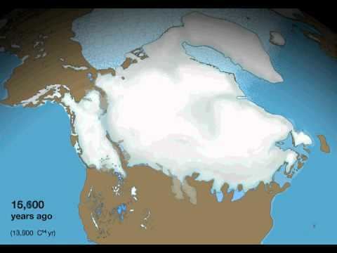
Its melting also caused major disruptions to the global climate cycle, because the huge influx of low-salinity water into the Arctic Ocean via the Mackenzie River is believed to have disrupted the formation of North Atlantic Deep Water, the very saline, cold, deep water that flows from the Greenland Sea. This interrupted the thermohaline circulation, creating the brief Younger Dryas cold epoch and a temporary re-advance of the ice sheet, which did not retreat from Nunavik until 6,500 years ago.
Some people have argued that huge influxes of fresh water stopped the feeding of the ice sheet and starved it, aiding the retreat that had already begun. This is a controversial position because it is known that the North Atlantic was very cold throughout glacial periods and it is likely that the anticyclone on top of the ice sheet helped sustain it through moist easterly winds which encouraged snow-bearing winds from the south.
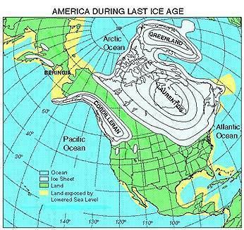
During the Pre-Illinoian Stage the Laurentide Ice Sheet extended even farther south, advancing as far as the Missouri and Ohio River valleys.
The ultimate collapse of the Laurentide Ice Sheet is also suspected to have influenced European agriculture indirectly through the rise of global sea levels.
Canada's oldest ice is a 20,000-year-old remnant of the Laurentide Ice Sheet called the Barnes Ice Cap, located on central Baffin Island.