
Topo map USGS Bloody Mountain Elevation 3,602 m Easiest route Hiking | First ascent 1926 by Norman Clyde Prominence 310 m | |
 | ||
Similar Mount Morrison, Bloody Mountain, Red Slate Mountain, Mount Baldwin, Dunderberg Peak | ||
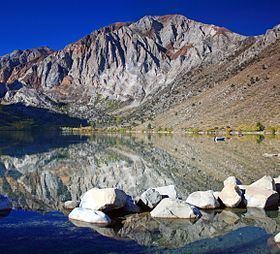
Laurel Mountain is a peak in Mono County, California. It lies in the Sherwin Range of the Sierra Nevada and is in the Inyo National Forest and the John Muir Wilderness. It reaches a height of 11,818 feet (3,602 m) and is largely composed of metamorphic rock caused by contact with an intruding pluton in the late Cretaceous.
Map of Laurel Mountain, California 93546, USA
References
Laurel Mountain (California) Wikipedia(Text) CC BY-SA