
COSPAR ID 2013-008A Mission duration 5–10 years (planned) Perigee 701,000 m Apogee 703,000 m | SATCAT no. 39084 Launch date 11 February 2013 Launch mass 2,623 kg | |
 | ||
Website landsat.usgs.gov/landsat8 Launch site Vandenberg Air Force Base, Vandenberg AFB Space Launch Complex 3 Manufacturers Similar | ||
Landsat 8 is an American Earth observation satellite launched on February 11, 2013. It is the eighth satellite in the Landsat program; the seventh to reach orbit successfully. Originally called the Landsat Data Continuity Mission (LDCM), it is a collaboration between NASA and the United States Geological Survey (USGS). NASA Goddard Space Flight Center in Greenbelt, Maryland, provided development, mission systems engineering, and acquisition of the launch vehicle while the USGS provided for development of the ground systems and will conduct on-going mission operations.
Contents
- History
- Launch
- Mission overview
- Technical details
- Spacecraft
- Operational Land Imager
- Thermal InfraRed Sensor
- Ground system
- References
The satellite was built by Orbital Sciences Corporation, who served as prime contractor for the mission. The spacecraft's instruments were constructed by Ball Aerospace and NASA's Goddard Space Flight Center, and its launch was contracted to United Launch Alliance. During the first 108 days in orbit, LDCM underwent checkout and verification by NASA and on 30 May 2013 operations were transferred from NASA to the USGS when LDCM was officially renamed to Landsat 8.
History
The original Landsat 8 plans called for NASA to purchase data meeting Landsat 8 specifications from a commercially owned and operated satellite system; however, after an evaluation of proposals received from industry, NASA cancelled the Request for Proposals in September 2003. In August 2004, a memorandum from the White House Office of Science and Technology Policy (OSTP) directed Federal agencies to place Landsat-type sensors on the National Polar-orbiting Operational Environmental Satellite System (NPOESS) platform. Following an evaluation of the technical complexity of this task, the strategy was adjusted and on December 23, 2005, the OSTP issued a memorandum directing NASA to implement the Landsat 8 in the form of a free-flyer spacecraft carrying an instrument referred to as the Operational Land Imager (OLI). In December 2009, a decision was made to add a thermal infrared sensor (TIRS) to the mission payload.
Launch
The satellite was launched aboard an Atlas V 401 carrier rocket with an Extended Payload Fairing. The launch took place at 18:02 UTC (10:02 PST) on 11 February 2013, from Space Launch Complex 3E at Vandenberg Air Force Base. Seventy eight minutes and thirty seconds later, the spacecraft separated from the Atlas V upper stage, successfully completing the launch.
First images from the spacecraft were collected on March 18, 2013. Landsat 8 joins Landsat 7 on-orbit, providing increased coverage of the Earth's surface.
Mission overview
With Landsat 5 retiring in early 2013, leaving Landsat 7 as the only on-orbit Landsat program satellite, Landsat 8 ensures the continued acquisition and availability of Landsat data utilizing a two-sensor payload, the Operational Land Imager (OLI) and the Thermal InfraRed Sensor (TIRS). Respectively, these two instruments collect image data for nine shortwave bands and two longwave thermal bands. The satellite has been developed with a 5.25 years mission design life but has enough fuel on board to provide for upwards of ten years of operations.
Landsat 8 consists of three key mission and science objectives:
Technical details
Providing moderate-resolution imagery, from 15 meters to 100 meters, of Earth’s land surface and polar regions, Landsat 8 operates in the visible, near-infrared, short wave infrared, and thermal infrared spectrums. Landsat 8 captures more than 700 scenes a day, an increase from the 250 scenes a day on Landsat 7. The OLI and TIRS sensors will see improved signal to noise (SNR) radiometric performance, enabling 12-bit quantization of data allowing for more bits for better land-cover characterization.
Planned parameters for Landsat 8 standard products
Spacecraft
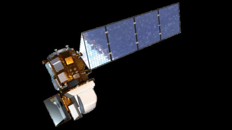
The Landsat 8 spacecraft was built by Orbital Sciences Corporation, under contract to NASA, and uses Orbital's standard LEOStar-3 satellite bus. Orbital was responsible for the design and manufacture of the Landsat 8 spacecraft bus, the integration of the customer-furnished payload instruments, and full observatory testing, including environmental and EMI/EMC. The spacecraft supplies power, orbit and attitude control, communications, and data storage for OLI and TIRS.
All components, except for the propulsion module, are mounted on the exterior of the primary structure. A single deployable solar array generates power for the spacecraft components and charges the spacecraft’s 125 amp-hour nickel-hydrogen (Ni-H2) battery. A 3.14-terabit solid state data recorder provides data storage aboard the spacecraft and an X-band antenna transmits OLI and TIRS data either in real time or played back from the data recorder. The OLI and TIRS are mounted on an optical bench at the forward end of the spacecraft.
Operational Land Imager
Landsat 8's Operational Land Imager (OLI) improves on past Landsat sensors and was built, under contract to NASA, by Ball Aerospace. OLI uses a technological approach demonstrated by the Advanced Land Imager sensor flown on NASA’s experimental EO-1 satellite. The OLI instrument uses a pushbroom sensor instead of whiskbroom sensors that were utilized on earlier Landsat satellites. The pushbroom sensor aligns the imaging detector arrays along Landsat 8's focal plane allowing it to view across the entire swath, 115 miles (185 kilometers) cross-track field of view, as opposed to sweeping across the field of view. With over 7,000 detectors per spectral band, the pushbroom design results in increased sensitivity, fewer moving parts, and improved land surface information.
OLI collects data from nine spectral bands. Seven of the nine bands are consistent with the Thematic Mapper (TM) and Enhanced Thematic Mapper Plus (ETM+) sensors found on earlier Landsat satellites, providing for compatibility with the historical Landsat data, while also improving measurement capabilities. Two new spectral bands, a deep blue coastal / aerosol band and a shortwave-infrared cirrus band, will be collected, allowing scientists to measure water quality and improve detection of high, thin clouds.
Thermal InfraRed Sensor
The Thermal InfraRed Sensor (TIRS), built by the NASA Goddard Space Flight Center, conducts thermal imaging and supports emerging applications such as evapotranspiration rate measurements for water management. The TIRS focal plane uses GaAs Quantum Well Infrared Photodetector arrays (known as QWIPs) for detecting the infrared radiation—a first for the Landsat program. The TIRS data will be registered to OLI data to create radiometrically, geometrically, and terrain-corrected 12-bit Landsat 8 data products. Like OLI, TIRS employs a pushbroom sensor design with a 185 kilometer swath width. Data for two long wavelength infrared bands will be collected with TIRS. This provides data continuity with Landsat 7's single thermal IR band and adds a second.
With TIRS being a late addition to the Landsat 8 satellite, the design life requirement was relaxed in order to expedite development of the sensor. As such, TIRS only has a three-year design life.
Ground system
The Landsat 8 ground system performs two main functions: command and control of the satellite and management of mission data sent from the satellite. Satellite command and control is provided by the Mission Operations Center at NASA's Goddard Spaceflight Center. Commands are sent from the Mission Operations Center to the satellite via a Ground Network Element (GNE). Mission data from the satellite is downlinked to receiving stations in Sioux Falls, SD, Gilmore Creek, AK, and Svalbard, Norway. From there, the data is sent via the GNE to the USGS Earth Resource Observation and Science (EROS) Center in Sioux Falls, where it is ingested into the Data Processing and Archive System.