
Primary inflows Basin countries Canada Surface elevation 202 m | Primary outflows Saint Francis River Max. length 9.1 km (5.7 mi) Province Québec Inflow source Saint Francis River | |
 | ||
Similar Lac Beauchamp Park, Gatineau River, Lake of Two Mountains, Lake Saint‑Louis, Watson Settlement Bridge | ||
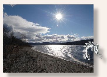
Lake Pohenegamook (Lac Pohénégamook) is a Canadian lake located in Temiscouata Regional County Municipality (MRC), in administrative region of Bas-Saint-Laurent, in southeastern Quebec immediately north of the International Boundary with Maine at Aroostook County. It is the source of the Saint Francis River.
Contents
Map of Pohenegamook Lake, Pohenegamook, QC, Canada
GeographyEdit
Oriented north-south, the lake is nestled in a valley in the Notre Dame Mountains, part of the Appalachian Range. Route 289 runs along the southern and western shores through the municipality of Pohénégamook - an amalgamation of several villages.
The National Transcontinental Railway constructed its mainline from Winnipeg to Moncton along the western and southern shores in 1912 - today this line forms the mainline of CN Rail between Halifax and Montreal.
The community of Estcourt Station, Maine (the northernmost point in New England) is located immediately south of the CN railway line at the lake's southern shore.
ToponymyEdit
The place name "Lake Pohenegamook" was formalized on December 5, 1968 at the Commission de toponymie du Québec (Quebec Names Board).