
Primary inflows Surface area 300 km (120 sq mi) Surface elevation 268 m | Area 300 km² Province Québec | |
 | ||
Primary outflows Kipawa River, Gordon Creek | ||
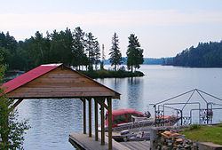
Lake kipawa fishing trip july 2014
Lake Kipawa (in French: Lac Kipawa) is a lake in far south-west Quebec, Canada, near the border with Ontario, north of Témiscaming, Quebec. Also see Kipawa River which is the only natural outflow of Kipawa Lake, the southern Gordon Creek in Temiskaming sud being a man made channel.
Contents
- Lake kipawa fishing trip july 2014
- Map of Lake Kipawa QuC3A9bec Canada
- Lake kipawa fishing 2015
- References
Map of Lake Kipawa, Qu%C3%A9bec, Canada
Lake Kipawa is currently the source of debate among Innergex and Hydro Quebec concerning water rights for their competing hydro electric projects.
Lake Kipawa is highly irregularly shaped, with deep bays (such as Chemagan, des Plongeurs, du Huard, Dorval, Pratt, des Anglais, and Campbell) and large islands (notably McKenzie and aux Ours). It forms a vast labyrinth with many other interconnecting bodies of water. Bordering the lake are the communities of Kipawa, Laniel, and the Keboawek Reserve. The lake is popular with fishermen for its walleye and northern pike abundance, as well as a supply of trout. Various lodges (such as Kipawa Lodge which is located at Edward's Narrows and Alwaki Lodge, which is located on Thompson Island) bordering the lake offer hunting and fishing tours and accommodations.
The lake's name, of Algonquin origin, has been written in many different forms before "Kipawa" became official in 1968: Kippawa, Kippewa, Kepawa, Keepawe (1884), Kipawe, Kipakowe, Kipahowe.
Lake Kipawa was the epicenter of the 2000 Kipawa earthquake.