
Type reservoir Surface area 315 acres (127 ha) Area 127 ha Number of islands 1 | Primary inflows Surface elevation 74 m Inflow source San Leandro Creek Cities Oakland | |
 | ||
Similar Lake Chabot Regional, Anthony Chabot Regional, Montara Mountain, Wapack Trail, Capitol Peak | ||
fishing at lake chabot by verdugoadventures
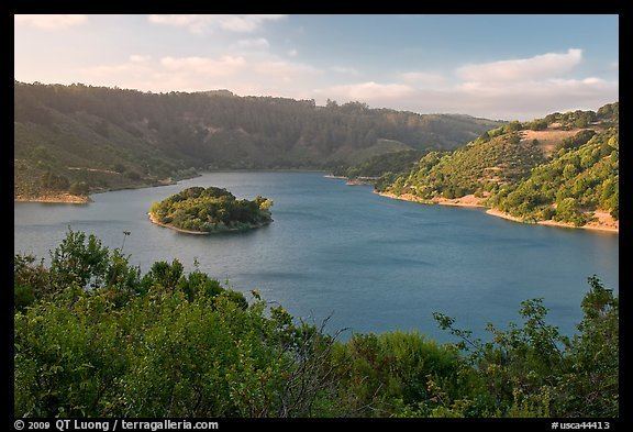
Lake Chabot is a man-made lake covering 317 acres (1.3 km2) in Alameda County, California. Part of the lake lies within Oakland city limits, but most of it lies in unincorporated Castro Valley, just east of San Leandro. It was formed by the damming of San Leandro Creek.
Contents
- fishing at lake chabot by verdugoadventures
- Map of Lake Chabot California USA
- Lake chabot quarry lakes bass fishing late january california fish
- HistoryEdit
- DescriptionEdit
- ImpactEdit
- References
Map of Lake Chabot, California, USA
Lake chabot quarry lakes bass fishing late january california fish
HistoryEdit
The Lake Chabot dam was built in 1874-1875 as a primary source for water in the East Bay. At that time, the dam and reservoir were known simply as the San Leandro Reservoir. It was renamed Lower San Leandro Reservoir when another dam was built on the same creek upstream of the original lake, creating Upper San Leandro Reservoir.
DescriptionEdit
Lake Chabot was closed to recreation for 91 years. Legislation passed in the 1960s opened the lake for controlled recreation uses. Currently, the lake serves as a standby emergency water supply. For this reason, visitors are asked to observe certain necessary regulations to keep the waters pure. There are also blooms of toxic blue-green algae in the lake during the summer and fall that make contact with the water dangerous.
Anthony Chabot Regional Park and Lake Chabot Regional Park offer a number of activities including family and group camping, hiking, a public marksmanship/shooting range, equestrian trails, bicycle trails, nature study, picnicking, golf, fishing, boat rental, a marina, a restaurant and boat tours of the lake.
ImpactEdit
Aside from sedimentation caused by normal earth-fill dam construction, much of the dam's clay core and soil overburden were washed away in a storm during construction in 1874, resulting in the formation of Arrowhead Marsh in San Leandro Bay, at the mouth of San Leandro Creek near the Oakland International Airport. Coastal surveys show the marsh appearing sometime between 1855 and 1895, though logging of the San Antonio Forest may have also played a role.
Today, Arrowhead Marsh is one of the last remaining wetlands in the East Bay, and part of Martin Luther King Jr. Regional Shoreline, while nearly all of the surrounding historic marsh has been covered with industrial development.