
Effective January 1, 1982 Time zone EST (UTC−5) Area 12,431 km² Province Québec | County seat Les Escoumins Area code(s) 418 and 581 Population 11,546 (2011) | |
 | ||
Points of interest Marine Environment Discovery, Centre d'interprétation des mam, Chapelle de Tadoussac, Centre D'Interpretation Archéo T, Les Ecumeurs Du Saint | ||
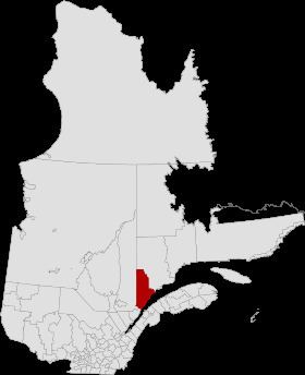
La Haute-Côte-Nord is a regional county municipality in northeastern Quebec, Canada, in the Côte-Nord region. It is located on the Gulf of Saint Lawrence where the Saguenay River flows into it. The seat is Les Escoumins. The municipality has a land area of 11,611.15 square kilometres (4,483.09 sq mi) and a 2006 census population of 12,303 inhabitants. Its largest community is the city of Forestville.
Contents
- Map of La Haute CC3B4te Nord Regional County Municipality QC Canada
- Subdivisions
- Access Routes
- References
Map of La Haute-C%C3%B4te-Nord Regional County Municipality, QC, Canada
Except for Sacré-Coeur, which is located along the Saguenay River, all places and municipalities of the RCM are along Quebec Route 138 directly on the shores of the Saint Lawrence River. The unorganized territory of Lac-au-Brochet makes up some 83% of the interior part of the RCM.
Subdivisions
There are 9 subdivisions and one native reserve within the RCM:
Access Routes
Highways and numbered routes that run through the municipality, including external routes that start or finish at the county border: