
Website www.kyenjojo.go.ug | Sub-region Toro sub-region Time zone EAT (UTC+3) Area 2,350 km² | |
 | ||
Region Western Region of Uganda | ||
Mapping priority service delivery needs in kyenjojo district wmv
Kyenjojo District is a district in the Western Region of Uganda. Kyenjojo town is the site of the district headquarters.
Contents
- Mapping priority service delivery needs in kyenjojo district wmv
- Thousands celebrate omukama s 23rd cerebrations in kyenjojo district
- Location
- Overview
- Population
- Economic activities
- References
Thousands celebrate omukama s 23rd cerebrations in kyenjojo district
Location
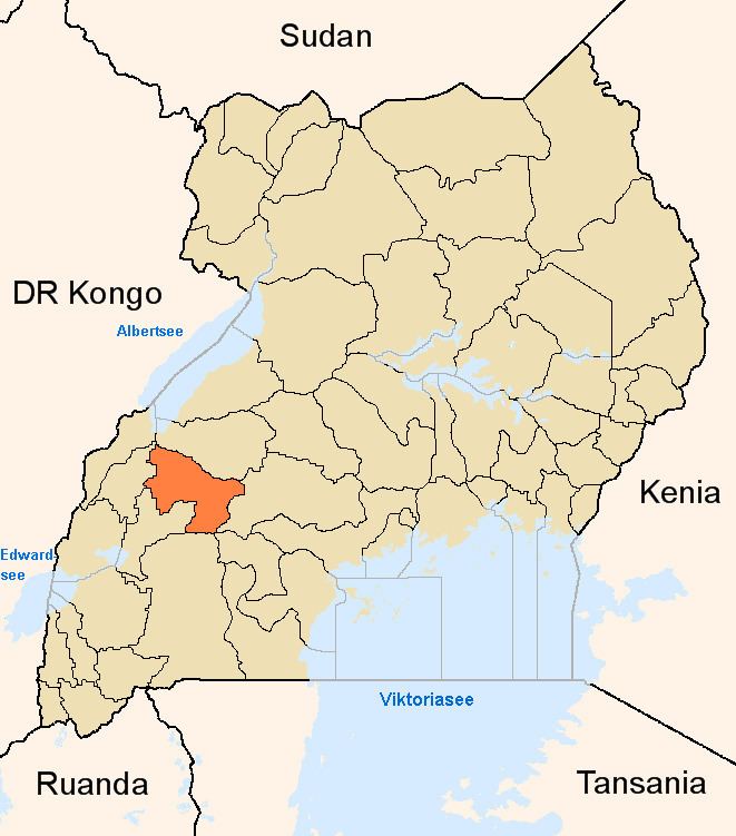
Kyenjojo District is bordered by Kibale District to the north, Kyegegwa District to the east, Kamwenge District to the south, and Kabarole District to the west. The district headquarters at Kyenjojo are approximately 274 kilometres (170 mi), by road, west of Kampala, Uganda's capital and largest city. The coordinates of the district are 00 37N, 30 37E.
Overview
Kyenjojo District was created in 2000. It is divided into two counties: Mwenge North and Mwenge South. Kyenjojo means: "the place where elephants live"; it is derived from the Rutooro word "enjojo", (elephant)(s). Like in most Ugandan Bantu languages, "Mwenge" means "banana beer". Mwenge county is famous for its banana beer production.
The district is part of Toro sub-region, which is coterminus with the Kingdom of Toro, one of the ancient traditional monarchies in Uganda.
Population
The 1991 national census estimated the district population at about 182,000. The next national census, in 2002, estimated the population at 266,250. In 2012, the population was estimated at 383,600.
Economic activities
Agriculture is the main economic activity in the district. The major crops grown include: