
 | ||
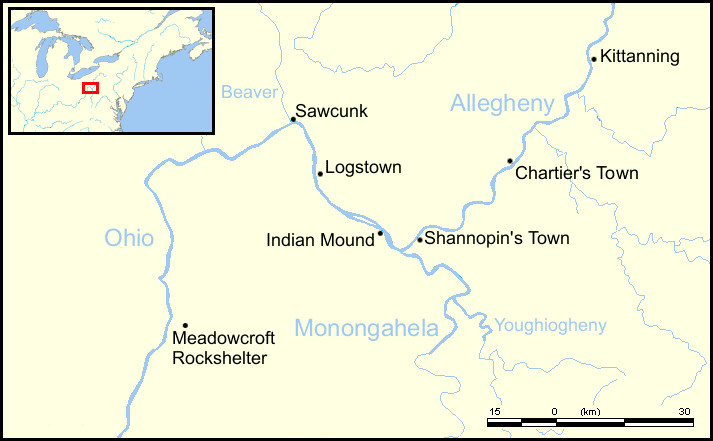
Kittanning (Lenape Kithanink; [kitˈhaːniŋ]) was an 18th-century Native American village in the Ohio Country, located on the Allegheny River at present-day Kittanning, Pennsylvania. The village was at the western terminus of the Kittanning Path, an Indian trail that provided a route across the Alleghenies between the Ohio and Susquehanna river basins. The village, inhabited by Delaware (Lenape) and Shawnee Indians, was most likely the largest such village on the western side of the Alleghenies at the time, having an estimated 300–400 residents in 1756. Kittanning was settled in 1724 by Indians who had migrated from eastern Pennsylvania as white settlement rapidly expanded.
The name Kithanink means 'on the main river' in the Lenape language, from kit- 'big' + hane 'mountain river' + -ink (suffix used in place names). "The main river" is a Lenape epithet for the Allegheny and Ohio, considered as all one river.
During the French and Indian War, Kittanning was used as a staging point for raids by Delaware and Shawnee warriors against British colonists at Fort Granville in the Juniata River valley in central Pennsylvania. In response, Lieutenant Colonel John Armstrong led Pennsylvania militiamen on the Kittanning Expedition, which destroyed the village on about 8 September 1756.