
Country United States GNIS feature ID 0470707 Area 1,871 km² Population 3,278 (2000) University Barclay College | Time zone Central (CST) (UTC-6) Elevation 665 m Local time Tuesday 10:30 AM Area code 620 | |
 | ||
Weather 1°C, Wind SE at 23 km/h, 60% Humidity | ||
Kiowa Rural Township is the sole township in Kiowa County, Kansas, United States. The population was 3,278 at the 2000 census, out of whom 2,346 lived in one of the township's three cities and 813 lived in unincorporated areas of the township. Kiowa Rural Township's boundaries are identical to those of Kiowa County: there are no other townships in the county, and none of the county's cities are governmentally independent.
Contents
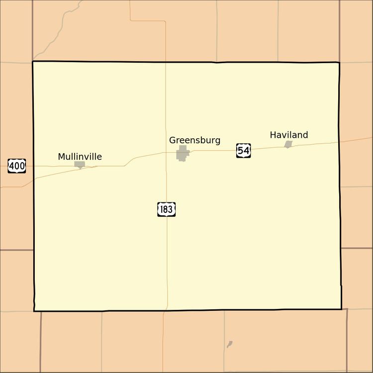
Map of Kiowa Rural, KS, USA
History
Kiowa Rural Township was once named simply "Kiowa Township." It has not always been the only township in the county: until 1980-01-01, when all existing townships in the county were dissolved, there was also Martin Township, located near Mullinville in the western part of the county, and Wellsford Township (previously Dowell Township), located near Haviland in the eastern part of the county. Even these three townships were significantly expanded from past years; in 1940, Kiowa County was composed of fifteen townships: Brenham, Butler, Center, Garfield, Glick, Highland, Kiowa, Lincoln, Martin, Reeder, Union, Ursula, Valley, Wellsford, and Westland. Although it includes the territories of those former townships, Kiowa Rural Township itself is not important to local government, having become inactive.
Geography
Because Kiowa Rural Township is coterminous with the county, its statistics are similar to the county's. It covers an area of 722.39 square miles (1871.0 square kilometers); of this, 0.2 square miles (0.5 square kilometers) or 0.03%, is water.
Six cemeteries are located in the township: Belvidere, Boles, Fairview, Haviland, Hillcrest, and McKinley.
Communities
Seven populated places are located in Kiowa Rural Township:
Adjacent townships
Transportation
Major highways in Kiowa Rural Township include U.S. Routes 54, 183, and 400. As well, two airports are located in the township: Gail Ballard Municipal Airport and Paul Windle Municipal Field.