
Founded 1873 Population 5,065 (2013) | Congressional district At-large Area 2,238 km² Unemployment rate 3.5% (Apr 2015) | |
 | ||
Named for George W. Kingsbury and T.A. Kingsbury Website kingsbury.sdcounties.org Cities | ||
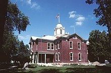
Kingsbury County is a county located in the U.S. state of South Dakota. As of the 2010 census, the population was 5,148. Its county seat is De Smet. The county was created in 1873 and organized in 1880. It was named for brothers George W. and T. A. Kingsbury, descendants of the colonial English Kingsbury family in Boston, Massachusetts. They were prominently involved in the affairs of Dakota Territory and served as elected members of several Territorial Legislatures.
Contents
- Map of Kingsbury County SD USA
- Geography
- Major highways
- Adjacent counties
- Demographics
- 2000 census
- 2010 census
- Cities
- Towns
- Unincorporated communities
- Ghost town
- Townships
- Notable residents
- References
Map of Kingsbury County, SD, USA
Geography
According to the U.S. Census Bureau, the county has a total area of 864 square miles (2,240 km2), of which 832 square miles (2,150 km2) is land and 3.6 square miles (9.3 km2) (6.2%) is water.
Major highways
Adjacent counties
Demographics
Industrialization of agriculture and the attraction of urban areas have contributed to the decline in population of Kingsbury County, similar to what has occurred in other Plains rural areas. In 2010 it had less than half the population of its peak in 1930, before the Dust Bowl and the Great Depression.
2000 census
As of the census of 2000, there were 5,815 people, 2,406 households, and 1,592 families residing in the county. The population density was 7 people per square mile (3/km²). There were 2,724 housing units at an average density of 3 per square mile (1/km²). The racial makeup of the county was 98.54% White, 0.05% Black or African American, 0.40% Native American, 0.29% Asian, 0.19% from other races, and 0.53% from two or more races. 0.69% of the population were Hispanic or Latino of any race. 36.2% were of German, 22.5% Norwegian, 8.4% Danish, 7.0% American and 5.9% Irish ancestry.
There were 2,406 households out of which 27.90% had children under the age of 18 living with them, 59.00% were married couples living together, 4.40% had a female householder with no husband present, and 33.80% were non-families. 31.50% of all households were made up of individuals and 17.80% had someone living alone who was 65 years of age or older. The average household size was 2.34 and the average family size was 2.95.
In the county, the population was spread out with 24.50% under the age of 18, 6.10% from 18 to 24, 22.90% from 25 to 44, 22.40% from 45 to 64, and 24.20% who were 65 years of age or older. The median age was 43 years. For every 100 females there were 96.30 males. For every 100 females age 18 and over, there were 95.90 males.
The median income for a household in the county was $31,262, and the median income for a family was $41,057. Males had a median income of $26,681 versus $19,174 for females. The per capita income for the county was $16,522. About 7.00% of families and 10.00% of the population were below the poverty line, including 13.50% of those under age 18 and 11.10% of those age 65 or over.
2010 census
As of the 2010 United States Census, there were 5,148 people, 2,222 households, and 1,418 families residing in the county. The population density was 6.2 inhabitants per square mile (2.4/km2). There were 2,720 housing units at an average density of 3.3 per square mile (1.3/km2). The racial makeup of the county was 98.1% white, 0.5% American Indian, 0.3% Asian, 0.1% black or African American, 0.3% from other races, and 0.8% from two or more races. Those of Hispanic or Latino origin made up 1.4% of the population. In terms of European ancestry, 42.8% were German, 25.5% were Norwegian, 10.9% were Danish, 9.6% were Irish, 7.2% were English, and 3.5% were American.
Of the 2,222 households, 24.3% had children under the age of 18 living with them, 55.6% were married couples living together, 5.0% had a female householder with no husband present, 36.2% were non-families, and 32.2% of all households were made up of individuals. The average household size was 2.23 and the average family size was 2.81. The median age was 47.1 years.
The median income for a household in the county was $44,948 and the median income for a family was $56,925. Males had a median income of $35,585 versus $28,141 for females. The per capita income for the county was $24,660. About 7.0% of families and 9.2% of the population were below the poverty line, including 8.8% of those under age 18 and 10.8% of those age 65 or over.
Cities
Towns
Unincorporated communities
Ghost town
Townships
The county is divided into thirteen townships: