
 | ||
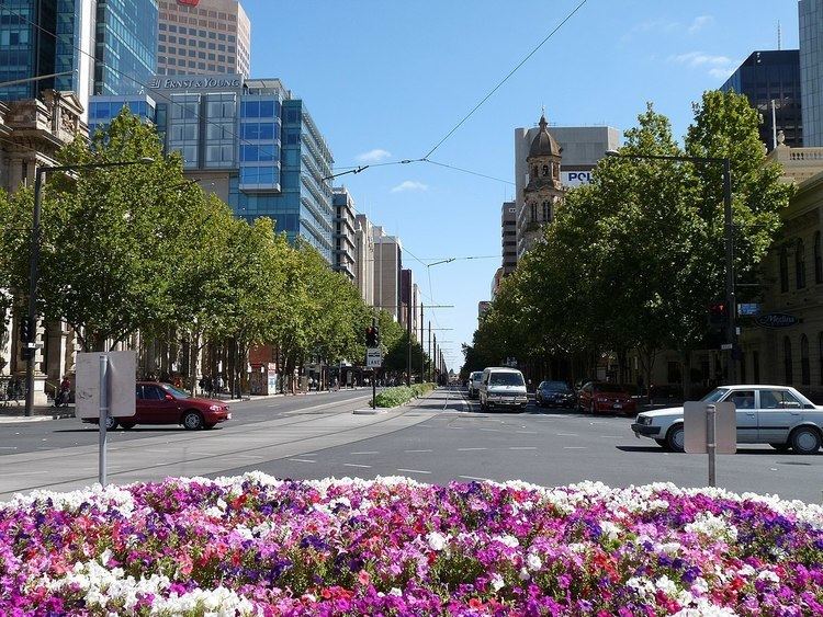
King William Street is the part of a major arterial road that traverses the CBD and centre of Adelaide (the capital of South Australia). It was named by the Street Naming Committee on 23 May 1837 after King William IV, the then reigning monarch, who died within a month. King William Street is 132 feet (40 m) wide, and is the widest main street of all the Australian State capital cities, which are significantly narrower by comparison. It is historically considered one of Adelaide's high streets, for its focal point of businesses, shops and other prominent establishments.
Contents
- Map of King William Rd South Australia Australia
- Glenelg Tramline
- King William Road
- Name changes on streets crossing King William Street
- In popular culture
- References
Map of King William Rd, South Australia, Australia
Glenelg Tramline
The Glenelg Tram runs the entire length of the street, with the northern end of the line continuing along North Terrace to the Entertainment Centre in Hindmarsh and the southern end continuing along its own off-road right-of-way to Glenelg. Tram travel north of South Terrace is free.
King William Road
The name King William is applied several times to the continuous stretch of road that begins in the inner southern suburbs and terminates in North Adelaide. Where it runs through the Adelaide city centre, it is named "King William Street"; elsewhere it is named "King William Road". It starts in the south as King William Road, at the north edge of Heywood Park in Unley Park, and runs through Hyde Park and Unley to Greenhill Road. It runs through the south parklands (as Peacock Road), the Adelaide city centre (as King William Street) and continues north from North Terrace as King William Road to Brougham Place, North Adelaide. The road continues north to National Highway 1 as O'Connell Street, but the name King William is not again used. The northern section called King William Road (connecting the Adelaide city centre with North Adelaide) passes several of Adelaide's landmarks, including Government House, Elder Park, the Adelaide Festival Centre, Adelaide Oval and St Peter's Cathedral. The section from North Terrace over the Adelaide Bridge to Pennington Terrace was named King William Road at the opening of the bridge in 1877.
Name changes on streets crossing King William Street
Between North Terrace and South Terrace, all east-west roads change their names as they cross King William Street. It is said this is because no one is allowed to cross the path of a monarch.
Also, travelling north-south, the cross-streets alternate between being wide (up to 4-lanes wide) and narrow (2-lanes wide), with the exception that Grote and Wakefield Streets are up to 6-lanes wide. Note that in the south half of the city, in several places the Adelaide City Council has increased the widths of footpaths and changed the road markings so that traffic is restricted to use a lesser number of lanes than the full width of the road.
Travelling south from North Terrace, the street pairs are:
In popular culture
King William Road was referenced in the John Schumann song "Hyde Park Calling (King William Road Scene 1)" on the 1993 album True Believers.