North Terrace is one of the four terraces that bound the central business and residential district of Adelaide, the capital city of South Australia. It runs east-west, along the northern edge of "the square mile". The western end continues on to Port Road, and the eastern end continues across the Adelaide Parklands as Botanic Road.
Theoretically, the northern side of North Terrace is part of the Adelaide Parklands. However, much of the space between North Terrace and the River Torrens is occupied by cultural institutions and other public buildings. Starting from West Terrace and travelling east, these buildings include:
(West Terrace)
ParklandThe new Royal Adelaide Hospital (construction site)South Australian Health and Medical Research Institute (SAHMRI)Adelaide Medical and Nursing Schools (construction site for the University of Adelaide)City Sk8 Park, a skateboarding facility next to the railway yards(Morphett Street bridge)
Adelaide Convention Centre, Exhibition Halls (partly above the railway station platforms)Riverside Centre (above the railway station platforms)InterContinental Hotel (above the railway station platforms)Adelaide railway station buildingAdelaide Casino (inside the historic station building)Old Parliament House - the original South Australian Parliament buildingParliament HouseThe Adelaide Festival Centre and Elder Park are behind Parliament House, between North Terrace and the River Torrens – also accessible from King William Road(King William Road)
Government House, the official residence of the Governor of South AustraliaThe historic Torrens Parade Ground is behind Government House, between North Terrace and the River Torrens – accessible from King William RoadThe South African War Memorial stands in front of Government House on a traffic island at the corner of North Terrace and King William RoadThe Jubilee 150 Walkway commences in front of Government HouseNational War Memorial(Kintore Avenue)
State Library of South AustraliaInstitute Building (1859)Spence WingMortlock Wing (1884)South Australian MuseumArt Gallery of South AustraliaUniversity of Adelaide (original campus, now called the Main campus):Mitchell BuildingElder Conservatorium of MusicBonython HallNapier BuildingLigertwood BuildingThe Jubilee 150 Walkway finishes in front of the Napier/Ligertwood plaza.University of South Australia (original campus, now called the City East campus)Brookman Building(Frome Road)
The (old/current) Royal Adelaide HospitalAdelaide Botanic Gardens(East Terrace)
Adelaide Botanic GardensNational Wine Centre of AustraliaStarting at West Terrace and travelling east, the southern side of the street includes:
(West Terrace)
The Newmarket HotelAssorted accommodation, businesses and medical practicesMany buildings forming the City West campus of the University of South AustraliaThe Lion Arts Centre (in the old Fowler's Lion Flour Factory building)(Morphett Street bridge)
The historic Holy Trinity Church (Anglican)Assorted accommodation, businesses and government officesThe Dame Roma Mitchell buildingAssorted accommodation and various Adelaide head offices (e.g. MyBudget, Origin Energy)(King William Street)
The former Adelaide head office of the Westpac BankThe exclusive, historic and discreetly labelled Adelaide Club (for gentlemen)The Myer Centre, part of the Rundle Mall shopping precinctThe exclusive, historic and unlabelled Queen Adelaide Club (for ladies)"Gawler Chambers", the former Adelaide offices of the South Australian Company(Gawler Place)
Assorted businesses and medical practicesDavid Jones, part of the Rundle Mall shopping precinctAssorted businesses, medical practices and University of Adelaide buildingsThe historic Scots Church (originally Free Church of Scotland, then Presbyterian, now Uniting Church)(Pulteney Street)
Various buildings occupied by the University of AdelaideThe historic and architecturally elaborate Freemasons' buildingThe Waterhouse houseAssorted businessesThe First Church of Christ, Scientist ("Christian Scientist" Church)(Frome Street)
Assorted businessesThe historic Ayers House19th century Terrace housesThe historic Botanic Hotel(East Terrace)
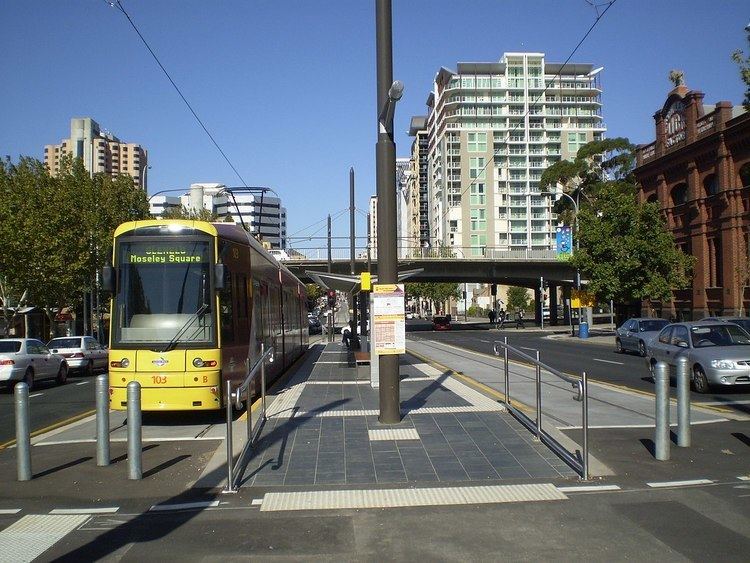
ParklandIn October 2007, the extension of the Glenelg Tramline from Victoria Square to the University of South Australia City West campus was completed. In 2009, construction commenced on a further extension of the line west to the Parklands, and then northwest and west through the Parklands to the Adelaide Entertainment Centre at the start of Port Road, Adelaide's major northwestern arterial road.
The tram now operates from Glenelg to South Terrace, along the entire length of King William Street to North Terrace, along North Terrace to West Terrace, and then to the Entertainment Centre. Talk of possible further extensions periodically surfaces in newspapers and politicians' speeches.