
Elevation 3,790 m Population 1,809 (1991) | Time zone Nepal Time (UTC+5:45) Local time Monday 3:19 PM Area code 038 | |
 | ||
Weather -1°C, Wind SW at 11 km/h, 52% Humidity Points of interest Khumbu, Kala Patthar, Khumbu Glacier, Gokyo Lakes, Ama Dablam | ||
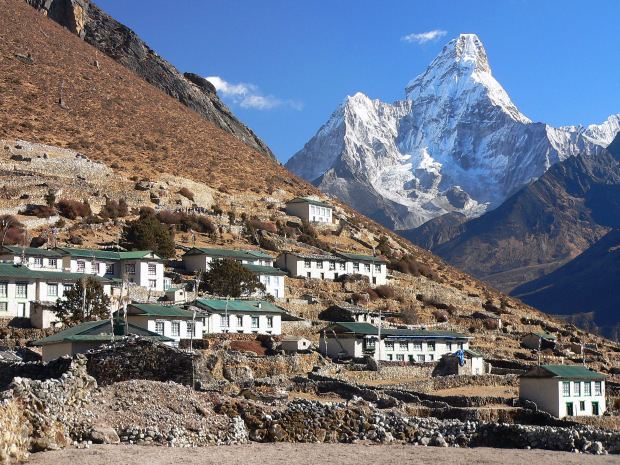
Nepal 2010 khumjung village
Khumjung (Nepali: खुम्जुंग) is a village and Village Development Committee in Solukhumbu District in the Sagarmatha Zone of north-eastern Nepal. It is located in the Khumbu region inside Sagarmatha National Park, a world heritage site. The village is at an elevation of 3,790 metres above sea level, and is situated near Mount Khumbila.
Contents
Map of Khumjung, Nepal
A monastery in Khumjung has a purported Yeti scalp. This village has modern communications such as the internet and mobile and landline phones.
The village is the seat of Khumjung village development committee which include Kunde, Khumjung, Tengboche (Tyangboche), Pangboche, Pheriche, Dole, Chharchung, Machhermo, Lobuche, Dingboche, and Gokyo. As of 1991, it had a population of 1809 people living in 433 individual households.
Khumjung school was built by Sir Edmund Hillary's Himalayan Trust in 1961.The school began as two classrooms but now caters for pre-school, primary and secondary sections with over 350 students.