
- elevation 1 m (3 ft) | - elevation 300 m (984 ft) | |
 | ||
- right | ||
Kesagami river solo with jim baird ep 1 packing for the expedition
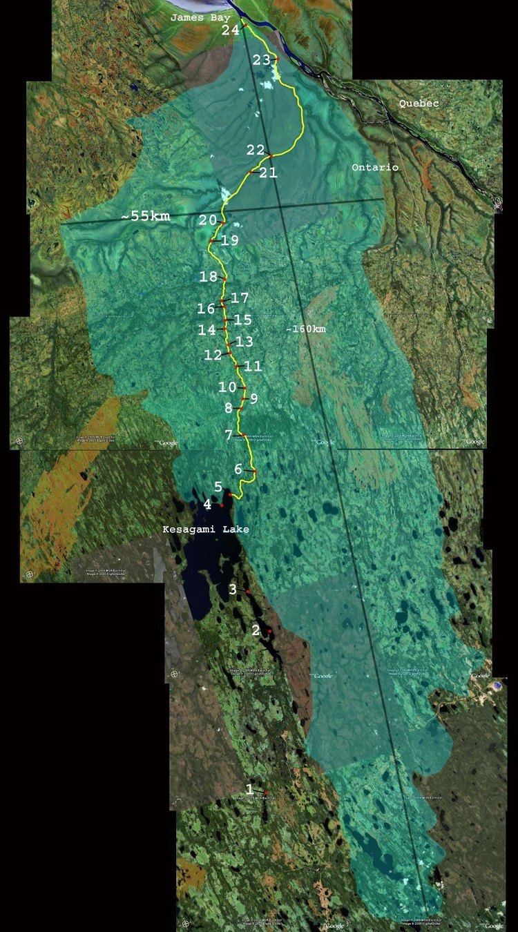
The Kesagami River is a river in northern Cochrane District in Northeastern Ontario, Canada. It is part of the James Bay drainage basin, and is a left tributary of the Harricana River. The lower two-thirds of the river, from about Kesagami Lake and downstream for 112 kilometres (70 mi), are part of Kesagami Provincial Park.
Contents
- Kesagami river solo with jim baird ep 1 packing for the expedition
- Map of Kesagami River Cochrane Unorganized North Part ON Canada
- Camp hurontario kesagami river 2016
- Tributaries
- References
Map of Kesagami River, Cochrane, Unorganized, North Part, ON, Canada
The river begins at an unnamed lake in the Abitibi Uplands just west of Ontario Highway 652 and flows north to the large Kesagami Lake. It exits the lake at the northeast, continues north and descends rapidly to the James Bay Lowlands, where it takes in several tributaries before reaching its mouth at the Harricana River, just upstream of that river's mouth at James Bay.
From Kesagami Lake downstream, the river can be traversed as a canoe route.