
Incorporated 1866 Lowest elevation 206 ft (63 m) Area 21,142 km² | Highest elevation 8,755 ft (2,669 m) Area code 661 Population 864,124 (2013) Unemployment rate 10.3% (Apr 2015) | |
 | ||
Country United States of America Destinations Colleges and Universities California State University, Bakersfield College, Taft College, Cerro Coso Community College, San Joaquin Valley Co | ||
Kern County is a county in the U.S. state of California. As of the 2010 census, the population was 839,631. Its county seat is Bakersfield.
Contents
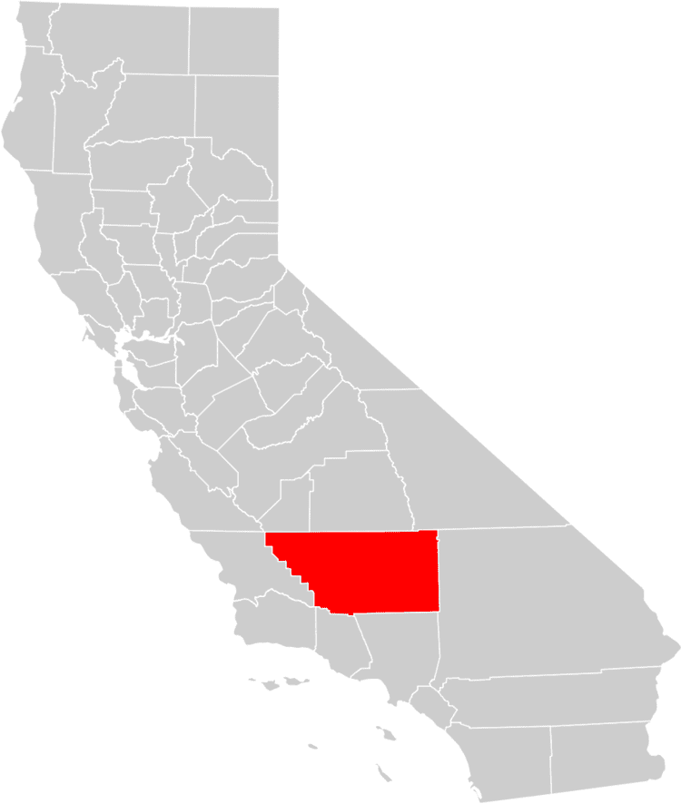
- Map of Kern County CA USA
- Spanish era
- American era
- Etymology
- Earthquakes
- Abuse trials
- Music and Film
- Geography
- Vegetation
- Demographics
- 2010
- 2000
- Metropolitan statistical area
- Public safety
- Fire
- Sheriffs Office
- Federal
- State
- County
- Crime
- General
- Petroleum
- Discovery and development
- Petroleum today
- Aviation and space
- Air pollution
- Public transportation
- Airports
- Recreation
- Magazines
- Newspapers
- TV stations
- Former places
- Population ranking
- References
Map of Kern County, CA, USA
Kern County comprises the Bakersfield, CA Metropolitan statistical area. The county spans the southern end of the Central Valley. Covering 8,161.42 square miles (21,138.0 km2), it ranges west to the southern slope of the Coast Ranges, and east beyond the southern slope of the eastern Sierra Nevada into the Mojave Desert, at the city of Ridgecrest. Its northernmost city is Delano and its southern reach expands just beyond Lebec to the Grapevine and the northern tip of the parallel Antelope Valley.
The county's economy is heavily linked to agriculture and to petroleum extraction. There is also a strong aviation, space, and military presence, such as Edwards Air Force Base, the China Lake Naval Air Weapons Station, and the Mojave Air and Space Port. It is one of the fastest growing areas in the United States in terms of population growth, and suffers from significant water supply issues and poor air quality.
Spanish era
The area was claimed by the Spanish in 1769, and in 1772 Commander Don Pedro Fages became the first European to enter it, from the south by way of the Grapevine Canyon.
Kern County was the site of the Battle of San Emigdio, in March 1824, between the Chumash Indians of the Santa Barbara Mission who rebelled against the Mexican government's taking over mission property and ejecting the natives. This battle with Mexican forces from Monterey under the command of Carlos Carrillo took place at the canyon where San Emigdio Creek flows down San Emigdio Mountain and the Blue Ridge south of Bakersfield near today's Highway 166. It was a low-casualty encounter, with only four Indians killed, and no Mexicans; the surviving Indians were pacified and brought back to Santa Barbara in June 1824 after a pursuit and negotiation in which many were allowed to keep their arms for the return march over the mountains.
American era
In the beginning, the area that became Kern County was dominated by mining in the mountains and in the desert. In 1855 an attempt to form a county in the area was made when the California legislature took the southeastern territory of Tulare County on the west of the Sierra Nevada Mountains for Buena Vista County, but it was never officially organized prior to 1859, when the time of the enabling legislation ran out. The south of Tulare County was later organized as Kern County in 1866, with additions from Los Angeles and San Bernardino Counties. Its first county seat was in the mining town of Havilah, in the mountains between Bakersfield and Tehachapi.
The flatlands were considered inhospitable and impassable at the time due to swamps, lakes, tule reeds and diseases such as malaria. This changed when settlers started draining lands for farming and constructing canals, most dug by hand by hired Chinese laborers. Within 10 years the valley surpassed the mining areas as the economic center of the county, and the county seat was moved as a result from Havilah to Bakersfield in 1874.
The discovery well of the Kern River Oil Field was dug by hand in 1899. Soon the towns of Oil City, Oil Center and Oildale came into existence.
Etymology
The county derives its name from the Kern River, which was named for Edward Kern, cartographer for General John C. Frémont's 1845 expedition, which crossed Walker Pass. The Kern River was originally named Rio Bravo de San Felipe by Father Francisco Garces when he explored the area in 1776.
Earthquakes
Severe earthquakes have struck Kern County within historical times, including the 1857 Fort Tejon earthquake.
On July 21, 1952, an earthquake occurred with the epicenter about 23 miles (37 km) south of Bakersfield. It measured 7.3 on the moment magnitude scale and killed 12 people. In addition to the deaths, it was responsible for hundreds of injuries and more than $60 million in property damage. The main shock was felt over much of California and as far away as Phoenix, Arizona and Reno, Nevada. The earthquake occurred on the White Wolf Fault and was the strongest to occur in California since the 1906 San Francisco earthquake. Tehachapi suffered the greatest damage and loss of life from the earthquake, though its effects were widely felt throughout central and southern California. The event had a significant aftershock sequence that persisted into July and August with the strongest coming on August 22, an M5.8 event with a maximum perceived intensity of VIII (Severe) and resulted in two additional deaths and an additional $10 million in property damage. Repercussions of the sequence of earthquakes were still being felt in the heavily damaged downtown area of Bakersfield well into the 1990s as city leaders attempted to improve safety of the surviving non-reinforced masonry buildings.
Following the event, a field survey was conducted along the fault zone with the goal of estimating the peak ground acceleration of the shock based on visually evaluating precarious rock formations and other indicators. Ground disturbances that were created by the earthquakes were also surveyed, both in the valley and in the foothills, with both vertical and horizontal displacements present in the epicenter area. The strong motion records that were acquired from the event were significant, and a reconnaissance report was recognized for its coverage of the event, and how it set a standard for those types of engineering or scientific papers.
Abuse trials
Between 1983 and 1986, several ritual sex ring child abuse cases occurred in Kern County, resulting in numerous long prison sentences, all of which were overturned—some of them decades later, because the prosecutors had coerced false testimonies from the purported child victims. The details of these false accusations are covered extensively in the 2008 documentary Witch Hunt, narrated by Sean Penn.
Music and Film
Kern county is considered to be a hotbed of country music, specifically the Bakersfield sound. The Buck Owens Crystal Palace is located in Bakersfield.
The 2015 Disney film McFarland, USA, starring Kevin Costner, is based on the cross-country team in the town of McFarland, California, which is located in northern Kern County.
Geography
According to the U.S. Census Bureau, the county has a total area of 8,163 square miles (21,140 km2), of which 8,132 square miles (21,060 km2) is land and 31 square miles (80 km2) (0.4%) is water. It is the third-largest county by area in California. Its area is nearly the size of the state of New Hampshire; it extends:
Vegetation
Chaparral comprises a considerable portion of the natural area within Kern County; the species diversity within these chaparral habitats, however, is considerably less than in many other regions of California. Whitethorn, California is a prominent example of chaparral species on the rocky slopes of the Sierra Nevada as well as the Inner Coastal Ranges. California Buckeye is a notable tree found in both chaparral and forests and whose southern range terminates in Kern County.
Demographics
According to the 2010 United States Census, Kern County's population was 839,631. It was the eleventh-largest county by population in California. The center of population of California is located in Kern County, in the town of Buttonwillow [3].
2010
The 2010 United States Census reported that Kern County had a population of 839,631. The racial makeup of Kern County was 499,766 (59.5%) White, 48,921 (5.8%) African American, 12,676 (1.5%) Native American, 34,846 (4.2%) Asian, 1,252 (0.1%) Pacific Islander, 204,314 (24.3%) from other races, and 37,856 (4.5%) from two or more races. Hispanic or Latino of any race were 413,033 persons (49.2%); 43.4% of Kern County residents are of Mexican heritage, 1.0% Salvadoran, 0.5% Colombian, and 0.4% Guatemalan.
2000
According to the census of 2000, there were 661,645 people, 208,652 households, and 156,489 families residing in the county. The population density was 81 people per square mile (31/km²). There were 231,564 housing units at an average density of 28 per square mile (11/km²). The racial makeup of the county was 61.6% White, 6.0% Black or African American, 3.4% Asian, 1.5% Native American, 0.2% Pacific Islander, 23.2% from other races, and 4.1% from two or more races. 38.4% of the population were Hispanic or Latino of any race. 8.4% were of German, 7.2% American and 5.7% Irish ancestry according to Census 2000. 66.8% spoke English, 29.1% Spanish and 1.0% Tagalog as their first language.
There were 208,652 households out of which 42.2% had children under the age of 18 living with them, 54.6% were married couples living together, 14.5% had a female householder with no husband present, and 25.0% were non-families. 20.3% of all households were made up of individuals and 7.8% had someone living alone who was 65 years of age or older. The average household size was 3.03 and the average family size was 3.50.
In the county, the age distribution of the population shows 31.9% under the age of 18, 10.2% from 18 to 24, 29.8% from 25 to 44, 18.7% from 45 to 64, and 9.4% who were 65 years of age or older. The median age was 31 years. For every 100 females there were 105.3 males. For every 100 females age 18 and over, there were 105.3 males.
The median income for a household in the county was $35,446, and the median income for a family was $39,403. Males had a median income of $38,097 versus $25,876 for females. The per capita income for the county was $15,760. About 16.8% of families and 20.8% of the population were below the poverty line, including 27.8% of those under age 18 and 10.5% of those age 65 or over.
(Total can be greater than 100% because Hispanics may be counted in any race.)
Metropolitan statistical area
The United States Office of Management and Budget has designated Kern County as the Bakersfield, CA Metropolitan Statistical Area. The United States Census Bureau ranked the Bakersfield, CA Metropolitan Statistical Area as the 63rd most populous metropolitan statistical area and the 68th most populous primary statistical area of the United States as of July 1, 2012.
Public safety
Fire protection within the county is provided by the Kern County Fire Department. Law enforcement within the county is provided by the Kern County Sheriff's Department.
Fire
The Kern County Fire Department (KCFD) is an agency that provides fire protection and emergency medical services for the county of Kern, California, USA. Over 625 permanent employees and 100 extra help employees protect an area which spans over 8,000 square miles (21,000 km2). KCFD provides fire protection services for over 500,000 citizens living in the unincorporated areas of Kern County and the cities of Arvin, Delano, Maricopa, McFarland, Ridgecrest, Shafter, Taft, Tehachapi and Wasco. This agency is contracted to provide dispatch services for the California City Fire Department, Kern Ambulance based in Wasco, and Care Ambulance based in Lake Isabella. Over 546 uniformed firefighters are stationed in 46 fire stations throughout the county.
Sheriff's Office
The Kern County Sheriff's Department is the agency responsible for law enforcement within the County of Kern. The department provides law enforcement within the county, maintains the jails used by both the county and municipal cities, and provides search and rescue. The department contains over 1,200 sworn officers and civilian employees. Its jurisdiction contains all of the unincorporated areas of Kern County, approximately 8,000 square miles. The department headquarters is located at 1350 Norris Road in Bakersfield. There are 15 additional substations located throughout the county. The metro patrol area is divided into four regions: north, south, east, and west.
In 2009, the county prosecutor claimed "the highest per capita prison commitment rate of any major California County." Among those convicted were many charged with crimes against children during a moral panic. Many of these have since been released. The county is amongst the most prolific with the death penalty assigning death penalty sentences in 26 cases since 1976. In 2015 Kern County policemen from all departments killed more people per capita than any other American county. In 2015, it was revealed that the Kern County Sheriff's office engaged in a longstanding program of attempted cash payoffs to women who had accused deputies of sexual assault. Also in 2015, a civil lawsuit filed by a survivor of a sexual assault committed by Kern County Sheriff's deputy Gabriel Lopez, was settled for $1 million.
Federal
Kern is a strongly Republican county in Presidential and congressional elections. The last Democratic candidate for President to win a majority in the county was Lyndon Johnson in 1964.
In the United States House of Representatives, Kern County is split between California's 21st congressional district, represented by Republican David Valadao, and California's 23rd congressional district, represented by Republican Kevin McCarthy.
State
In the State Assembly, Kern County is split between the following four Assembly districts:
In the State Senate, Kern County is split between the 14th Senate District, represented by Republican Andy Vidak, and the 16th Senate District, represented by Republican Jean Fuller.
On Nov. 4, 2008 Kern County voted 75.5% in favor of Proposition 8, which amended the California Constitution to ban same-sex marriages.
County
Kern County is governed by a five-member board of supervisors. As of 2015, they are:
Crime
Kern County also holds the distinction of having the most deaths per capita in the US by police shooting per an article published in The Guardian on 1 December 2015. In 2015 to the date of publication of the article, there have been 13 deaths by police shootings in a county of less than 875,000 population.
The following table includes the number of incidents reported and the rate per 1,000 persons for each type of offense.
General
The county has a large agricultural base and is a significant producer of oil, natural gas, hydro-electric power, wind turbine power and geothermal power. Kern County is a hub of various power sources. The county accounts for one-tenth of overall U.S. oil production, and three of the five largest U.S. oil fields are in Kern County. Kern is also noted for its mineral wealth, including gold, borate, and kernite. The largest open pit mine in California, which mines borax, is at Boron in Kern County.
Petroleum
As of 2009, Kern is California's top oil-producing county, with 81% of the state's 52,144 active oil wells.
Discovery and development
Oil development began with the 1894 discovery of the Midway-Sunset Oil Field, now the third-largest in the United States, in the southwestern portion of Kern County near Maricopa. Yet it was an 1899 discovery along the Kern River, today part of the giant Kern River Oil Field, that was the breakthrough in Kern's oil production. Oil was refined here even before the establishment of the county. The Buena Vista Petroleum Company was organized and incorporated in 1864. Soon thereafter a refinery was built that operated until April 1867 when work ceased because of high freight charges.
It was in the Midway-Sunset Oil Field that well drillers brought about the 1910 Lakeview Gusher, the largest recorded oil strike in U.S. history. The well spewed approximately nine million barrels for 18 months onto the adjacent terrain before workers finally were able to cap it.
Other big oil fields in southwestern Kern County discovered early in the 20th century include the Buena Vista, the South Belridge and the Cymric fields. The latter is the fastest-growing field in California in terms of barrels produced per year. Later large fields include the Kern River Oil Field, the fifth-largest in the U.S., the adjacent Kern Front Oil Field, the Mount Poso Oil Field in the lower foothills of the Sierra north-northeast of Bakersfield and the Fruitvale Oil Field, which underlies much of the city of Bakersfield, along and north of the Kern River.
On July 22, 2009, Occidental Petroleum announced it had discovered the equivalent of 150 million to 250 million barrels of oil in Kern County, which the company called the largest oil discovery in California in 35 years. The find added about 10 percent to California's known reserves. Occidental's Ray Irani said it is likely that more oil would be found in the areas outside the initial six wells that tapped the discovery. Occidental has not revealed the exact location of the find, two-thirds of which is natural gas. BNET, an industry web publication, said the find would add to the company's 708 million barrels of proven reserves in California.
Petroleum today
The county today contributes more than three-quarters of all the oil produced onshore in California. Some of the large oil fields in Kern County which are still active include:
Aviation and space
Department of Defense facilities include Edwards Air Force Base and China Lake Naval Air Weapons Station. As home to Edwards Air Force Base the Air Force's main flight test facility, Kern has been the site of many milestones, including the first supersonic flight and the first landing of the Space Shuttle. The base has brought prosperity to the railroad towns of Mojave and Rosamond. Kern County is also the home of the first inland spaceport in the United States, the Mojave Spaceport.
Air pollution
Kern County suffers from severe air pollution. Particulates cause poor visibility, especially in the winter. Western Kern County lies in the San Joaquin Valley and the topography traps pollutants. Although the topography is not as unfavorable in eastern Kern County, eastern Kern County is a non-attainment area for particulates.
Public transportation
Airports
Recreation
Among the outdoor recreational activities are horseback riding, water skiing (Lake Buena Vista, Lake Ming, and private ski ranches), off-road biking and dune buggies (Jawbone Canyon, California City and Randsburg), auto racing (Willow Springs, Buttonwillow, Bakersfield Speedway, Famoso, and an unnamed half-mile speedway under construction), hunting, paint-ball courses, white-water rafting, kayaking, snow skiing (Shirley Meadows and Mount Pinos), shooting ranges (5 Dogs Range), hiking, biking (trails, paths, and roads), camping and fishing.
Magazines
Newspapers
TV stations
Former places
Population ranking
The population ranking of the following table is based on the 2010 census of Kern County.
† county seat