
Country United States County Kern FIPS code 06-44280 Elevation 93 m Zip code 93249 Area code Area code 661 | Time zone PST (UTC-8) GNIS feature ID 1660956 Area 14.41 km² Population 2,412 (2010) | |
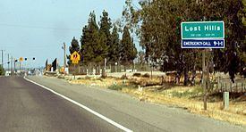 | ||
Near crash interstate 5 lost hills california
Lost Hills (formerly, Lost Hill) is a census-designated place (CDP) in Kern County, California, United States. Lost Hills is located 42 miles (68 km) west-northwest of Bakersfield, at an elevation of 305 feet (93 m). The population is 2,412 at the 2010 census, up from 1,938 at the 2000 census. About 75% of the population is engaged in agricultural positions.
Contents
- Near crash interstate 5 lost hills california
- Map of Lost Hills CA USA
- Geography
- Climate
- History
- 2010
- 2000
- References
Map of Lost Hills, CA, USA
A rest stop by Interstate 5 including restaurants, gasoline stations, and motels is located about one mile (1.6 km) from the town.
Geography
Lost Hills is located at 35°36′59″N 119°41′39″W. It stands on the east bank of the California Aqueduct. Interstate 5 is located near, but not adjacent, to Lost Hills. The town is at the intersection of State Route 46 and Lost Hills Road. The enormous Lost Hills Oil Field, which is sixth largest by remaining reserves in California, is west and northwest of town, extending about ten miles (16 km) along the range of the low Lost Hills Range, which the town was named after.
According to the United States Census Bureau, Lost Hills has a total area of 5.6 square miles (15 km2), of which, over 99% of it is land and 0.21% is water.
Climate
According to the Köppen Climate Classification system, Lost Hills has a semi-arid climate, abbreviated "BSk" on climate maps.
History
The Lost Hills post office opened in 1911, closed in 1912, re-opened in 1913 (having transferred it from Cuttens), and moved in 1937. At one time, the Post Office was a small rented room, in the Edmondson's cafe and bar. Later it was a small mobile home size building. In 2012-2013, Paramount Farms, the company 75% of the population works for, gave the small town of Lost Hills a helping hand with the reopening of the Lost Hills park. In 2012, the town of Lost Hills underwent through infrastructure projects like new sidewalks paved and gentrification in the town. By 2014, new housing developments start to spring up in the town of Lost Hills.
2010
The 2010 United States Census reported that Lost Hills had a population of 2,412. The population density was 433.5 people per square mile (167.4/km²). The racial makeup of Lost Hills was 132 (5.5%) White, 5 (0.2%) African American, 1 (0.0%) Native American, 17 (0.7%) Asian, 1 (0.0%) Pacific Islander, 2,232 (92.5%) from other races, and 24 (1.0%) from two or more races. Hispanic or Latino of any race were 2,354 persons (97.6%).
The Census reported that 2,412 people (100% of the population) lived in households, 0 (0%) lived in non-institutionalized group quarters, and 0 (0%) were institutionalized.
There were 448 households, out of which 353 (78.8%) had children under the age of 18 living in them, 288 (64.3%) were opposite-sex married couples living together, 50 (11.2%) had a female householder with no husband present, 83 (18.5%) had a male householder with no wife present. There were 51 (11.4%) unmarried opposite-sex partnerships, and 2 (0.4%) same-sex married couples or partnerships. 9 households (2.0%) were made up of individuals and 3 (0.7%) had someone living alone who was 65 years of age or older. The average household size was 5.38. There were 421 families (94.0% of all households); the average family size was 5.02.
The population was spread out with 970 people (40.2%) under the age of 18, 356 people (14.8%) aged 18 to 24, 730 people (30.3%) aged 25 to 44, 295 people (12.2%) aged 45 to 64, and 61 people (2.5%) who were 65 years of age or older. The median age was 22.6 years. For every 100 females there were 134.6 males. For every 100 females age 18 and over, there were 147.3 males.
There were 469 housing units at an average density of 84.3 per square mile (32.5/km²), of which 178 (39.7%) were owner-occupied, and 270 (60.3%) were occupied by renters. The homeowner vacancy rate was 2.7%; the rental vacancy rate was 1.8%. 976 people (40.5% of the population) lived in owner-occupied housing units and 1,436 people (59.5%) lived in rental housing units.
2000
As of the census of 2000, there were 1,938 people, 346 households, and 320 families residing in the CDP. The population density was 345.3 people per square mile (133.4/km²). There were 367 housing units at an average density of 65.4 per square mile (25.3/km²). The racial makeup of the CDP was 18.63% White, 2.63% Black or African American, 1.55% Native American, 0.05% Asian, 71.83% from other races, and 5.31% from two or more races. 96.75% of the population were Hispanic or Latino of any race.
There were 346 households out of which 70.2% had children under the age of 18 living with them, 74.0% were married couples living together, 6.4% had a female householder with no husband present, and 7.5% were non-families. 3.8% of all households were made up of individuals and 0.9% had someone living alone who was 65 years of age or older. The average household size was 5.60 and the average family size was 5.22.
In the CDP, the population was spread out with 39.1% under the age of 18, 17.3% from 18 to 24, 30.9% from 25 to 44, 10.7% from 45 to 64, and 2.1% who were 65 years of age or older. The median age was 22 years. For every 100 females there were 139.0 males. For every 100 females age 18 and over, there were 161.6 males.
The median income for a household in the CDP was $31,875, and the median income for a family was $29,402. Males had a median income of $17,804 versus $12,885 for females. The per capita income for the CDP was $8,317. About 26.4% of families and 30.6% of the population were below the poverty line, including 36.5% of those under age 18 and 25.8% of those age 65 or over.