
Country United States Incorporated 1945 Time zone CST (UTC-6) Local time Friday 11:22 PM Mayor Fabol Hughes | Demonym(s) Katyite Elevation 43 m Population 15,013 (2013) | |
 | ||
Weather 20°C, Wind SE at 2 km/h, 97% Humidity | ||
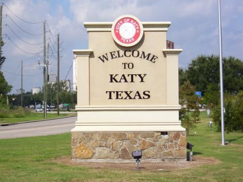
Katy is a city in the U.S. state of Texas, within the Houston–The Woodlands–Sugar Land metropolitan area. The city is located in Harris, Fort Bend, and Waller counties. The population was 14,102 at the 2010 census, up from 11,775 at the 2000 census. The population was estimated to be 16,158 in 2015.
Contents
- Map of Katy TX USA
- History
- Economy
- Geography
- Climate
- Demographics
- Government and infrastructure
- Primary and secondary schools
- Colleges
- Public libraries
- Parks and recreation
- Mass transit
- Intercity buses
- Airports
- List of mayors
- Notable people
- References
Map of Katy, TX, USA
History
In the mid-1800s Katy was known as "Cane Island", named for the creek that runs through the area, a branch of Buffalo Bayou. The creek was filled with cane, presumed to have been planted by earlier residents to aid in fur trapping. In the middle of the flat coastal prairie, this "island" of cane was surrounded by an ocean of tall grass; thus the area became known as "Cane Island". The trail from Harrisburg to San Antonio, known as the San Felipe Road, ran right through it.
In 1845 James J. Crawford received a land grant that included this area. The hot summers, cold winters, thick mud and voracious mosquitoes made it difficult to attract settlers to the area. Thirty years later Crawford, John Sills, and freedmen Thomas and Mary Robinson were the only recorded residents of Cane Island. In 1893 the Missouri–Kansas–Texas Railroad (now a part of Union Pacific) started laying rails through Cane Island. The railroad began operation in 1895.
That same year James Oliver Thomas laid out a town, and in January 1896 the town of Katy was named through Thomas's post office application. The name was based on the MKT Railroad (which was called "the Katy" by railroad officials) and the anticipations of prosperity its arrival would bring to the new town. The town developed around the original train stop and railroad tracks.
By the early 1900s many families had come by train and wagon to establish Katy. Several hotels, stores, liveries and saloons were prospering, and farms and ranches were being developed on the wild prairie. Cotton and peanuts were the first successful crops, but rice soon became the primary commodity crop. Katy later became known for rice farming; the first concrete rice driers in the state of Texas were built here in 1944 and still stand as landmarks.
In 1945 the city of Katy was incorporated as a municipality. Boundaries were determined by finding the area that contained the most residents and was reasonably sized so that it could be managed by city services. The city of Katy is now the anchor for the greater Katy area, defined by the boundaries of the 181 sq mi (470 km2) Katy Independent School District.
The construction and opening of Interstate 10 in 1966 allowed for rapid development of the area, as Houston expanded westward. The city has grown to a population of approximately 16,000 residents. Almost 270,000 people live in the Katy area, which has won national accolades for growth and sustainability.
In 2009 the Gadberry Group named Katy as one of "9 from 2009" most notable high-growth areas in the United States.
Economy
Several corporations are headquartered in areas surrounding Katy.
Igloo Corporation is headquartered west of Katy in unincorporated Waller County. Academy Sports and Outdoors has its corporate offices and product distribution center in unincorporated western Harris County.
BP America is headquartered in the Houston Energy Corridor and is the area's largest employer, with 5,500 employees on its Westlake campus as of 2009. BP's Katy operations include engineering and business support for much of BP's onshore operations in the contiguous United States, as well as its operations in the Gulf of Mexico.
With the economy improving after 2009, retail centers were developed throughout Katy to accommodate the rapid residential growth. The major retail growth is taking place along Katy Fort Bend Road near the east entrance to the Katy Mills shopping mall. In August 2010, H-E-B Food & Drug opened a new UP format store at I-10 and Pin Oak. In July 2013, Costco announced that it would open a store at the southwest corner of Grand Parkway and I-10 in 2014. Construction began in August 2013. The new store was planned for completion by early spring 2014 and would be Costco's fourth Houston-area location.
The Katy Area Economic Development Council serves as the economic development organization for the area. Founded in 2003, the Katy Area Economic Development Council’s (Katy Area EDC) mission is to establish the Katy area as the premier location for families and businesses through planned economic growth and economic development. Since its inception, the Katy Area EDC has grown to over 210 members, has a budget of $900,000 and has assisted in the creation of over 16,200 jobs and more than $2.5 billion in capital investment. Katy Area EDC is a full-service private, non-profit, 501 (c) 6 economic development corporation.
Geography
The city of Katy is located at the three-border intersection of Harris, Fort Bend, and Waller counties, along Interstate 10, 29 miles (47 km) west of downtown Houston and 22 miles (35 km) east of Sealy. According to the United States Census Bureau, the city of Katy has a total area of 11.3 square miles (29.3 km2), of which 11.2 square miles (29.1 km2) is land and 0.04 square miles (0.1 km2), or 0.38%, is water.
Katy is often further defined as either "old Katy" or "the Katy area". "Old Katy" refers to the city of Katy, which was incorporated in 1945 and is located near the western edge of the greater Katy area. The "Katy area" includes the city of Katy plus large sections of unincorporated land surrounding the city corresponding to the boundaries of the 181 sq mi (470 km2) Katy Independent School District. The "All Aboard Katy!" public art project and the Katy Area Economic Development Council's "Energy Grows Here" branding initiative are large-scale projects launched to help promote, identify and unite the Katy area.
Greater Katy includes new upscale developments and master-planned communities such as Cinco Ranch, Green Trails, Pin Oak Village, Grayson Lakes, Seven Meadows, and the new Pine Mill Ranch, Silver Ranch, Firethorne, Grand Lakes and Cane Island. It also encompasses suburban developments from the 1970s and 1980s, such as Memorial Parkway, Kelliwood and Nottingham Country.
The city of Houston's extraterritorial jurisdiction (ETJ) stretches well west of Katy. This means that most of the unincorporated lands in the Katy area may be annexed by the city of Houston at some time in the future. The city of Katy's ETJ, meanwhile, is limited to parcels of land west and north of the city itself.
Climate
The climate in this area is characterized by hot, humid summers and generally mild to cool winters. According to the Köppen Climate Classification system, Katy has a humid subtropical climate, abbreviated "Cfa" on climate maps.
Demographics
As of the census of 2000, there were 11,775 people in "Old Katy", 3,888 households, and 3,083 families residing in the city. The population density was 1,103.7 people per square mile (426.1/km²). There were 4,072 housing units at an average density of 381.7 per square mile (147.3/km²). The racial makeup of the city was 83.98% White, 4.24% African American, 0.56% Native American, 0.50% Asian, 0.04% Pacific Islander, 8.65% from other races, and 2.03% from two or more races. Hispanic or Latino of any race were 23.75% of the population.
There were 3,888 households out of which 45.7% had children under the age of 18 living with them, 63.9% were married couples living together, 10.9% had a female householder with no husband present, and 20.7% were non-families. 17.4% of all households were made up of individuals and 6.7% had someone living alone who was 65 years of age or older. The average household size was 3.00 and the average family size was 3.37.
In the city, the population was spread out with 31.5% under the age of 18, 8.7% from 18 to 24, 30.9% from 25 to 44, 20.7% from 45 to 64, and 8.1% who are 65 years of age or older. The median age was 33 years. For every 100 females there were 98.6 males. For every 100 females age 18 and over, there were 97.5 males.
The median income for a household in the city was $51,111, and the median income for a family was $57,741. Males had a median income of $38,412 versus $33,004 for females. The per capita income for the city was $21,192. 8.4% of the population and 7.0% of families were below the poverty line. Out of the total people living in poverty, 9.1% were under the age of 18 and 6.5% were 65 or older.
Government and infrastructure
Katy is a home-rule city, chartered in 1945. Residents within the city limits are governed by a city council made up of five council members and the mayor. The city is split into two wards; two council members are elected from each ward, and one council member and the mayor are elected at-large. This type of organization favors candidates who can appeal to the widest number of voters and tends to limit the choices of minority voters to elect candidates of their choice.
Residents within the city limits pay city taxes and receive municipal police, fire, EMS, and public works service. The city has territory in three counties, each of which has its own representative governments. The counties have a greater influence on areas outside the incorporated city limits.
The Katy area lies in three counties. Residents in unincorporated Harris, Fort Bend and Waller counties are governed by those counties. The county residents elect representative county commissioners who represent them on the county courts of each county, presided over by the county judge of each county.
Harris County Precinct Three, headed by Steve Radack as of 2008, serves the Harris County portion of Katy.
Primary and secondary schools
People who live in Katy are zoned to schools in Katy Independent School District. The elementary schools in the city of Katy are listed here:
The following middle schools serve City of Katy residents:
The following high schools serve City of Katy residents:
Aristoi Classical Academy is a charter school in Katy.
Colleges
Katy is served by the Houston Community College System. HCC Northwest College operates the Katy Campus in an unincorporated section of Harris County.
The Bible Seminar offers non-denominational college-level Bible study and ministry training, including a graduate-level Master of Divinity degree. It also offers a Bible Certificate program for local church members and leaders.
Public libraries
Katy is served by the Katy Branch of Harris County Public Library (HCPL) at 5414 Franz Road. The branch is a partnership between HCPL and the City of Katy. The city joined the county library system in 1921. The Katy Garden Club started the first library, which was housed in several private houses. At a later point it shared space with the Katy Fire Department. The first Katy branch opened in 1940. The Friends of the Katy Library began in 1972. The construction of the current 15,000-square-foot (1,400 m2) branch began in 2002. The current branch building opened for regular business in Monday April 28, 2003, with its grand opening ceremony on the previous day.
The Cinco Ranch Branch Library is in Cinco Ranch, in unincorporated Fort Bend County, south of Katy. The HCPL Maud Smith Marks Branch Library is in unincorporated Harris County, west of Katy.
Parks and recreation
Mass transit
Metropolitan Transit Authority of Harris County (METRO) operates the Kingsland Park and Ride (Route 221) east of Katy at 21669 Kingsland Boulevard. In February 2008 METRO opened a new park and ride location at the Cinemark parking lots near the intersection of Grand Parkway and I-10. The new Route is #222. Currently, only these express routes operate to and from downtown Houston during morning and evening commute hours; METRO does not serve Katy with local routes, as most westbound bus lines in Houston terminate at or near Highway 6, a couple of miles before the Katy city limits.
Intercity buses
Greyhound Bus Lines operates the Katy Station at Millers Exxon. Megabus.com stops at Katy Mills en route between Austin, San Antonio and Houston. This serves as a park-and-ride location for riders from the Katy and Greater Houston area.
Airports
Privately owned airports for fixed-wing aircraft for public use located near Katy include:
Privately owned airports for private use include:
Area airports with commercial airline service include George Bush Intercontinental Airport and William P. Hobby Airport, both of which are in Houston.