
Country Japan Website city.kesennuma.lg.jp Local time Friday 4:11 PM Region Tōhoku region | Area 42.29 km² Population 8,463 (2005) | |
 | ||
Time zone Japan Standard Time (UTC+9) Weather 2°C, Wind W at 21 km/h, 66% Humidity | ||
Karakuwa (唐桑町, Karakuwa-chō) was a town located in Motoyoshi District, in the extreme northeast of Miyagi Prefecture, bordering Kesennuma to the north-west and Rikuzentakata, part of Iwate Prefecture, to the north, and with Kesennuma Bay including Oshima island to the west, Hirota Bay to the north-east, and the Pacific Ocean to the south and east.
Contents
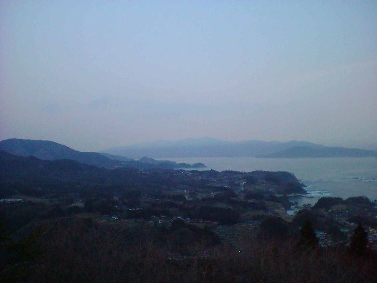
- Map of Karakuwachoura Kesennuma Miyagi Prefecture 988 0581 Japan
- Name origin
- History
- Geography
- Economy
- Education
- Transportation
- Tourist attractions
- References
Map of Karakuwachoura, Kesennuma, Miyagi Prefecture 988-0581, Japan
On March 31, 2006, Karakuwa was merged into the expanded city of Kesennuma and is no longer an independent municipality.
The highest point in former Karakuwa is Sasanagane-yama (笹長根山 meaning 'bamboo grass with long roots mountain') (520 m), near the border with Rikuzentakata, and the lowest point is sea level.
Name origin
Karakuwa's name (唐桑) literally means "China (Tang Dynasty, specifically) Mulberry", and has been used to refer to the area back to the times when it was part of a larger Kesen District in Mutsu Province. According to the story of where the name came from, a Chinese ship wrecked on the rocky coast, and in its hold was a mulberry tree. The tree was rescued and planted, and it survived and spread to become common in the area, as did the legend.
History
Around 700 A.D., there is record of Emishi presenting local marine products at the Imperial Court, which may have encouraged immigration to the area. The area remained peaceful during the Nara period, due to the powerful influence of the Minamoto Clan. However, during the Heian Period, the Minamotos were defeated by Taira no Kiyomori in the Heiji Rebellion. The Kasai Clan received the region, but were left heirless near the end of the Azuchi-Momoyama period. After the Battle of Sekigahara in 1600, the area was given to Date Masamune as part of his lands.
During the Meiji Restoration, it was taken from the Date clan as punishment for their involvement and given to the Takasaki Clan to administer, becoming part of Motoyoshi District in 1868, then becoming part of several short-lived prefectures before finally becoming part of Miyagi Prefecture on April 18, 1876.
In 1889, the two villages in the area, Karakuwa and Koharagi (小原木 meaning 'small, original tree') merged to form a larger village called Karakuwa, then incorporated into a town in 1955.
In 2004 and 2005 there were discussions with Motoyoshi and Kesennuma regarding a merge to create a larger city. Although Motoyoshi withdrew from the talks, an agreement to merge was made with Kesennuma. On March 31, 2006, Karakuwa ceased to exist as a separate town.
Geography
The town center was located at the base of a rocky peninsula which juts out into the Pacific Ocean, a small extension of the north-south running mountains in the area. Most of the underlying rock is granite, though there is significant marble as well. These hard rock mountains make the land an abundance of sharp hills and valleys, and also give the area many small bays. There is some farmland, but the hills make large open fields impossible.
Like much of Japan, Karakuwa is prone to earthquakes. Large earthquakes with centers in the ocean from those off western Hokkaido to those off to Oshika peninsula to the south have been felt in the area. Tsunami can also be a danger; in recent times, large waves hit the area after a local earthquake in 1896, and after the Chilean earthquake of 1960.
The peninsula area of the former town, from the town center to the south-east is about 3 km (1.9 mi) long, and about 1 km (0.62 mi) wide. The town extended another 4 km (2.5 mi) up the coastline to include the Koharagi area, and 1 km (0.6) along the coast facing Oshima island. There are a few small streams along the peninsula, the largest stretching 2 km (1.2 mi) inland towards Sasanagane-yama, which lies another kilometer (0.6 miles) beyond the streams source at the widest point in Karakuwa.
Economy
The local economy has some mixed farming, including a few apple orchards, but due to the rocky granite and marble coastline, which favours small ports over farmland, the focus is on commercial deep-sea fishing. There is also some commercial activity in processing the catch, and the rugged beauty of the coastline encourages significant tourism.
Education
There are three elementary schools and two junior high schools in former Karakuwa. Nakai (中井小学校 -shōgakkō) and Karakuwa Elementary in the south feed Karakuwa Junior High, and in the north Koharagi Elementary students go to Koharagi Junior High. There were no high schools in the town; students must go to Kesennuma, Rikuzentakata or farther to continue their education.
Transportation
(Note: There are no train stations in Karakuwa itself.)