
Area 360.6 km² Population 14,060 (Feb 2014) | Phone number 0195-62-2111 Local time Friday 5:50 PM | |
 | ||
Weather -1°C, Wind W at 14 km/h, 58% Humidity | ||
Iwate (岩手町, Iwate-machi) is a town located in Iwate Prefecture, Japan. As of February 2014, the town had an estimated population of 14,060 and a population density of 39 persons per km2. The total area was 360.55 km2.
Contents
- Map of Iwate Iwate District Iwate Prefecture Japan
- Geography
- Neighboring municipalities
- History
- Economy
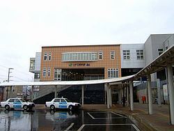
- Railway
- Highway
- Local attractions
- Notable people from Iwate
- References
Map of Iwate, Iwate District, Iwate Prefecture, Japan
Geography
Iwate is located in northwest Iwate Prefecture.
Neighboring municipalities
History
The area of present-day Iwate was part of ancient Mutsu Province. It was under the control of the Nambu clan during the Edo period, who ruled Morioka Domain under the Tokugawa shogunate.
Numakunai, Kawaguchi, Ikkatai and Midō villages were created within Kita-Iwate District on April 1, 1889 with the establishment of the municipality system. Kita-Iwate and Minami-Iwate Districts merged to form Iwate District on March 29, 1896. The four villages merged to form Iwate Town on July 21, 1955.
Economy
The local economy is based on agriculture. Iwate is famous for its blueberry production.