
Time zone NPT (UTC+5:45) | Region {{{region}}} Area 1,738 km² | |
 | ||
Website www.ddckapilvastu.gov.np | ||
Normal life in kapilvastu district was affected due to the i
Kapilvastu district (Nepali: कपिलवस्तु जिल्ला Listen ), often Kapilbastu, is one of the districts of Province No. 5, Nepal. The district, with Kapilbastu municipality as its district headquarters, covers an area of 1,738 square kilometres (671 sq mi) and in 2001 had a population of 481,976, which increased to 571,936 in 2011.
Contents
- Normal life in kapilvastu district was affected due to the i
- Strike in kapilvastu district office
- History
- Geography and climate
- Demographics
- Municipalities and Village Development Committees
- Economy
- Population
- Culture
- World Marsh Region
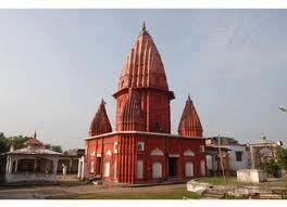
- Archaeological sites
- References
Strike in kapilvastu district office
History
The district's name comes from the sage Kapila and his followers who built here a city called Kapilavastu. This District was a part of the ancient Shakya Kingdom ruled by King Śuddhodana who was the father of Gautama Buddha.
Geography and climate
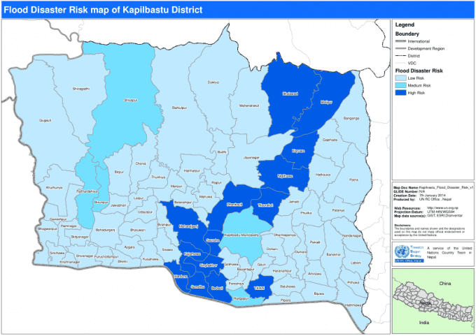
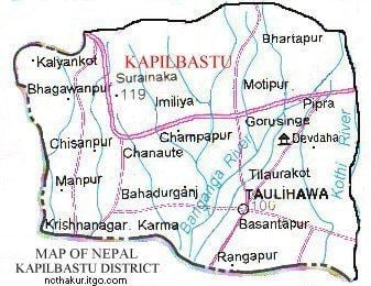
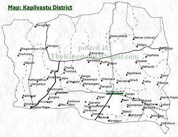
The district is situated at a height of 93 to 1,491 metres (305 to 4,892 ft) above sea level. Geographically, the district can be divided into the low land plains of Terai and the low Chure hills.
Kapilvastu is bounded by Rupandehi District to the east, Dang Deukhuri District in Rapti zone to the northwest, Arghakhanchi District to the north, Balrampur district, Awadh region, Uttar Pradesh, India to the west and Siddharthnagar district, Purvanchal region, Uttar Pradesh to the south.
The summer is hot with temperature above 27 °C and winter temperature remains below 15 °C.
Demographics
According to the 2001 census, the major ethnic groups in this district are Nepali (90%) and Indians (10%).
The 2011 census found that 80% of people in the district were Awadhi speakers followed by , Tharu (5%) and (15%) are native Nepali speakers. The number of immigrants from the neighbouring hilly region is increasing every year.Bangai is located here.
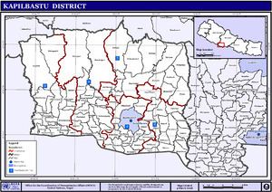
Municipalities and Village Development Committees
Municipalities
Kapilvastu
Banganga
Bhrikuti
Shivaraj
Krishnanagar
Buddhabatika
Village Development Committees
Abhirawa, Ajingara, Bahadurganj, Jamuni, Sukharampur, Balarampur, Baluhawa, Bangai, Banganga, Baraipur, Barakulpur, Basantapur, Baskhaur, Bedauli, Bhagawanpur Choti, Bhalabari, Bijuwa, Bithuwa, Budhi, Dhankauli, Dharampaniya, Dohani, Dubiya, Dumara, Gajehada, Ganeshpur, Gauri, Gotihawa, Gugauli, Haranampur, Hardauna, Hariharpur, Hathausa, Hathihawa, Jahadi, Jayanagar, Kajarhawa, Khurhuriya, Kopawa, Kushawa, Labani, Bithuwa, Lalpur, Maharajganj, Mahendrakot, Mahuwa, Malwar, Manpur, Milmi, Motipur, Nanda Nagar, Nigalihawa, Pakadi, Parsohiya, Patariya, Patna, Patthardaihiya, Phulika, Pipari, Purusottampur, Rajpur, Ramghat, Ramnagar, Rangapur, Sauraha, Shivagadhi, Singhkhor, Sisawa, Shivapur Palta, Somdiha, Taulihawa, Thunhiya, Tilaurakot, Titirkhi, Udayapur, Vidhya Nagar
Economy
Most of the population of the district is dependent on agriculture. Paddy rice is a major crop of the district. A number of youths rely on foreign employment while sugarcane is an important cash crop.
Population
At the time of 2011 A.D National population and Housing census 2011 was reported that total population of kapilvastu district was 571,936 . Male=285,599 and Female=286,337 and number of total household was 91,321 Data source: central bureau of statistics , kathmandu government of Nepal .
Culture
Awadhi people are the major inhabitants of this region, which is very rich in their culture. Awadhi cuisine is well known. Tharu people living in the western part of the district have their own distinct culture. The main culture of Tharu is Maghi.
World Marsh Region
A region with biodiversity, cultural, archaeological and historical monuments that has been proposed to be enlisted in the list of World Cultural Heritage of UNESCO.
Archaeological sites
More than 138 historical sites related to Buddha have already been identified within the boundary to the east of Banganga, west of Kothi, north to Indian border and south to Mahendra highway. The forest of the district stands as a natural park. The land is irrigated by the rivers like Banganga, Koili, Surai, Chirai, Bhutera and others.