
Length 275 km | ||
 | ||
- location Ambora, Nagpur district, Maharashtra | ||
24th august 2013 flood of kanhan river at mouda nagpur
The Kanhan River is an important right bank tributary of the Wainganga River draining a large area lying south of Satpura range in central India. Along its 275 km run through the Indian States of Maharashtra & Madhya Pradesh, it receives its largest tributary - Pench River, a major water source for the metropolis of Nagpur.
Contents
- 24th august 2013 flood of kanhan river at mouda nagpur
- Map of Kanhan River Maharashtra
- Within Madhya Pradesh
- Within Maharashtra
- Dam
- Surroundings
- News
- References
Map of Kanhan River, Maharashtra
Kanhan was surprisingly not mentioned in the 2001 list of notified rivers in Maharashtra which has led to unrestricted exploitation in the form of sand mining along the river bed. This failure to recognise its presence has been viewed as a deliberate attempt at unregulated economic gains.The catchment area has also seen large scale coal mining in recent years. Efforts are currently underway to notify the river to prevent further environmental damage.This has been undermined by plans for construction of a barrage.
Within Madhya Pradesh
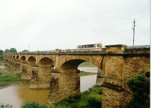
The Kanhan is Wainganga's longest tributary, at 275 km. It rises in the southern spurs of the Satpura Range in the north-western region of Chindwara District. Flowing south from its origin, Damua is the first town it encounters. Here it intersects the town and allows for its flow to be controlled by means of a dam.It then runs along a south & southeastern direction, meandering through the countryside of Chindwara District where it has been productively harnessed for growing Tur dal and cotton. The river comes to lie about 5 km to the south of Deogarh fort where it humbly receives an insignificant tributary.Upon reaching the town of Ramakona it is crossed by a rail bridge as well as another road bridge which supports NH-26 B. Nearly at the end of its course in Madhya Pradesh, it is joined by Jam River, and for a short distance provides a natural boundary with adjoining state Maharashtra.
Within Maharashtra
Within Maharashtra the river is at its widest at Kamptee where it receives the Pench River- a left bank tributary and its largest one. Another tributary connecting it at its right bank is Kolar River - the spill off from Kolar Dam. The river now comes to be at the northeast of Nagpur from which it receives the metropolitan city's effluent waste by way of the Nag River. A little further from Kamptee, it flows along the town Kanhan - its etymology derived from the river. Situated alongside the town is a large coal mine, one of the many coal mines situated along its river basin. From here the river flows south-east and ends its course by joining the Wainganga at the village of Ambora in Nagpur District.
Dam
Sand mining activities takes place on a large scale on the Kanhan river bed preventing the construction of any major dams . Kochi barrage is one of the proposed projects on Kanhan river.
Surroundings
Mauda Super Thermal Power Station, Koradi Thermal Power Station and Khaparkheda Thermal Power Station are on the bank of Kanhan River.
Mauda Town, Kamthi, Kanhan, Sausar, Hirdagarh, Damua are few major town and cities on the bank of Kanhan River.
NH-69 A, NH-26 B, NH-7, NH-6 are major National Highway crossing Kanhan River.
News
In sep 2012, a youngster duo who went to swim in the river were later discovered dead along the banks, allegedly drowned in the river.