
Country United States FIPS code 27-07282 Elevation 292 m Zip code 55006 Area code 320 | Time zone Central (CST) (UTC-6) GNIS feature ID 0640423 Local time Thursday 6:46 AM Population 1,789 (2013) | |
 | ||
Weather -10°C, Wind NW at 11 km/h, 79% Humidity Area 4.196 km² (4.17 km² Land / 3 ha Water) | ||
How to say or pronounce usa cities braham minnesota
Braham is a city in Isanti and Kanabec counties in the U.S. state of Minnesota. The population was 1,793 at the 2010 census.
Contents
- How to say or pronounce usa cities braham minnesota
- Map of Braham MN 55006 USA
- History
- Pie Capital of Minnesota
- Geography
- 2010 census
- 2000 census
- Former Basketball Champions
- Major highways
- Notable people
- References
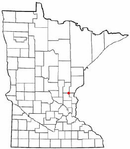
Map of Braham, MN 55006, USA
Braham is located 12 miles north of Cambridge, 15 miles southwest of Pine City, 16 miles south–southeast of Mora, and 12 miles west of Rush City.
History
A post office called Braham has been in operation since 1891. The city was named by railroad officials.
Pie Capital of Minnesota
Braham is the homemade pie capital of Minnesota. Every year on the first Friday in August, the people of Braham celebrate Pie Day. This celebration includes craft sales, music, food stands, games, and entertainment, and various types of pie.
Braham was declared the Pie Capital of Minnesota by former Governor Rudy Perpich in 1990. Braham became famous for its pie in the 1930s and 1940s when Minnesotans would take the "shortcut to Duluth through Braham." While taking this "shortcut," people would stop in Braham and visit the Park Cafe, the cafe that made Braham pie famous. Pie Day began in July 1990, after Independence Day, as an ice-cream social for fundraising and other charitable activities. The date was changed to the first Friday in August when the Isanti County Historical Society took charge of the event in 1992.
Geography
According to the United States Census Bureau, the city has a total area of 1.62 square miles (4.20 km2), of which 1.61 square miles (4.17 km2) is land and 0.01 square miles (0.03 km2) is water.
2010 census
As of the census of 2010, there were 1,793 people, 708 households, and 457 families residing in the city. The population density was 1,113.7 inhabitants per square mile (430.0/km2). There were 755 housing units at an average density of 468.9 per square mile (181.0/km2). The racial makeup of the city was 96.7% White, 0.5% African American, 0.2% Native American, 0.4% Asian, 0.1% from other races, and 2.1% from two or more races. Hispanic or Latino of any race were 1.1% of the population.
There were 708 households of which 39.0% had children under the age of 18 living with them, 41.9% were married couples living together, 16.0% had a female householder with no husband present, 6.6% had a male householder with no wife present, and 35.5% were non-families. 29.9% of all households were made up of individuals and 15.1% had someone living alone who was 65 years of age or older. The average household size was 2.52 and the average family size was 3.09.
The median age in the city was 30.5 years. 30.5% of residents were under the age of 18; 8.1% were between the ages of 18 and 24; 29% were from 25 to 44; 19.5% were from 45 to 64; and 12.8% were 65 years of age or older. The gender makeup of the city was 46.3% male and 53.7% female.
2000 census
As of the census of 2000, there were 1,276 people, 511 households, and 331 families residing in the city. The population density was 1,010.9 people per square mile (391.0/km²). There were 566 housing units at an average density of 448.4 per square mile (173.4/km²). The racial makeup of the city was 97.18% White, 0.31% Black or African American, 0.94% Native American, 0.31% Asian, and 1.25% from two or more races. Hispanic or Latino of any race were 0.24% of the population.
There were 511 households out of which 37.8% had children under the age of 18 living with them, 44.8% married couples lived together, 15.1% had a female householder with no husband present, and 35.2% were non-families. 29.7% of all households were of individuals and 16.8% had someone living alone 65 years of age or older. The average household size was 2.49 and the average family size was 3.06.
In the city, the population was dispersed with 29.7% under the age of 18, 10.0% from 18 to 24, 30.2% from 25 to 44, 16.8% from 45 to 64, and 13.4% who were 65 years of age or older. The median age was 32 years. For every 100 females there were 95.7 males. For every 100 females age 18 and over, there were 87.3 males.
The median income for a household in the city was $34,830, and the median income for a family was $43,229. Males had a median income of $32,455 versus $22,750 for females. The per capita income for the city was $16,693. About 13.1% of families and 14% of the population were below the poverty line, including 18.1% of those under age 18 and 12.0% of those age 65 or over.
Former Basketball Champions
Braham's boys basketball team, the Bombers, won three straight Class AA state championships, 2004-2006. Braham's girls basketball team, won the 2011 Class AA state championship. The boys team won another state title in 2016
Major highways
The following routes are located in the Braham area.
Highways 65 and 107 are two of the main routes in Braham. Highway 70 is nearby.