
Country Greece Area 134.5 km2 | ||
Kalymnos, (Greek: ) is a Greek island and municipality in the southeastern Aegean Sea. It belongs to the Dodecanese and is located to the west of the peninsula of Bodrum (the ancient Halicarnassos), between the islands of Kos (south, at a distance of 12 km (7 mi)) and Leros (north, at a distance of less than 2 km (1 mi)): the latter is linked to it through a series of islets. Kalymnos lies between two to five hours away by sea from Rhodes. The island is known as Calino in Italian and Kilimli or Kelemez in Turkish.
Contents
- Map of Kalymnos
- Petzl roctrip kalymnos 2006 rock climbing in greece
- Rock climbing in kalymnos greece
- Geography
- History
- Economy
- Kalymnos bizarre foods 2
- References
Map of Kalymnos
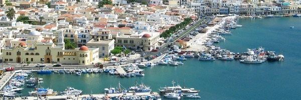
In 2011 the island had a population of 16,001, making it the third most populous island of the Dodecanese, after Kos and Rhodes. It is known in Greece for the affluence of much of its population, and also stands as both the wealthiest member of the Dodecanese and one of the wealthiest Greek islands overall. The Municipality of Kalymnos, which includes the populated offshore islands of Pserimos (pop. 80), Telendos (94), Kalolimnos (2), and Plati (2), as well as several uninhabited islets, has a combined land area of 134.544 square kilometres (51.948 sq mi) and a total population of 16,179 inhabitants.
Petzl roctrip kalymnos 2006 rock climbing in greece
Rock climbing in kalymnos greece
Geography
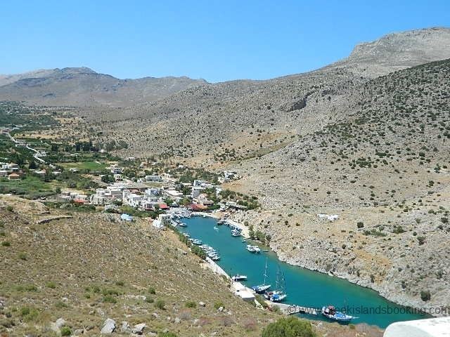
The island is roughly rectangular in shape, with a length of 21 km (13 mi) and a width of 13 km (8 mi), and covers an area of 109 square kilometres (42 sq mi). Moreover, on the north side there is a peninsula which stretches in a northwest direction.
Kalymnos is mainly mountainous with complicated topography. There are three main chains going from W-NW to E-SE, and a fourth which innervates the peninsula. The coastline is very irregular, with many sheltered coves. There are some springs, one among them being thermal. The soil is mainly limestone-based, but in the valleys there is a compact bank of volcanic tuff, the relic of an ancient volcano, located near the village of Kantouni. The island is mainly barren, except for the two fertile valleys of Vathi and Pothia, where olives, oranges and vines are grown.
Earthquakes are a frequent occurrence around Kalymnos.
History
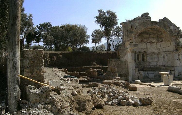
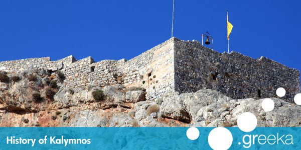
Inhabited originally by Carians, in Antiquity Kalymnos depended on Kos, and followed its history. The islands Hellenistic Temple of Apollo was excavated by the British archaeologist Charles Newton in the nineteenth century; many of the finds he made, including important epigraphic inscriptions, are in the British Museums collection. In the Middle Ages it was under the influence of the Byzantine Empire, and during the 13th century it was used by the Venitian Republic as a naval base. In 1310 it came under the control of the Knights of Rhodes, and later (mainly in 1457 and 1460) was often attacked by the Ottomans, who eventually conquered it in 1522. Unlike Rhodes and Kos, during the Ottoman period there was no Turkish immigration to Kalymnos.
On May 12, 1912, during the Italo-Turkish War, Kalymnos was occupied by Italian sailors of the Regia Marina. Italy took control of the island along with other islands of the Dodecanese until 1947, when the Dodecanese were finally united with mainland Greece, as part of the modern Greek state.
Economy
Being mostly barren (only 18% of the land can be cultivated), agriculture has always played a minor role in the economy of the island, except for the valley of Vathi. The island is famous for its citrus fruits grown in this area.