
Time zone PST (UTC+8) Area 242.7 km² | Barangays ZIP code 2606 Local time Friday 7:37 PM Neighborhoods Apunan, Mongoto, Kagosit | |
 | ||
Weather 15°C, Wind E at 6 km/h, 92% Humidity Points of interest Mount Pulag, Kabayan Mummies, Timbac Caves, Mt Pulag National Park Akiki | ||
Ballay kabayan benguet philippines
Kabayan, officially the Municipality of Kabayan (Ilocano: Ili ti Kabayan; Filipino: Bayan ng Kabayan), is a municipality in the province of Benguet in the Cordillera Administrative Region (CAR) of the Philippines. The population was 15,260 at the 2015 census. In the 2016 electoral roll, it had 8,547 registered voters.
Contents
- Ballay kabayan benguet philippines
- Map of Kabayan Benguet Philippines
- Mt tabayoc the four lakes and junior mt pulag of ballay kabayan benguet
- Etymology
- Pre colonial period
- Spanish period
- American period
- Post war Era
- Geography
- Barangays
- Demographics
- Tourism
- Public schools
- References
Map of Kabayan, Benguet, Philippines
Kabayan is the site of centuries-old Ibaloi mummies buried inside caves scattered around its villages.
The third highest mountain in the Philippines, Mount Pulag, is located in the territorial boundary of the vegetable farming town.
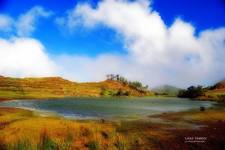
Mt tabayoc the four lakes and junior mt pulag of ballay kabayan benguet
Etymology
The name Kabayan was derived from the term Kaba-ayan, from the Ibaloi word ba-ay, a root crop vine thriving in the place. Most of the early Ibaloi settlements, in the area, which include Eddet and Duacan, were named after grasses in the heavily-forested area.
Pre-colonial period
The first Ibaloi settlers in Benguet arrived at Imbose (or Embosi), located in present-day Kabayan.
Mummification of the dead was practiced long before Spanish colonizers reached the place.
Spanish period
In the late 1800s, Spanish colonizers reached Kabayan via trails constructed throughout the mountain region. Organized into three rancherias, namely Adaoay, Kabayan, and Lutab (or Dutab), Kabayan was registered under the comandancia politico-militar of Benguet in 1846. Lutab (currently barangay Poblacion or Kabayan Central) was later integrated into the Kabayan rancheria.
The practice of mummification of the dead was discouraged by the Spaniards, until it eventually died out.
American period
During the American rule, Kabayan and Adaoay were established as two of the 19 townships of the province of Benguet, upon the issuance of Act No. 48 by the Philippine Commission on November 22, 1900.
On August 13, 1908, Benguet was established as a sub-province of the newly created Mountain Province with the enactment of Act No. 1876. Six townships of Benguet were later abolished, including Adaoay, which was integrated into the township of Kabayan.
Post-war Era
On June 25, 1963, then-President Diosdado Macapagal issued Executive Order No. 42 converting eight (8) of the thirteen (13) towns (designated as municipal districts) of Benguet sub-province into regular municipalities. Kabayan was among them.
On June 18, 1966, the sub-province of Benguet was separated from the old Mountain Province and was converted into a regular province. Kabayan remained to be a component municipality of the newly established province.
Geography
Kabayan is located at 16°37′N 120°50′E, at the central-eastern section of Benguet. It is bounded by Buguias on the north, Kibungan on the north-west, Atok on the south-west, Bokod on the south, Kayapa on the southeast, and Tinoc on the north-east.
According to the Philippine Statistics Authority, the municipality has a land area of 242.69 square kilometres (93.70 sq mi) constituting 7000876000000000000♠8.76% of the 2,769.08-square-kilometre- (1,069.15 sq mi) total area of Benguet.
Barangays
Kabayan is politically subdivided into 13 barangays.
In the 2010 Census of Population and Housing, Barangay Anchukey was registered as the least populous barangay in the province of Benguet.
Demographics
In the 2015 census, Kabayan had a population of 15,260. The population density was 63 inhabitants per square kilometre (160/sq mi).
In the 2016 electoral roll, it had 8,547 registered voters.
Tourism
Kabayan is best known for the antiquated centuries-old mummies and Mount Pulag, the third highest mountain in the Philippines. The Kabayan mummy burial caves are officially proclaimed Philippine National Cultural Treasures pursuant to Presidential Decree No. 374, and is under consideration as a World Heritage Site. The mummified body of Apo Annu, a tribal leader, was stolen but recovered by an antique collector and was returned to the town. Archaeologists from various countries have visited the town to promote preservation of the mummies due to deterioration of the cadavers. The caves containing the cadavers of these mummies have been declared by Monument Watch as one of the "100 Most Endangered Sites" in the world.
Mount Pulag is a destination for mountaineers, hikers, including picnickers. At its summit, the climbers can see the surroundings of the whole north Luzon.
Public schools
As of 2014, Kabayan has 22 public elementary schools and 3 public secondary schools.