
Length 87.9 km | ||
 | ||
Counties | ||
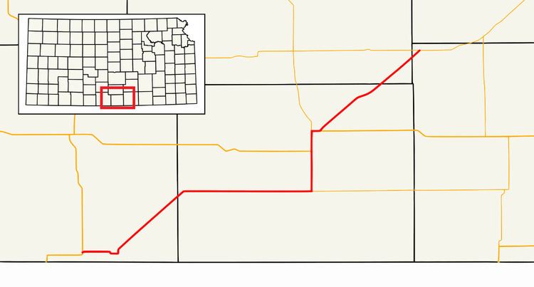
K-2 is a state highway in the south-central portion of the U.S. state of Kansas. Its southwestern terminus is at its intersection with U.S. Highway 281 east of Hardtner. Its northeastern terminus is at its intersection with K-42 west of the unincorporated town of Suppesville. It is 54.6 miles (87.9 km) long.
Contents
Route description
From its western terminus in Barber County, K-2 proceeds east for 5 miles (8.0 km) to the town of Kiowa, where it forms the northern terminus of the brief southern leg of K-8. In Kiowa, K-2 turns to the north and then to the northeast, running parallel to a BNSF Railway track for about 12 miles (19 km), skirting the town of Hazelton and crossing into Harper County. K-2 then runs eastward for about 17 miles (27 km) to Anthony, where it forms the western terminus of K-44 and turns northward. Six miles north of Anthony, K-2 intersects with US-160, which it overlaps for the next four miles (6 km). Three miles north of that intersection, K-2/US-160 turn to the east, through the town of Harper. On the eastern edge of Harper, US-160 continues east, while K-2 goes north and then northeast. It continues northeast for 18 miles (29 km), clipping the southeast corner of Kingman County and crossing briefly into Sumner County, where it ends at K-42 near Suppesville.