
Time zone EET (UTC+2) Website www.joutsa.fi Local time Tuesday 9:15 PM | Municipal tax rate 19.5% Area 1,066 km² | |
 | ||
Area rank 89th largest in Finland Weather 1°C, Wind S at 23 km/h, 89% Humidity | ||
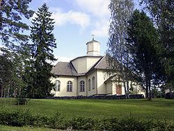
Joutsa is a municipality of Finland.
Contents
Map of 19650 Joutsa, Finland
It is located in the province of Western Finland and is part of the Central Finland region. The municipality has a population of 4,677 (31 March 2016) and covers an area of 867.11 square kilometres (334.79 sq mi) of which 199.25 km2 (76.93 sq mi) is water. The population density is 5.39 inhabitants per square kilometre (14.0/sq mi).
Neighbouring municipalities: Hartola, Hirvensalmi, Jyväskylä, Kangasniemi, Luhanka, Pertunmaa and Toivakka. Municipality of Leivonmäki was consolidated with Joutsa on January 1, 2008.
The municipality is unilingually Finnish.
Nature and Culture
There are all together 192 lakes in Joutsa. Biggest lakes are Puula, Suontee and Jääsjärvi.
Leivonmäki National Park is located in Joutsa. At area is swamps, beaches and forest in esker.
Newspapers:
Sahticulture in Joutsa is known by Joutsan sahti.
Some villages
Havumäki, Kivisuo, Kälä, Laitjärvi, Lapinkylä, Leivonmäki, Marjotaipale, Pärnämäki, Ruokoranta, Ruorasmäki, Rutalahti, Savenaho, Selänpohja, Taka-Ikola, Tammilahti, Tolvasniemi, and Vehmaa