
 | ||
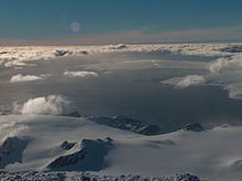
Johnsons Glacier is the 1.8 km long and 2.3 km wide glacier on Hurd Peninsula, Livingston Island in the South Shetland Islands, Antarctica bounded by Charrúa Ridge and Charrúa Gap to the north, Napier Peak to the east, Mirador Hill to the southeast, Hurd Ice Cap (from which it receives ice influx) to the southwest and Mount Reina Sofía to the west. It is draining northwestwards into Johnsons Dock. The glacier provides overland access from the Spanish base Juan Carlos Primero to the interior of the eastern Livingston Island.
Contents
Map of Johnsons Glacier, Antarctica
The feature receives its name from the adjacent Johnsons Dock.
Location
The midpoint of the glacier is located at 62°40′05″S 60°21′00″W (Detailed Spanish mapping in 1991, and Bulgarian mapping in 1996, 2005 and 2009).
Maps
References
Johnsons Glacier Wikipedia(Text) CC BY-SA