
Population 443,672 (2000) | Area 7,133 km2 | |
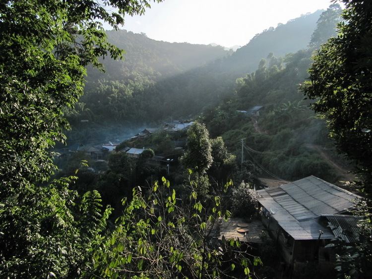 | ||
Map of Jinghong
Jinghong (Chinese: 景洪; pinyin: Jǐnghóng; Dai / Tai Lü: , pronounced [tsêŋhuŋ]; Thai: เชียงรุ่ง, [t͡ɕʰīaŋ rûŋ]; rtgs: Chiang Rung; also formerly romanised as Chiang Hung, Chengrung, Cheng Hung, Jinghung, Keng Hung, Kiang Hung and Muangjinghung) is a city in and the seat of Xishuangbanna Dai Autonomous Prefecture, in the far south of China's Yunnan province, and the historic capital of the former Tai kingdom of Sipsongpanna.
Contents
- Map of Jinghong
- Jinghong
- Jinghong city china
- History
- Yuan Dynasty
- Ming Dynasty
- Geography and climate
- Transport
- Places of interest
- References
Jinghong
Jinghong city china
History

The town was founded as Chiang Hung (Cheli), by Tai king Phanya Coeng in 1180.
Yuan Dynasty
During the Mongol Yuan Dynasty in China, the Tai kingdom of Sipsongpanna began a close and long-lasting relationship to Lanna, another historic Tai kingdom that lay south. In 1296, Lanna's capital Chiang Mai was founded by Mangrai, whose maternal grandfather was King Rung Kaen Chai (lang-th|รุ้งแก่นชาย) of Jinghong (i.e.: Sipsongpanna).
The kingdoms of Sipsongpanna and Lanna maintained ties of migration, intermarriage and
Ming Dynasty
In 1401 during the Chinese Ming Dynasty, the Sipsongpanna Tai ruler Tau Se Da Xam (pinyin: Dao Xianda) attacked a smaller Tai area to the north unknown as Weiyuan equivalent to modern Jinggu). The Ming administration sought to retaliate but adopted a cautious response of diplomacy and Tau Se Da Xam withdrew his troops. About this period Sipsongpanna began to pay tribute to the Ming.
In 1405 the Sipsongpanna Tai attacked Chiang Mai, in conjunction with Ming Chinese troops.
In 1421 the Chinese attempted to cause a split in Sipsongpanna by backing multiple administrations during a period of civil strife, but their plan failed to succeed.
1448 saw the defeat of Mong Mao, a Tai state in eastern Burma, by a combination of Chinese, Sipsongpanna and allied forces united under the Ming.
In the 1450s another struggle for succession arose in Sipsongpanna, with one faction backed by Kengtung and one by Chiang Mai. Despite the Kengtung faction's victory, conflict started with that state shortly afterwards.
The Burmese Toungoo state arose in the 1530s to crush Chiang Mai, and its influence also extended to Kengtung and Sipsongpanna, which like other Tai kingdoms soon began to pay tribute.
Geography and climate
Jinghong has a latitude range of 21°27'–22°36' N and a longitude range of 100°25'–101°31' E. It borders Pu'er City to the north, Mengla County to the east and Menghai County to the west, as well as Burma's Shan State to the south. The city is limited to the south by Hengduan Mountains, and the Lancang River (Mekong) passes through Jinghong. Two bridges near the city span this river, which flows south-east towards Laos.
Climatically, Jinghong has a tropical wet and dry climate (Köppen Aw). The city has a generally humid climate with strong monsoonal influences. Summer is long and there is virtually no "winter" as such; instead, there is a dry season (December thru April) and wet season (May thru October). Annual sunshine hours amount to between 1800 and 2300 and annual rainfall ranging from 1,100 to 1,700 millimetres (43 to 67 in). The coolest month is December, averaging 18.4 °C (65.1 °F), while the warmest is June, at 27.1 °C (80.8 °F); the annual mean is 23.8 °C (74.8 °F). However, high temperatures reach their peak in April before the onset of the monsoon from the Indian Ocean.
Transport
Places of interest
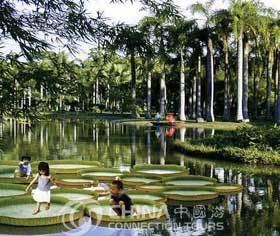
The Dai Water Splashing Festival and nearby villages of that and other ethnic groups are the main attractions. Additionally, at least three botanical parks and gardens and are located in or near the city.