
Country Burma Region Shan State | ||
 | ||
Map of Kengtung
Kengtung (Shan: ၵဵင်းတုင်; Burmese: ကျိုင်းတုံမြို့; MLCTS: kyuing: tum mrui., [tɕáɪɴtòʊɴ mjo̰]; Thai: เชียงตุง, rtgs: Chiang Tung, [t͡ɕʰīaŋ tūŋ]; also spelled Kyaingtong, Chiang Tung, Cheingtung, and Kengtong) is a town in Shan State, Burma. It is the principal town of Kengtung Township. Kengtung is located on the National Highway 4 (NH4) and at the AH2 and AH3 of the Asian Highway.
Contents
- Map of Kengtung
- Burmese street food adventures curry crepes in kengtung
- Kengtung burma dec 2014
- History
- Geography
- Transportation
- Climate
- References
The city is served by Kengtung Airport and it is home to the Technological University of Kengtung.
Formerly located at the crossroads of the trade between China and Siam, Kengtung lost its importance owing to the international isolation of the military-ruled Burmese state.
Burmese street food adventures curry crepes in kengtung
Kengtung burma dec 2014
History
The early history of Kengtung is made up of myths and legends. The oral tradition of the Wa people says that the ancient city of Kengtung was founded in the distant past by them as the original inhabitants of the region, and was later reestablished by the grandson of King Mangrai after defeating the Wa. This migration of the Chiang Mai dynasty in the 13th century, with the founding a new kingdom which was later named Lanna, has resulted in Kengtung having a different type of Tai population from the rest of the Shan State, the Tai Khün.
Kengtung, like other major towns in the Shan Plateau, was home to a Shan Saopha (Sawbwa). Kengtung was the capital of the Kengtung State, and had a palace, built by Sao Kawng Kiao Intaleng in 1905.
The city was occupied by the Thai Phayap Army from 1942 until the end of the Second World War and became the headquarters of the Saharat Thai Doem territory. After the independence of Burma Kengtung suffered heavily from insurgency and military rule, followed by heavy cultural Burmanization. The headquarters of the regional military command of the Tatmadaw is in the town.
Geography
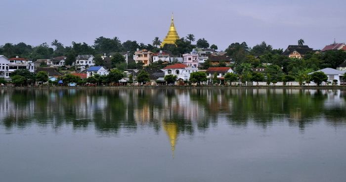
Kengtung contains several lakes. The largest, Naung Tung Lake, lies in the western part of the city, followed by Naung Kham Lake and Naung Yarng Lake to the south of the Kentung Roman Catholic Mission.
Transportation
The town has an airport which offers domestic flights.
Climate
Kengtung has a tropical wet and dry/ savanna climate (Köppen-Geiger classification: Aw) with a pronounced dry season in the low-sun months , no cold season, wet season is in the high-sun months. Temperatures are very warm throughout the year, although the winter months (December-February) are milder and nights can be quite cool. There is a winter dry season (December-April) and a summer wet season (May-November).