
Country United States GNIS feature ID 0453501 Area 126.2 km² Population 920 (2010) | ZIP codes 47108, 47167 47281 Elevation 168 m Local time Friday 2:20 PM | |
 | ||
Weather 7°C, Wind NW at 18 km/h, 33% Humidity | ||
Jefferson Township is one of thirteen townships in Washington County, Indiana, United States. As of the 2010 census, its population was 920 and it contained 451 housing units.
Contents
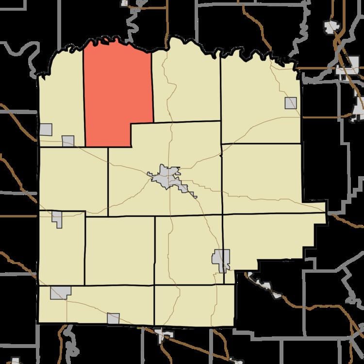
- Map of Jefferson Township IN USA
- Geography
- Unincorporated towns
- Adjacent townships
- Cemeteries
- Lakes
- School districts
- Political districts
- References
Map of Jefferson Township, IN, USA
Geography
According to the 2010 census, the township has a total area of 48.74 square miles (126.2 km2), of which 48.1 square miles (125 km2) (or 98.69%) is land and 0.64 square miles (1.7 km2) (or 1.31%) is water.
Unincorporated towns
(This list is based on USGS data and may include former settlements.)
Adjacent townships
Cemeteries
The township contains these four cemeteries: Covenanter, Pollock, Thompson and Wheeler.
Lakes
School districts
Political districts
References
Jefferson Township, Washington County, Indiana Wikipedia(Text) CC BY-SA