
Country United States Elevation 232 m Local time Saturday 3:52 PM | GNIS feature ID 0453159 Area 108.6 km² Population 1,510 (2010) | |
 | ||
Weather 11°C, Wind SE at 10 km/h, 30% Humidity | ||
Carr Township is one of twelve townships in Jackson County, Indiana, United States. As of the 2010 census, its population was 1,510 and it contained 645 housing units.
Contents
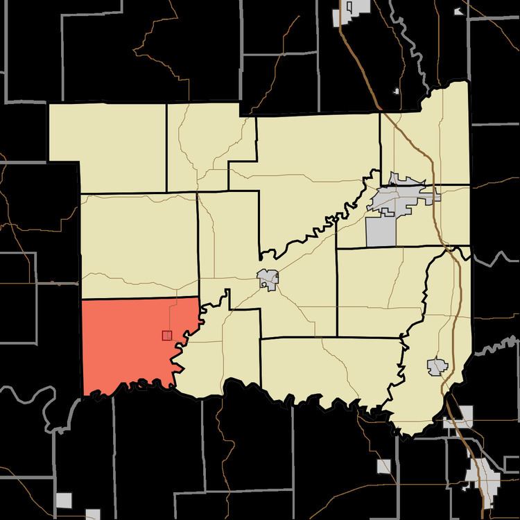
- Map of Carr Township IN USA
- History
- Geography
- Cities and towns
- Unincorporated towns
- Adjacent townships
- Cemeteries
- Major highways
- References
Map of Carr Township, IN, USA
Carr Township was named for Thomas Carr, an early county commissioner.
History
Carr High School and Medora Covered Bridge are listed on the National Register of Historic Places.
Geography
According to the 2010 census, the township has a total area of 41.95 square miles (108.7 km2), of which 41.32 square miles (107.0 km2) (or 98.50%) is land and 0.63 square miles (1.6 km2) (or 1.50%) is water. The streams of Dry Creek and Greasy Creek run through this township.
Cities and towns
Unincorporated towns
(This list is based on USGS data and may include former settlements.)
Adjacent townships
Cemeteries
The township contains ten cemeteries: Beem, Brown, Goss, Heighton Hill, Hinderlider, Holmes, Lanning Sput, Shoemaker, Stewart and Zollman.