
Car plates DJA | Area 581.2 km² | |
 | ||
Gminas Total 6 (incl. 1 urban)JaworGmina BolkówGmina MęcinkaGmina MściwojówGmina PaszowiceGmina Wądroże Wielkie Points of interest Świny Castle, Peace Church in Jawor, Bolków Castle, Rezerwat przyrody Wąwóz M, Muzeum Regionalne w Jaworze | ||
Jawor County (Polish: powiat jaworski) is a unit of territorial administration and local government (powiat) in Lower Silesian Voivodeship, south-western Poland. It came into being on January 1, 1999, as a result of the Polish local government reforms passed in 1998. The county covers an area of 581.2 square kilometres (224.4 sq mi). Its administrative seat is the town of Jawor; the only other town in the county is Bolków.
Contents
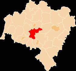
Map of Jawor County, Poland
As at 2006 the total population of the county is 52,058, out of which the population of Jawor is 24,347, the population of Bolków is 5,380, and the rural population is 22,331.
Neighbouring counties
Jawor County is bordered by Legnica County to the north, Środa Śląska County to the east, Świdnica County to the south-east, Wałbrzych County and Kamienna Góra County to the south, and Jelenia Góra County and Złotoryja County to the west.
Administrative division
The county is subdivided into six gminas (one urban, one urban-rural and four rural). These are listed in the following table, in descending order of population.