
Car plates DKA Population 46,470 (2006) | Area 396.1 km² | |
 | ||
Points of interest Colourful lakelets, Krzeszów Abbey, Basilica of the Assumpti, Okraj, Skalnik | ||
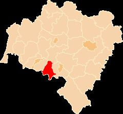
Kamienna Góra County (Polish: powiat kamiennogórski) is a unit of territorial administration and local government (powiat) in Lower Silesian Voivodeship, south-western Poland. It came into being on January 1, 1999, as a result of the Polish local government reforms passed in 1998. The county covers an area of 396.1 square kilometres (152.9 sq mi). Its administrative seat is the town of Kamienna Góra; the only other town in the county is Lubawka.
Contents
Map of Kamienna G%C3%B3ra County, Poland
As at 2006 the total population of the county is 46,470, out of which the population of Kamienna Góra is 21,440, the population of Lubawka is 6,529, and the rural population is 18,501.
Neighbouring counties
Kamienna Góra County is bordered by Jelenia Góra County to the west, Jawor County to the north and Wałbrzych County to the east. It also borders the Czech Republic to the south.
Administrative division
The county is subdivided into four gminas (one urban, one urban-rural and two rural). These are listed in the following table, in descending order of population.