
Website Official website Average annual precipitation 3,160 Colleges and Universities Maynaguri College | Area 3,044 km² | |
 | ||
Major highways National Highway 31, National Highway 10, National Highway 317, National Highway 27 Destinations Points of interest Gorumara National Park, Jaldapara National Park, ISKCON Temple, Salugara Monastery, Bengal Safari : North Be | ||
Additonal video of jalpaiguri opposite to jalpaiguri central jail nearer to jalpaiguri district sa
Jalpaiguri district (Pron: dʒɔlpaːiːguɽiː) (Bengali: জলপাইগুড়ি জেলা) is a district of the Indian state of West Bengal,2. It is situated between 26° 16' and 27° 0' North latitudes and 88° 4' and 89° 53' East longitudes. The district was established in 1869 in British India.
Contents
- Additonal video of jalpaiguri opposite to jalpaiguri central jail nearer to jalpaiguri district sa
- Map of Jalpaiguri West Bengal
- Etymology
- History
- Geography
- Climate
- Topography
- Economy
- Sub divisions
- Assembly constituencies
- Impact of delimitation of constituencies
- Police stations
- Telephone districts
- Transport
- Demographics
- Languages
- Flora and fauna
- References
Map of Jalpaiguri, West Bengal
The headquarters of the district are in the Indian city of Jalpaiguri, which is also the divisional headquarters of North Bengal and has its special importance in respect of tourism, forest, hills, tea gardens, scenic beauty and commercialisation and business.
Etymology
The name Jalpaiguri comes from the Bengali word jalpai meaning "olive" because of the olives which grew in the district and were seen even in the 1900s. The suffix guri means a place. The name can also be associated with Jalpesh (Shiva), the presiding deity of the entire region.
History
Jalpaiguri district comprises western Dooars and the major part of the eastern Morang; and this area, according to Sailen Debnath, in the ancient time was a part of the kingdom of Kamrup, and since the middle of the seventh century it became a part of the Kingdom of Kamatapur. Sailen writes that three of the five ancient capitals of Kamatapur were geographically in the district of Jalpaiguri; and the three capitals were at Chilapata, Mainaguri and Panchagarh in sequence. According to him, Hingulavas, the first capital of the next Koch kingdom as well was in Jalpaiguri district. Hingulavas has well been identified with Mahakalguri in Alipurduar Sub-Division.
Geography
Jalpaiguri is a part of West Bengal which is situated in North Bengal.
The district situated in the northern part of West Bengal has international borders with Bhutan and Bangladesh in the north and south respectively and district borders with Darjeeling hills in the west and northwest and Alipurduar district and Cooch Behar district on the east.
National protected areas include the Gorumara National Park and the Chapramari Wildlife Sanctuary.
Climate
Jalpaiguri is part of monsoon climate zone of South-Eastern Asia. May is the hottest month of this region with average maximum temperature of about 32 °C whereas January is coldest with 11 °C. Highest ever recorded maximum and minimum temperature are 40 °C and 2 °C. The average annual humidity in the district is of 82%. The annual average rainfall is 3160mm. December is the driest month with average rainfall 0.2 mm and July is wettest with 809.3 mm. Number of rainy days are 0 to 1 during November to February and 24 days during July. Thunderstorms are common weather phenomenon during May.
Topography
The entire topography is crisscrossed with rivulets, rivers and hills. Jalpaiguri - this narrow stretch of land lying between the Sikkim - Darjeeling Himalayas and Gangetic West Bengal has more than often evoked a sense of both eerie and romanticism in many a heart since the early British Rule. Veined by mighty rivers like the Teesta, Torsa, Jaldhaka, Raidak, Dyna, Neora, Sankosh etc. this piece of land has been aptly named as the land of 'Tea, Timber and Tourism'. A major stretch of area is bordered in the north by Bhutan and hence the name - Dooars/Duars which mean - Door of Bhutan.
Economy
The agricultural area of Jalpaiguri is over 2530.63 square kilometres. The dominant agricultural products of Jalpaiguri district are jute and tobacco. Paddy rice is also grown before and after the rainy season. Common plantation crops are arecanut, coconut and black pepper. Vegetable, mustard plant, and potato cultivation are increasing. To support agriculture, special programs have been taken for the production of sunflowers, maize and groundnuts. Revolutionary methods are being used in Boro paddy and potato cultivation. But due to nonadoption of modern technology, a large number of farmers still depend on traditional technology. Only 33% of the potentially cultivable land is developed for irrigation. In Kharif, the area of production of vegetables and other crops is much less. The ovine breed in the region originates from Tibet and was brought to the plains of West Bengal by traders. The trade between Tibetan traders and traders from the plains of Bengal took place from the region. The sheep along with other items of trade were transported to a place known as Bhot Patti (situated in Mainaguri Block of the district). The major trading occurred at a place known as Rangpur, situated now in Bangladesh. The goods were exchanged and the sheep were also taken to plains of Bengal by the returning traders, the animals were given to the farmers of Sunderban region for rearing and bringing them back to their health. The sheep were used for their meat by the Europeans during the colonial era. They preferred mutton over Chevon so sheep meat was in great demand. A single consignment of the sheep were transported to Australia in the late 18th century when the Australian colony was being settled. The consignment was shipped from the port of Fulta near Kolkata. However, the sheep were not preferred by the settlers as their size was small and wool quality too was inferior. The breed Booroola Merino of Australia are the descendents of the same sheep.
Sub-divisions
Jalpaiguri district earlier had three sub-divisions – Jalpaiguri Sadar subdivision, Mal subdivision and Alipurduar subdivision. Alipurduar district was created in June 2014 and Jalpaiguri district was left with two subdivisions – Jalpaiguri Sadar and Mal.
Assembly constituencies
The district is divided into seven assembly constituencies:
- Dhupguri (assembly constituency no. 15),
- Maynaguri (assembly constituency no. 16),
- Jalpaiguri (assembly constituency no. 17),
- Rajganj (assembly constituency no. 18),
- Dabgram-Phulbari (assembly constituency no. 19),
- Mal (assembly constituency no. 20) and
- Nagrakata (assembly constituency no. 21).
Nagrakata and Malbazar constituencies are reserved for Scheduled Tribes candidates. Dhupguri, Mainaguri and Rajganj constituencies are reserved for Scheduled Castes candidates. Dhupguri, Mainaguri, Malbazar, Dabgram-Phulbari, Jalpaiguri and Rajganj constituencies form the Jalpaiguri (Lok Sabha constituency), which also contains one assembly constituency from Cooch Behar district.
Impact of delimitation of constituencies
As per order of the Delimitation Commission in respect of the delimitation of constituencies in the West Bengal, the district will be divided into seven assembly constituencies:
- Dhupguri (SC) (assembly constituency no. 15),
- Maynaguri (SC) (assembly constituency no. 16),
- Jalpaiguri (SC) (assembly constituency no. 17),
- Rajganj (SC) (assembly constituency no. 18),
- Dabgram-Phulbari (assembly constituency no. 19),
- Mal (ST) (assembly constituency no. 20) and
- Nagrakata (ST) (assembly constituency no. 21).
Malbazar and Nagrakata constituencies will remain to be reserved for Scheduled Tribes candidates. Dhupguri, Mainaguri, Jalpaiguri and Rajganj constituencies will be reserved for Scheduled Castes candidates. Along with one assembly constituency from Cooch Behar district, Dhupguri, Mainaguri, Jalpaiguri, Rajganj, Dabgram-Phulbari, and Malbazar constituencies will form the Jalpaiguri (Lok Sabha constituency), which will be reserved for Scheduled Castes.
Police stations
There are 16 police stations in the district, viz.:
- Banarhat
- Chalsa
- Bhaktinagar
- Danguajhar
- Dhupguri
- Domohani
- Gairkata
- Jalpaiguri (Kotwali)
- Krantihat
- Malbazar
- Matelli
- Mainaguri
- Nagrakata
- Phulbari
- Rajganj
Telephone districts
There are six telephone area codes of Jalpaiguri district. They are 03561, 03562, 03563, 03564, 03565, 03566.
Transport
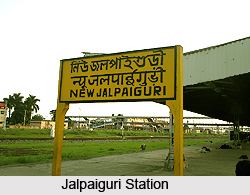
It is well connected by rail, road and air from any part of the country. One can avail train up to Jalpaiguri/Jalpaiguri Road/New Jalpaiguri Stn. By road it is well connected with rest of the country. Air travel is available up to Bagdogra Airport, and from there it is well connected by a 50 km road.
Demographics
According to the 2011 census Jalpaiguri district has a population of 3,869,675, roughly equal to the nation of Liberia. This gives it a ranking of 66th in India (out of a total of 640). The district has a population density of 621 inhabitants per square kilometre (1,610/sq mi) . Its population growth rate over the decade 2001-2011 was 33.77%. Jalpaiguri has a sex ratio of 954females for every 1000 males, and a literacy rate of 73.79%.
Languages
Vast Majority of the population speak Bengali, along with minority Hindi, Nepali, Bijori- a Munda language distantly related to Khmer and Vietnamese, spoken by about 25,000 people. A vast area on the western part (Salugara) of Jalpaiguri district is habitated by Nepali-speaking people. There are around 4 Lakhs Nepali-speaking people residing in the Jalpaiguri district.
Flora and fauna
It is home to Gorumara National Park, which was established in 1994 and has an area of 79 km2 (30.5 sq mi). Apart from Gorumara National Park, the district contains Chapramari Wildlife Sanctuary.