
Website Official website Lok sabha constituency Cooch Behar | Major highways NH 31 Area 3,387 km² Average annual precipitation 3,201 Major highway National Highway 31 | |
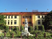 | ||
Points of interest Cooch Behar Palace, Madan Mohan Temple, Sagardighi - Cooch Behar, Rajbari National Park, Gosanimari Rajpat Colleges and Universities Uttar Banga Krishi Vis, Acharya Brojendra Nath Seal, Cooch Behar College, Tufanganj Mahavidyalaya, Cooch Behar Panchan | ||
Cooch Behar district ( Bengali: কোচবিহার জেলা, Rajbongshi/Kamatapuri: কোচবিহার, [ˈkuːtʃ biˈɦaːr]) is a district of the state of West Bengal, India, as well as the district's namesake town. During the British Raj, the town of Cooch Behar was the seat of a princely state of Koch Bihar, ruled by the Koch dynasty.
Contents
- Map of Cooch Behar West Bengal
- Geography
- Rivers and topography
- Sub divisions
- Assembly constituencies
- Impact of delimitation of constituencies
- Demographics
- Flora and fauna
- References
Map of Cooch Behar, West Bengal
As of 2011 it is the third least populous district of West Bengal (out of 19), after Dakshin Dinajpur and Darjeeling.
Geography
Cooch Behar is a district under the Jalpaiguri Division of the state of West Bengal. Cooch Behar is located in the northeastern part of the state and bounded by the district of Jalpaiguri and Alipurduar in the north, Dhubri and Kokrajhar district of Assam in the east and by Bangladesh in the west as well as in the south. The district forms part of the Himalayan Terai of West Bengal.
A geopolitical curiosity was that there were 92 Bangladeshi exclaves, with a total area of 47.7 km² in Cooch-Behar. Similarly, there were 106 Indian exclaves inside Bangladesh, with a total area of 69.5 km². These were part of the high stake card or chess games centuries ago between two regional kings, the Raja of Cooch Behar and the Maharaja of Rangpur.
Twenty-one of the Bangladeshi exclaves were within Indian exclaves, and three of the Indian exclaves were within Bangladeshi exclaves. The largest Indian exclave was Balapara Khagrabari which surrounded a Bangladeshi exclave, Upanchowki Bhajni, which itself surrounded an Indian exclave called Dahala Khagrabari, of less than one hectare (link to external map here [1]). But all this has ended in the historic India-Bangladesh land agreement. See Indo-Bangladesh enclaves.
Rivers and topography
Cooch Behar is a flat country with a slight southeastern slope along which the main rivers of the district flow. Most of the highland areas are in the Sitalkuchi region and most of the low-lying lands lie in Dinhata region.
The rivers in the district of Cooch Behar generally flow from northwest to southeast. Six rivers that cut through the district are the Teesta, Jaldhaka, Torsha, Kaljani, Raidak, Gadadhar and Ghargharia.
Sub-divisions
The district of Cooch Behar comprises five sub-divisions:
Assembly constituencies
The district is divided into 8 assembly constituencies:
- Sitalkuchi (SC) (assembly constituency no. 2),
- Mathabhanga (SC) (assembly constituency no. 3),
- Cooch Behar North (assembly constituency no. 4),
- Cooch Behar West (assembly constituency no. 5),
- Sitai (assembly constituency no. 6),
- Dinhata (assembly constituency no. 7),
- Natabari (assembly constituency no. 8) and
- Tufanganj (SC) (assembly constituency no. 9).
Mekliganj, Sitalkuchi, Mathabhanga and Tufanganj constituencies are reserved for Scheduled Castes (SC) candidates. Mekhliganj constituency is part of Jalpaiguri (Lok Sabha constituency), which also contains six assembly segments from Jalpaiguri district. Sitalkuchi, Mathabhanga, Cooch Behar North, Cooch Behar West, Sitai, Dinhata and Natabari constituencies form the Cooch Behar (Lok Sabha constituency), which is reserved for Scheduled Castes (SC). Tufanganj constituency is part of Alipurduars (Lok Sabha constituency), which also contains six assembly segments from Jalpaiguri district.
Impact of delimitation of constituencies
As per order of the Delimitation Commission in respect of the delimitation of constituencies in the West Bengal, the district will be divided into 9 assembly constituencies:
- Mathabhanga (SC) (assembly constituency no. 2),
- Cooch Behar Uttar (SC) (assembly constituency no. 3),
- Cooch Behar Dakshin (assembly constituency no. 4),
- Sitalkuchi (SC) (assembly constituency no. 5),
- Sitai (SC) (assembly constituency no. 6),
- Dinhata (assembly constituency no. 7),
- Natabari (assembly constituency no. 8) and
- Tufanganj (assembly constituency no. 9).
Mekliganj, Mathabhanga, Cooch Behar Uttar, Sitalkuchi and Sitai constituencies will be reserved for Scheduled Castes (SC) candidates. Mekhliganj constituency will remain part of Jalpaiguri (Lok Sabha constituency), which will also contain six assembly segments from Jalpaiguri district. Mathabhanga, Cooch Behar Uttar, Cooch Behar Dakshin, Sitalkuchi, Sitai, Dinhata and Natabari constituencies will continue to form the Cooch Behar (Lok Sabha constituency), which will be reserved for Scheduled Castes (SC). Tufanganj constituency will remain a part of Alipurduars (Lok Sabha constituency), which will also contain six assembly segments from Jalpaiguri district.
Demographics
According to the 2011 census Cooch Behar district has a population of 2,822,780, roughly equal to the nation of Jamaica. This gives it a ranking of 136th in India (out of a total of 640). The district has a population density of 833 inhabitants per square kilometre (2,160/sq mi) . Its population growth rate over the decade 2001–2011 was 13.86%. Koch Bihar has a sex ratio of 942 females for every 1000 males, and a literacy rate of 75.49%.
Flora and fauna
The flora here includes among others palms, bamboos, creepers, ferns, orchids, aquatic plants, fungi, timber, grass, vegetable and fruit trees.
In absence of large forest area in the district, except at Patlakhawa, not many species of animal are found though there are many wildlife sanctuaries, national parks and animal reserves in the neighbouring Alipurduar district and Jalpaiguri district which are not very far from the district.
In 1976 Cooch Behar district became home to the Jaldapara Wildlife Sanctuary (now Jaldapara National Park), which has an area of 217 km2 (83.8 sq mi). It shares the park with Alipurduar district.