
Country India District Murshidabad Area 122 km² | Time zone IST (UTC+5:30) Lok Sabha constituency Mushidabad Population 252,477 (2011) | |
 | ||
Jalangi is a community development block that forms an administrative division in Domkol subdivision of Murshidabad district in the Indian state of West Bengal. Jalangi police station serves this block. Headquarters of this block is at Sahebrampur. It is located 50 km from Baharampur, the district headquarters.
Contents
- Map of Jalangi West Bengal 742305
- Location
- Area
- Physical features
- Gram panchayats
- Population
- Large villages
- Literacy
- Language
- Transportation
- Healthcare
- References
Map of Jalangi, West Bengal 742305
Location
Jalangi is located at 24°08′N 88°43′E
Jalangi CD Block is bounded by Rajshahi District of Bangladesh, across the Padma, in the north and in the east, Karimpur I CD Block, in Nadia district, in the south and Raninagar I, Raninagar II and Domkal CD Blocks in the west.
Area
Jalangi CD Block has an area of 122.00 km2.
Physical features
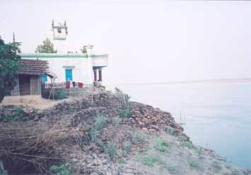
The Bhagirathi divides the district into two parts namely Bagri on the east and Rahr on the west. The Padma separates the district from Malda district, and Chapai Nawabganj and Rajshahi districts of Bangladesh.
Gram panchayats
Gram panchayats of Jalangi block/ panchayat samiti are: Choapara, Debipur, Faridpur, Ghoshpara, Jalangi, Katabari, Khairamari, Sadikhan's Dearh, Sagarpara and Sahebnaga.
Population
As per 2011 Census of India Jalangi CD Block had a total population of 252,477, all of which were rural. There were 129,430 (51%) males and 123,047 (49%) females. The population below 6 years numbered 32,313. Scheduled Castes numbered 31,831 and Scheduled Tribes numbered 2,918.
As per 2001 census, Jalangi block has a total population of 215,538, out of which 111,267 were males and 104,271 were females. Jalangi block registered a population growth of 24.55 per cent during the 1991-2001 decade. Decadal growth for the district was 23.70 per cent.Decadal growth in West Bengal was 17.84 per cent.
Large villages
Large villages in Jalangi CD Block were (2011 population in brackets): Khayramari (18,943), Debipur (17,877), Natial (10,719), Dhanirampur (6,851), Kazipara (10,522), Sahebnagar (4,376), Sagarpara (27,385), Godagari (6,061), Ghanashyam Chak (6,814), Narsinghpur (4,939), Bara Bil Raghunathpur (11,314), Joykrishnapur (13,122), Muradpur Jalangi (10,890), Paschim Sahebrampur (25,005), Sadikhanr Diar (4,531), Bilaspur Nachharerpara (6,112), Faridpur (20,041) and Tikar Bariakalkihara (7,433).
Literacy
As per 2011 census the total number of literates in Jalangi CD Block was 148,291 (58.73% of the population above 6 years) out of which 78,389 (53%) were males and 69,902 (47%) were females.
As per 2011 census, literacy in Murshidabad district was 66.59.Literacy in West Bengal was 77.08% in 2011.Literacy in India in 2011 was 74.04%.
Language
Bengali is the local language in these areas.
Transportation
The 251 km long State Highway No. 11 passes through this block. Jalangi is well connected with district sadar town Baharampur, Murshidabad and Kolkata via Krishnanagar. Freequent bus services are there.
Healthcare
Jalangi block is one of the areas where ground water is affected by arsenic contamination.