
Congressional district At-large Area 4,846 km² Population 3,216 (2013) | Founded 1914 Unemployment rate 5.8% (Apr 2015) | |
 | ||
Rivers White River, South Fork Bad River, Indian Creek Points of interest Badlands National Park, Minuteman Missile National, Ben Reifel Visitor Center, Big Badlands Overlook, 1880 Town | ||
Jackson County is a county located in the U.S. state of South Dakota. As of the 2010 census, the population was 3,031. Its county seat is Kadoka. The county was created in 1883 and organized in 1915. Washabaugh County was merged into Jackson County in 1983.
Contents
- Map of Jackson County SD USA
- Geography
- Major highways
- Adjacent counties
- National protected areas
- 2000 census
- 2010 census
- City
- Towns
- Census designated place
- Unincorporated communities
- Townships
- Unorganized territories
- References
Map of Jackson County, SD, USA
Geography
According to the U.S. Census Bureau, the county has a total area of 1,871 square miles (4,850 km2), of which 1,864 square miles (4,830 km2) is land and 7.4 square miles (19 km2) (0.4%) is water. About 57 percent of its land, the portion south of the White River, is on the Pine Ridge Indian Reservation. The county includes the easternmost portion of Badlands National Park.
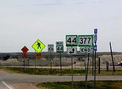
Major highways
Adjacent counties
National protected areas
2000 census
As of the census of 2000, there were 2,930 people, 945 households, and 675 families residing in the county. The population density was 2 people per square mile (1/km²). There were 1,173 housing units at an average density of 1 per square mile (0/km²). The racial makeup of the county was 50.07% White, 0.03% Black or African American, 47.85% Native American, 0.03% Asian, 0.03% Pacific Islander, 0.14% from other races, and 1.84% from two or more races. 0.41% of the population were Hispanic or Latino of any race.
There were 945 households out of which 38.60% had children under the age of 18 living with them, 51.40% were married couples living together, 14.70% had a female householder with no husband present, and 28.50% were non-families. 25.20% of all households were made up of individuals and 11.90% had someone living alone who was 65 years of age or older. The average household size was 3.08 and the average family size was 3.73.
In the county, the population was spread out with 36.50% under the age of 18, 8.00% from 18 to 24, 23.60% from 25 to 44, 20.30% from 45 to 64, and 11.60% who were 65 years of age or older. The median age was 31 years. For every 100 females there were 98.80 males. For every 100 females age 18 and over, there were 95.40 males.
The median income for a household in the county was $23,945, and the median income for a family was $25,161. Males had a median income of $22,460 versus $17,895 for females. The per capita income for the county was $9,981. About 29.50% of families and 36.50% of the population were below the poverty line, including 46.10% of those under age 18 and 20.10% of those age 65 or over. The county's per-capita income makes it one of the poorest counties in the United States.
2010 census
As of the 2010 United States Census, there were 3,031 people, 996 households, and 703 families residing in the county. The population density was 1.6 inhabitants per square mile (0.62/km2). There were 1,193 housing units at an average density of 0.6 per square mile (0.23/km2). The racial makeup of the county was 52.0% American Indian, 42.7% white, 0.2% black or African American, 0.2% from other races, and 4.8% from two or more races. Those of Hispanic or Latino origin made up 1.3% of the population. In terms of ancestry, 20.7% were German, 12.3% were Irish, 10.1% were Norwegian, 5.7% were English, and 0.2% were American.
Of the 996 households, 40.2% had children under the age of 18 living with them, 45.8% were married couples living together, 16.2% had a female householder with no husband present, 29.4% were non-families, and 26.2% of all households were made up of individuals. The average household size was 3.00 and the average family size was 3.65. The median age was 31.5 years.
The median income for a household in the county was $36,354 and the median income for a family was $41,838. Males had a median income of $32,377 versus $25,000 for females. The per capita income for the county was $14,568. About 20.6% of families and 30.0% of the population were below the poverty line, including 35.9% of those under age 18 and 5.6% of those age 65 or over.
City
Towns
Census-designated place
Unincorporated communities
Townships
The county has five organized townships:
Unorganized territories
The county contains four areas of unorganized territory: