
Established March 9, 1883 GNIS feature ID 1265805 Area 2,748 km² | Dissolved January 1, 1983 Elevation 827 m Population 1,389 (1970) | |
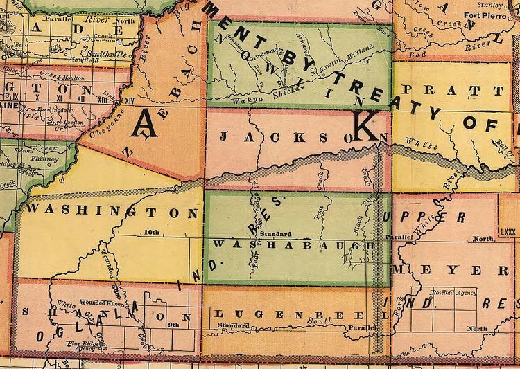 | ||
Washabaugh County was a county in South Dakota. The county was named after Frank J. Washabaugh, a prominent South Dakota politician.
Contents
History
First established in 1883 as a county in Dakota Territory from a part of Lugenbeel County, it became a county in the new state of South Dakota in 1889. Washabaugh remained an unorganized county, attached to various other counties for judicial purposes, until it merged with Jackson County in 1983.
Geography
The county encompassed the northeast corner of the Pine Ridge Indian Reservation including the community of Wanblee. The eastern portion of the county was within the Rosebud Indian Reservation until 1911, when that part was annexed into the newly created Mellette County. By 1914, Washabaugh County's boundaries were expanded to include a portion of Washington County to the west and all of Jackson County south of the White River.
Demographics
As an unorganized county lying entirely within two American Indian reservations, Washabaugh did not report separate population totals during the 1890, 1900, and 1910 censuses. Instead, population was included in the total population counts for the Pine Ridge and Rosebud reservations. The county started reporting separate population counts with the 1920 Census.