
Website www.co.jackson.mn.us Area 1,862 km² Unemployment rate 3.9% (Apr 2015) | Founded 23 May 1857 Population 10,260 (2013) | |
 | ||
Rivers Elk Creek, Des Moines River, West Fork Little Sioux River | ||
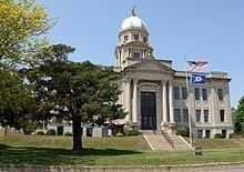
Jackson County is a county located in the U.S. state of Minnesota. As of the 2010 census, the population was 10,266. Its county seat is Jackson. The county was named for Henry Jackson, the first merchant in St. Paul.
Contents
- Map of Jackson County MN USA
- Geography
- Lakes
- Major highways
- Adjacent counties
- Demographics
- Cities
- Unincorporated communities
- References
Map of Jackson County, MN, USA
Geography
According to the U.S. Census Bureau, the county has a total area of 719 square miles (1,860 km2), of which 703 square miles (1,820 km2) is land and 16 square miles (41 km2) (2.3%) is water.
Lakes
There are 18 lakes completely within Jackson County and three lakes which extend into it from other counties.
Major highways
Adjacent counties
Demographics
As of the census of 2000, there were 11,268 people, 4,556 households, and 3,116 families residing in the county. The population density was 16 people per square mile (6/km²). There were 5,092 housing units at an average density of 7 per square mile (3/km²). The racial makeup of the county was 97.07% White, 0.09% Black or African American, 0.12% Native American, 1.38% Asian, 0.97% from other races, and 0.38% from two or more races. 1.86% of the population were Hispanic or Latino of any race. 51.9% were of German, 14.1% Norwegian and 5.6% American ancestry.
There were 4,556 households out of which 29.80% had children under the age of 18 living with them, 60.00% were married couples living together, 5.40% had a female householder with no husband present, and 31.60% were non-families. 28.50% of all households were made up of individuals and 13.40% had someone living alone who was 65 years of age or older. The average household size was 2.40 and the average family size was 2.95.
In the county, the population was spread out with 24.50% under the age of 18, 7.00% from 18 to 24, 25.30% from 25 to 44, 22.60% from 45 to 64, and 20.50% who were 65 years of age or older. The median age was 41 years. For every 100 females there were 100.60 males. For every 100 females age 18 and over, there were 99.30 males.
The median income for a household in the county was $36,746, and the median income for a family was $43,426. Males had a median income of $29,123 versus $20,860 for females. The per capita income for the county was $17,499. About 5.20% of families and 8.60% of the population were below the poverty line, including 11.00% of those under age 18 and 8.40% of those age 65 or over.