
Population 11,616 (2013) | Area 1,681 km² Unemployment rate 3.7% (Apr 2015) | |
 | ||
Founded May 23, 1857 (created)1870 (organized) Website www.co.cottonwood.mn.us Rivers Mound Creek, Des Moines River | ||
Cottonwood County is a county located in the U.S. state of Minnesota. As of the 2010 census, the population was 11,687. Its county seat is Windom. The county was formed in 1857 and organized in 1870.
Contents
- Map of Cottonwood County MN USA
- History
- County NRHP listings
- Geography
- Watersheds
- Major highways
- Adjacent counties
- Demographics
- County parks
- Cities
- Unincorporated community
- References
Map of Cottonwood County, MN, USA
History
Cottonwood County was established May 23, 1857 and formally organized on July 29, 1870. It was named after the Cottonwood River - a translation of the Dakota Sioux name, "Waraju" - which runs through the northeast corner of Germantown Township. The river received its name from the abundance of cottonwood trees on its banks.
Minnesota Governor Austin appointed three county commissioners when the county was established. They met at a private home about six miles northwest of Windom on the Des Moines River at Big Bend. During this meeting, they designated the commissioners districts and changed various county officers. In the fall of 1870, the first general election was held. The first deed on record was filed on January 10, 1870. The first land assessments were made in 1871, and in 1872, the first taxes were paid.
The city of Windom was declared the county seat in the 1872 general election and a proclamation was signed by the governor.
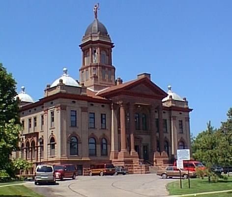
County NRHP listings
Geography
According to the U.S. Census Bureau, the county has a total area of 649 square miles (1,680 km2), of which 639 square miles (1,660 km2) is land and 10 square miles (26 km2) (1.5%) is water.
Watersheds
The northeast part of the county drains north to the Minnesota River through numerous small creeks, the Cottonwood River and Watonwan River. The southwest part of the county drains south through the Des Moines River. These two watersheds come together at the Mississippi River near Keokuk, Iowa. Most wetlands in the county have been drained for agricultural use.
Major highways
Adjacent counties
Demographics
As of the census of 2000, there were 12,167 people, 4,917 households, and 3,338 families residing in the county. The population density was 19 people per square mile (7/km²). There were 5,376 housing units at an average density of 8 per square mile (3/km²). The racial makeup of the county was 95.23% White, 0.34% Black or African American, 0.23% Native American, 1.63% Asian, 0.08% Pacific Islander, 1.35% from other races, and 1.14% from two or more races. 2.19% of the population were Hispanic or Latino of any race. 50.2% were of German and 18.6% Norwegian ancestry.
There were 4,917 households out of which 28.60% had children under the age of 18 living with them, 58.10% were married couples living together, 6.90% had a female householder with no husband present, and 32.10% were non-families. 28.90% of all households were made up of individuals and 15.90% had someone living alone who was 65 years of age or older. The average household size was 2.39 and the average family size was 2.94.
In the county, the population was spread out with 25.00% under the age of 18, 6.50% from 18 to 24, 23.20% from 25 to 44, 23.20% from 45 to 64, and 22.10% who were 65 years of age or older. The median age was 42 years. For every 100 females there were 94.50 males. For every 100 females age 18 and over, there were 91.50 males.
The median income for a household in the county was $31,943, and the median income for a family was $40,237. Males had a median income of $28,993 versus $19,934 for females. The per capita income for the county was $16,647. About 7.40% of families and 11.70% of the population were below the poverty line, including 18.40% of those under age 18 and 8.70% of those age 65 or over.