
 | ||
Jümme is a group of municipalities in the Leer district of Lower Saxony in Germany, named after the river Jümme. It has an area of 82.34 km² and a population of 6,421.
Map of 26849 J%C3%BCmme, Germany
The districts are (area in km² / population):
The Samtgemeinde Jümme is an association of municipalities in the district of Leer in Lower Saxony region Ostfriesland. It is next to the Samtgemeinde Hesel one of the two joint communities in the district, and consists of the three towns: Detern, Filsum and Nortmoor who joined forces in the wake of local government reform in the year 1973. It is named after the river Jümme which flows through all three member communities. Filsum serves as the administrative center.
Due to the location of Jümme and Leda, Jümme is also known as "Mesopotamia". The East Frisian geographer Dodo Wildvang coined the term "East Frisian Mesopotamia" in the 1920s. The cities re located on the rivers with the Puente Wilts Hausen the oldest, still in operation, hand drawn ferry in Central Europe and Germany's smallest car bridge in the district Amdorf.
The integrated municipality has historical significance by the battle of Detern, where in 1426 the East Frisian chieftain focko ukena his adversary Ocko II. Tom defeated Brok and its allies. The Stickhausen castle in the town district was also over some three centuries an important border fortification of the County of East Frisia. For cultural heritage of Samtgemeinde count next to the remains of the castle and historic churches, of which the Filsumer St. Paul's church from the 13th century is the oldest.
The self in occupied stainless Frisian comparison only sparsely populated Samtgemeinde is dominated by agriculture, in the grassland plains along the rivers prevails especially dairy farming. Tourism is of some importance, among the municipalities of the district is empty. Jimmy is in third place for the number of overnight stays behind Borkum and the county seat. Jümme is lightly industrialized and overall commuters area, especially in the neighboring county seat.
Geography Location and extent
The Samtgemeinde Jümme located in the eastern district of Leer in East Frisia, in the northwest of the German federal state of Lower Saxony. The main town Filsum situated about ten kilometers from the center of the county town of Leer. The nearest major town is Oldenburg, located about 42 km as the crow flies from Filsum. Further larger, nearby towns are Emden (about 30 kilometers) and Aurich (nearly 27 kilometers).
With 6,453 inhabitants, spread over 82.34 square kilometers, the Samtgemeinde Jümme is sparsely populated. Definitely square kilometers get an average of about 78 inhabitants. Thus the Municipality is well below the average of the East Frisian 148 inhabitants per square kilometer, which in turn the Lower Saxony (168) and the West German average (230) still falls significantly. With around 6,500 inhabitants, the Municipality is located (compared to other velvet and unit municipalities) only in the rear field of the most populous municipalities of East Friesland. The Regional Planning program of the district Leer divides the capital Filsum the function of a fundamental center for the region to Samtgemeinde. [2]
The biggest area member congregation of the comprehensive three municipalities Samtgemeinde is Detern. With 43.3 square kilometers it is the second largest after Hesel member congregation of the six East Frisian Samtgemeinden.
Geology and soil
Geologically is superficially formed of layers of the Pleistocene and the Holocene the Samtgemeinde Jümme as completely Ostfriesland. Pleistocene layers can be found in the Geest areas, which account for the bulk of the integrated municipality territory. Part rests on the Geest layers peaty soil, a Holocene layer. The floors of the East Frisian Geest were largely made up of sand and boulder clay cover. [3]
Along the Leda and the Jümme the soil consists of river marshes, which are formed from silty clays. In the transition area between the rivers and the Geest are bog marshes that consist mostly of clay less than 40 centimeters thick on peat soils. The central portion of the area between the Leda and the Jümme formed by now fully cultivated fen. North and east of this area, in the places Nortmoor, Filsum, Detern and Stickhausen prevail podzol soils before in mostly humid location. They are mostly on hardpan and have been improved by Plagge Esch in their sustainability over the centuries. By Plagge fertilization that has been made for centuries until the occurrence of artificial fertilizer at the end of the 19th century, there especially around the villages Geest anthropogenic plaggen soil floors. Because of the constant Neubodenauftrag is of Esch, in East Frisia (the) Guest called today higher than the village centers. The land value figure was significantly increased by this form of fertilizers, although they are still clearly lagged behind the fertile soil of the march. Some of the podzol soils of Anmoor are penetrated or were there converted by Abtorfung and subsequent cultivation in areas with strong humus rich topsoil. Along the river Holtslander marriage depth and along the Südgeorgsfehnkanals are strips of fen. [4]
Waters Aerial view of Jümme
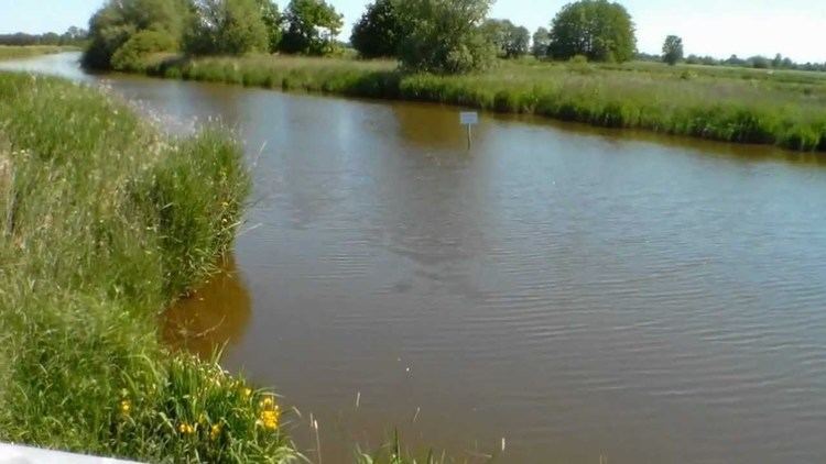
5.5 percent of Samtgemeinde area are water surfaces. In Jümme there are more than 150 km of watercourses, lakes added, scours and oxbow lakes. The most important river is the Jümme whose name is reflected in the joint community name. On the border to the town of Leer, the Jümme flows into the Leda, who also runs earlier in the district Amdorf. A few kilometers above the Samtgemeinde area and further upstream the river flows just south of the border Samtgemeinde. In the field of Samtgemeinde the Leda is classified as an inland waterway. [5] Because of this situation on the rivers of the East Frisian geographer Dodo Wildvang has already spoken in the 1920s, the "East Frisian Mesopotamia", as he described the area of today's integrated municipality. In the self-representation of the integrated municipality until today likes to call "Mesopotamia". Bascule bridge spanning the Nordgeorgsfehnkanal at Brückenfehn: The building was built in 2000 to replace an earlier building and allowed the speedy passage of boats. [6]
If the Leda barrage in Leer not - which occurs in severe storm surges - is closed, the tidal range on the Ems can be felt far inland. The mean tidal range is at Leda barrage three meters and on Dreyschloot, a cross-connection between Leda and Jümme in the district Barge in southeastern Samtgemeinde territory, after all, still 80 centimeters. [7] flood control, dyke safety and drainage are tasks of the Leda-Jümme association with based in Leer. Besides the dikes and the barrage the Association are five large controlled discharge polder available. These are flooded when the Leda barrage must remain closed due to storm surges, but at the same time (eg. Because of heavy rain or melting snow) high domestic water levels on the Leda and Jümme occur. One of the five discharge polder is located south of Detern and has a volume of three million cubic meters. In these polders, the water is "cached" until the locking mechanism can be reopened. [8]
In addition to the natural waters Leda and Jümme lying on the velvet municipality area also many anthropogenic waters, especially the numerous small drainage ditches of each agricultural fields. These are called in Ostfriesland Schloote. In addition, the South and the Nordgeorgsfehnkanal that Fehnkanäle the two Fehnorte same name. The Nordgeorgsfehnkanal was created after the establishment of Fehns in 1829 and completed in the 1920s. Since it provides a continuous link of EMS / Leda / Jümme the Ems-Jade Canal at Marcardsmoor. The channel played an important role in the formation of Wies Moors and is still of importance for the drainage of the central East Friesland. Through him water levels between the Ems-Jade Canal Jümme and can be compensated. In addition, the Nordgeorgsfehnkanal is used for water tourism.
The zoning table on the right makes the extremely high proportion of agricultural land in the total area of Samtgemeinde significantly. He is about 81.4 percent (compared Ostfriesland around 75 percent [9]; Germany 52.3 percent.) The proportion of forest in the climate of grassland lowland areas Samtgemeinde is however only at just 0.83 per cent (2.6 Ostfriesland percent; Germany: 30.1 percent). Neighbouring communities
The integrated municipality borders on several other (velvet) communities in the district of Leer, but is also one of the few municipalities in East Frisia, bordering municipalities of two neighboring counties at the same time. East of Jümme is the community Apen district Ammerland. In the southeast Jümme bordering the municipality in the district of Cloppenburg Barßel. The remaining municipalities, the Jümme borders, are in the district of Leer, these are (continued clockwise) Ostrhauderfehn in the south, Rhauderfehn in the Southwest, the county seat empty in the West, the Municipality Hesel in the northwest and north (in the municipalities of Brinkum, Holtland and Hesel) and the Municipality Uplengen in the Northeast.
Jümme lies in the temperate zone, the influence of the North Sea. In summer, the daytime temperatures are lower, often higher in winter than in other domestic. The climate is influenced by the Central European west wind zone.
Weather data is collected for the immediately adjacent empty, having very similar climatic conditions: The temperatures are presently there throughout the year at 9 °C, with average highs in the months of July and August around 20 °C and mean lowest values around -2 °C in December and in January. The average rainfall is 738 mm / year. Most rainy days there, each with 14 in November and December, the fewest in March and May, which falls precipitation at nine days. The average annual sunshine duration is 1550–1600 hours, with the average number of hours of sunshine per day between a (December / January) and six hours (May / June) varies. [11] The average frost-free period is given as 170–187 days. [12]
In the joint community there since 1941 a nature reserve, the Barger sea at the eponymous village. The area is 6.3 hectares and almost completely part of the same FFH area. Since 1975, the 45.5 hectare conservation area Filsumer bog is under protection. It is a former bog area between the towns of stable Brügger field Busboomsfehn and Brückenfehn. There are also several natural monuments in the form of protection of valuable old trees in Nortmoor, Stickhausen and Detern. [15] story Prehistory and Early History
The northwestern part of the integrated municipality Region belongs to that spur of the Oldenburg-East Frisian Geest ridge on which the previously oldest archaeological was discovered: an approximately 35,000- to 40,000-year-old, twelve centimeters long and nine centimeters wide flint device as a tool for cutting and scraping from the Middle Palaeolithic . [16] the presence of Neanderthals in East Frisia was detected by this Fund for the first time. The find was made in the immediate northern Holtland. The oldest traces of human settlement in the districts of Filsum Nortmoor and date from the Neolithic period, both from the Funnel Beaker culture as well as from the single grave culture. Other finds are the Bronze Age assign. As grave goods tweezers and a razor made of bronze, a semicircle scraper made of flint and a double-leaf arrowhead from dentin were aiusgemacht, around the graves were found deep engraving decorated shards of Funnel Beaker Culture.
Already in the Bronze Age there was an over the Geest and the Jümmeniederung leading way that connected the rooms of today's cities Oldenburg and Leer. This is the conclusion arrived archaeologists that the Bronze Age path network in East Frisia based on barrows and further discovered artifacts, especially their spatial agglomeration, studied in the 1950s. [17] Early and High Middle Ages
In the Becoming arable Filsum were (as Fillisni) and Ammersum (as Ambriki) first mentioned (around the year 900). [18] mention was there also a place called Suthanbroka, Südmoor. These were believed to be the predecessor settlement of Nortmoor which was northward, relocated in later centuries closer to the überflutungssicherere Geest.
In the High Middle Ages Jümme belonged to Frisian country municipality Moormerland. The medieval country community was much greater than the present municipality of the same name: You also included the territory of the town of Leer, the joint communities Hesel and the municipality Moormerland. Chieftain time (14th and 15th centuries)
The consular constitution of the Frisian freedom had existed until about the middle of the 14th century. Then she collapsed and was gradually replaced, as powerful families took over the chieftainship. Unlike other regions, however, was able to establish the East Frisian part not own appreciable chief rule in the Leda-Jümme area. The area thus came under the influence of the chief focko ukena from Neermoor. This was a former henchman of the leading chief Ocko II. Tom Brok, but then turned against him. Detern was on September 27, 1426 venue named after the place battle in which a peasant Ostfriesisches army under Ukena the troops of Ocko II. Tom Brok and its called to help allies from Oldenburg, the Archbishop of Bremen and the counts of Hoya, Diepholz and Tecklenburg defeated.
In the subsequent conflict between Ukena and Freiheitsbund the Seven Ostfrieslande This area was on the side of Neermoorer or Leeraner chief. After the defeat Ukena the chief family Cirksena rose to the Count of East Frisia, the order also dominated the present area. Decisive contribution came from Hanseatic cities, especially Hamburg. This saw themselves as early as the late 14th century, but also exposed in the first half of the 15th century the raids Vitalienbrüder that merchant ships in the North Sea raided and thereby made ostfriesische ports to their hiding places. The Cirksena scent of opportunity and allied themselves in 1433 with the city of Hamburg, which militarily engaged in the following period in East Frisia.
The Stickhausen castle was built around 1435 by the City of Hamburg. The Hamburger gave the castle about 1453 to the chief and later Counts (since 1464) Ulrich I, who ordered to expand the castle as a border fortification against the county Oldenburg. The castle secured the Oldenburg about Apen and Stickhausen to Leer leading way [19] and henceforth replaced the neighboring, older Schlüsselburg. Among the Cirksena (1464-1744)
The counts of East Frisia created new administrative structures, by setting up offices. The Stickhausen castle was the seat of one of the eight East Frisian offices, in addition to Aurich, Berum, Emden, Friedeburg, Greetsiel, Leerort and north. The Office Stickhausen comprised roughly the area of present-day (velvet) communities Jümme, Hesel, Uplengen, Rhauderfehn and Ostrhauderfehn, ie approximately the eastern third of the present-day district empty. Officials of the counts took henceforth the administrative business. The Office Stickhausen part due to lower soil quality as in the march to the poorer in the county and remained so during the following centuries. A comparison between the Office and the uneven surface Greetsiel larger office Stickhausen from 1596 shows the differences: In office Stickhausen there were 2311 Grazing farmland, in the Official Greetsiel contrast with 23 355 Grazing tenfold [20]. Countess Anna decreed the abolition of primogeniture in East Frisia. Between her sons and Edzard Johann the County of East Frisia then de facto divided. Johann chose Stickhausen to one of its two whereabouts.
The Reformation held very early in Ostfriesland collection, said today Samtgemeinde area became Lutheran, while permeated the Reformed faith in the western offices of the county. The fact that the country, despite the regime cuius regio about not falling apart, due to a decision by the Countess Anna, who had taken over the guardianship regency for her still minor children and Edzard Johann since 1542nd They decreed in 1558 the abolition of primogeniture in the East Frisian Graf house so the firstborn Edzard, the Lutheran doctrine inclining and very encouraged by its strict Lutheran wife Katharina von Wasa therein, in the county could not alone enforce Lutheranism. The younger brother Johann was reformed faith. De facto Ostfriesland a divided county with two regents: Johann ruled the reformed offices Greetsiel and Leerort and through the Office Stickhausen and also could be the support of the reformed ex Emden be sure Edzard prevailed in the remaining offices. Johann held next Leerort primarily on the Stickhausen Castle, which thus became a kind of "second residence" East Friesland. The Count's officials often received exactly contradictory instructions from their two regents, a political paralysis in the country was the result. The dispute ended only with John's brother's death in 1591 at the castle Stickhausen, Count Edzard II. Reigned alone after that. However, his reputation had suffered greatly. Stickhausen Castle 1632
The relationship between the Count's officials at the castle and the subjects did not always without tension. So protesting residents of the Office at the regional parliament in Leer in 1598 against the encroachments of officials. In winter 1607, the population of Stickhausen and surroundings had refused to free the ditch of the castle from the ice and then set up guards, when the castle was not to be occupied by the count's soldiers once. The number of stationed at the castle Count's soldiers will be given for the 1617 with 70th For comparison: In the country Aurich domination maintained a garrison of 500 men, in Berum of 200 and in Esens, Wittmund and Greetsiel from 70 to 100. [21]
During the Thirty Years War Ostfriesland was taken three times (1622-1624, 1627-1631 and 1637-1651) of foreign troops and used as a base, even if no hostilities with other foreign armies took place. The Stickhausen castle was repeatedly fought over. In the years 1622-1624 the Mansfeld had occupied it. They reinforced the castle by several outworks. The surrounding areas suffered from the occupation by the troops. Not only farms were looted, but probably also the churches, and then the fact indicates that after the withdrawal of mercenaries heap had to be replenished many furnishings. In Amdorf and Neuburg the pulpits [22] were not only replaced, but newly acquired also the altarpieces. After the withdrawal of troops Mansfeld'schen the counts took over for a short time back the castle. While the following two occupations also meant exposure to indemnities. The occupiers 1627-1631, however, imperial troops under Tilly, "thought discipline and avoiding excesses" [23] that 1637-1651 quartered in Ostfriesland Hessian troops likewise under William V of Hesse-Cassel. The Hessen completed the expansion of Stickhausen Castle fortress. Also material was the situation among the two occupations differently than under Mansfeld:. There have been driven contributions, but these were also re-issued in the region [24] During the war broke out in East Frisia and the plague, death figures for the present field are not documented. [25]
1712 was built a new barracks in the field of embroidery Hauser Castle during the reign of Prince Georg Albrecht. In her 600-man crew were stationed until the end of the county. The cost of the garrison was carried to one third by the Princely House and two-thirds of the East Frisian stalls. [26]
In appeal-war between the East Frisian country rule and the so-called recalcitrant villages today Samtgemeinde were officially on the part of the country's sovereignty. Together with Brinkum, Holtland and Hesel formed Nortmoor outposts within the insurgent area around Leer. There were attacks by the insurgents, coupled with looting. The recalcitrant subject in 1726, after the country's government had reinforced with additional Danish troops. Prussian period (1744-1806 / 15)
In 1744, East Frisia fell to Prussia by a Exspektanz. Frederick the Great had after taking office, most castles Ostfrieslands grind, so the Stickhausen Castle, only the castle tower remained of the. Even in Prussian time remained Stickhausen the seat of the Office of the same name. The forced by Friedrich Moorkolonisierung the inhabitants of the Office grew during this period from around 5100 to around 9300 people. 1806 was the official Stickhausen the by population third largest behind the offices Aurich and Leer [27] The village Detern was within the sprawling office one with the highest number of artisans in the early decades of the Prussian rule. For the year 1756, in addition to seven merchants three coopers, six bakers, nine Leineweber, three masons, seven tailors, three blacksmith, cobbler twelve and three carpenters documented. In nearby Stickhausen again came five Leineweber as well as one bakers, glaziers, dyers, tailors, blacksmith and carpenter and a businessman added. [28] Urbarmachungsedikt
In the second half of the 18th century several peat were applied after Frederick the Great had signed his Urbarmachungsedikt on today Samtgemeinde area. These include Busboomsfehn, Lammertsfehn and Brückenfehn that were colonized from 1772nd While Busboomsfehn and Lammertsfehn were named after the first settlers, the name Brückenfehn goes back to a bridge over the Hollener marriage. Despite the name broadcast on -fehn is not a Fehnkanal settlement, but a scattered settlement. The ending on -fehn refers in these cases, only that it is in the bog settlements. [29] A year later, the peat colony was added Stall Brügger field. All those peat lying northeast of Filsum, its history is closely linked to the establishment of additional peat in today's neighboring municipalities and Uplengen Hesel. When expanding settlement of local Detern does however Deternerlehe, which was inhabited from the 18th century. 1816 were counted 11 houses. [30] Food basis of the first settlers Moor: Buckwheat (Fagopyrum esculentum)
From 1760 Rudolpf Heinrich Karl von Glan was the bailiff and treasurer of the Office Stickhausen and remained there until his death in 1807. Under his aegis, not only said Moor colonies were created in today Samtgemeinde area. He also gained merit as one of the five founders of Rhauderfehn-Compagnie, which from 1769 Fehnsiedlung Rhauderfehn allowed to invest in office Stickhausen belonging Moor, which later became the present-day municipality Ostrhauderfehn emerged.
Agricultural basis of peat bog fire was the culture. Here in the summer small trenches were built to drain a bit Moor. In the fall of the Moor was chopped into flakes that were harrowed in winter by freezing and the following spring. In late spring, the settlers set fire to the of such processed moorland and put seeds of (mostly) Buckwheat in the ashes. Buckwheat grows very quickly and could therefore be harvested after a few weeks. Were also cultivated potatoes, rye and oats. [31] The peaty soil, however, was exhausted by this form of processing after a few years, so that the revenues decreased. The peat was therefore with only a few exceptions to distressed areas.
After the Battle of Jena-Auerstedt 1806 Ostfriesland was and thus the present territory in the Kingdom of Holland and hence incorporated into the French sphere of influence. 1810 it came as a department of EMS Orientale (Osterems) directly to the French Empire, 1813 fell after the wars of liberation again to Prussia. After the Congress of Vienna in 1814-15 Prussia Ostfriesland ceded to the Kingdom of Hanover. Kingdom of Hanover and Empire (1815-1918) The confluence of the North and Südgeorgsfehnkanal
In the 51 years in which Ostfriesland belonged to the Kingdom of Hanover (1815-1866), three new Fehnsiedlungen were created in the region, including Nordgeorgsfehn and Südgeorgsfehn. The channels, which were necessary for the application of the Fehnsiedlungen, lead through the territory of today's integrated municipality.
The northwestern area of the district is intersected by Nortmoor in 1834 landscaped stone road from empty to Aurich, which was the first in such a developed road Ostfrieslands. 1867 Street of Leer on Nortmoor and Filsum was created after Stickhausen. [32] Since the Oldenburg-Leer railway was opened by the Grand Duchy of Oldenburg State Railways on 15 June 1869, the area is connected to the national rail network. In Stickhausen-Velde, Filsum and Nortmoor emerged stations.
In Prussia there was 1885 a territorial reform, in which the old offices were resolved in favor of newly created district, as well as in East Frisia. The district of Leer was created from the previous offices and Leerort Stickhausen. For the county seat town of Leer was determined. In addition to the office and the district court Stickhausen was disbanded, was responsible also the Leer District Court. Stickhausen and nearby places Velde and Detern have suffered economically under this measure. In addition to officials and judges also lawyers departed, the declining purchasing power could move away more inhabitants. In the three locations were in the following years many homes empty. [33] Weimar Republic and National Socialism
The villages Amdorf and Neuburg were up early strongholds of the NSDAP. Already at the county council election on 17 November 1929, the Nazis showed here two of their best results in the district of Leer with 51 and 53.7 percent. [34] Even at the last council elections on March 12, 1933 showed that the Leda-Jümme- area some particularly pronounced strongholds of the Nazis existed: So they got in Amdorf 72, in Ammersum 83, in Detern 76 and in Filsum 80 percent of the vote. By comparison, county wide received the National Socialists 52.1 percent of the vote [35] In situated near the county seat empty Nortmoor contrast there was during the Weimar years and always a strong tendency for the election of leftist parties.. In the general election in December 1932 while 51 percent chose the NSDAP, the SPD and the KPD but still accounted for 20 and 16 percent, which in those days represented a special feature compared to other Geest villages of East Friesland. [32]
The takeover by the National Socialists initially focused on the East Frisian cities, then to the district offices. [36] However, the Leer District Hermann Conring retained this function. He played at the onset immediately after the seizure of power persecution of political dissidents, particularly communists, an active role, sat down but partly also for the release of detainees, which had been deported to concentration camps. [37] end of July 1933 there were 30 Communists from the district in concentration camps, especially in the nearby Börgermoor, among which also the Nortmoorer communist Johann was plate.
In the course of job-creation measures to overcome the very high unemployment rate in the district of Leer, several major projects were envisaged, including the long-overdue improvement in the drainage situation in Leda-Jümme area. However, this could only be collected after 1936 in attack, as the unemployment figures were already fallen significantly. [38] 1938/1939 were also Jews from Vienna used as forced laborers in the dike increasing at Leda and Jümme. [39] The Jews, mostly people with higher education, have been housed in two camps: Located in Wilts Hausen on today Leer metropolitan area and in Terheide between Detern and Potshausen. Contacts with the local population there were hardly any.
During the war, the area is not of airstrikes was affected. After the Allied troops on the 28 / 29 April 1945 Leer had conquered, they moved further east in front of the area of today's integrated municipality.